
MyTopo
Roanoke Island NE North Carolina US Topo Map
Couldn't load pickup availability
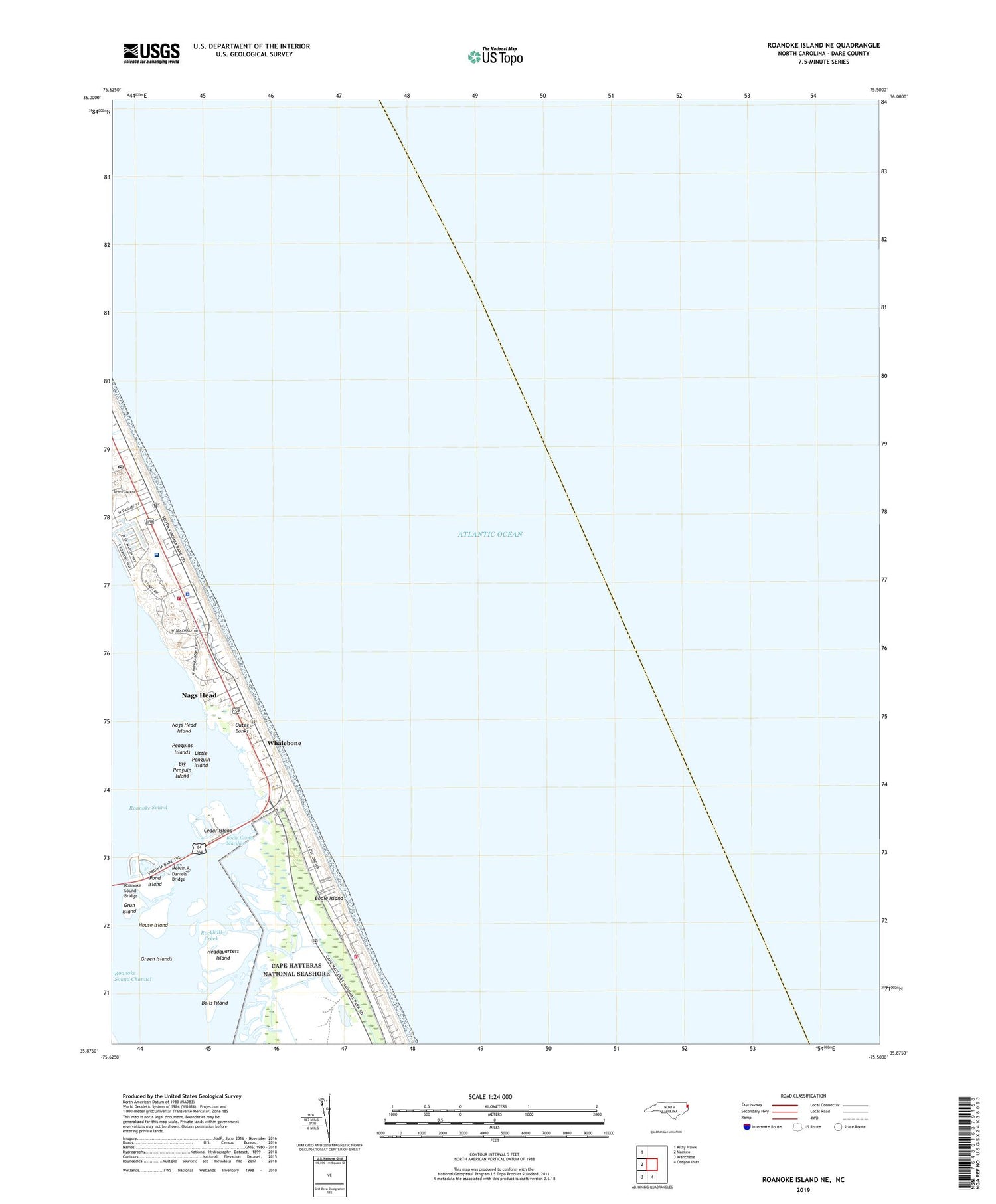
2019 topographic map quadrangle Roanoke Island NE in the state of North Carolina. Scale: 1:24000. Based on the newly updated USGS 7.5' US Topo map series, this map is in the following counties: Dare. The map contains contour data, water features, and other items you are used to seeing on USGS maps, but also has updated roads and other features. This is the next generation of topographic maps. Printed on high-quality waterproof paper with UV fade-resistant inks.
Quads adjacent to this one:
West: Manteo
Northwest: Kitty Hawk
South: Oregon Inlet
Southwest: Wanchese
Contains the following named places: Bells Island, Big Penguin Island, Bodie Island, Bodie Island Marshes, Cedar Island, Cow Island, Dare County Emergency Medical Services Station 5, Dare County Sheriff's Office, Green Islands, Grun Island, Headquarters Island, House Island, Jeanettes Pier, Little Penguin Island, Melvin R Daniels Bridge, Nags Head, Nags Head Fire and Rescue Station 16, Nags Head Fire and Rescue Station 21, Nags Head Island, Nags Head Police Department, Nags Head Post Office, Outer Banks Pier and Fishing Center, Penguins Islands, Pond Island, Roanoke Inlet, Rockhall Creek, Seven Sisters, The Outer Banks Hospital, Township of Nags Head, Whalebone, Whalebone Junction Information Station, ZIP Code: 27959


