
MyTopo
Rowland North Carolina US Topo Map
Couldn't load pickup availability
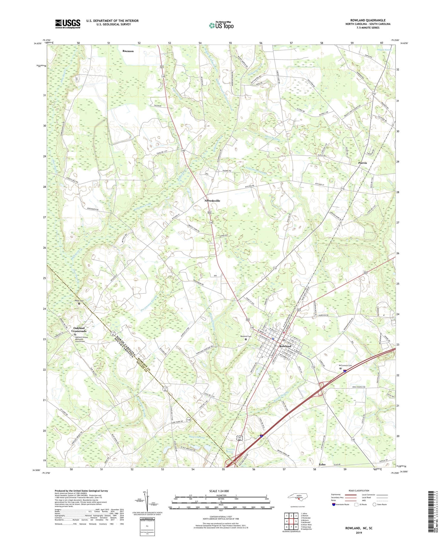
2019 topographic map quadrangle Rowland in the states of North Carolina, South Carolina. Scale: 1:24000. Based on the newly updated USGS 7.5' US Topo map series, this map is in the following counties: Robeson, Dillon. The map contains contour data, water features, and other items you are used to seeing on USGS maps, but also has updated roads and other features. This is the next generation of topographic maps. Printed on high-quality waterproof paper with UV fade-resistant inks.
Quads adjacent to this one:
West: Minturn
Northwest: Johns
North: Maxton
Northeast: Pembroke
East: McDonald
Southeast: Gaddysville
South: Dillon East
Southwest: Dillon West
Contains the following named places: Alfordsville, Ashpole Center Church, Ashpole Center School, Ashpole Presbyterian Church, Baker Cemetery, Bakers Mill, Beauty Spot Church, Bracey Swamp, Bullard Branch, Contrary Swamp, Faith Lighthouse Tabernacle, First Swamp, Fullermore Swamp, McCormick Cemetery, Middle Branch Wilkinson Creek, Mitchell Swamp, Mount Pelier Church, Mount Tabor Church, New Saint Marks Church, Oakland Crossroads, Oakland School, Oakland United Methodist Church, Oakland United Methodist Church Cemetery, Persimmon Swamp, Purvis, Raemon Census Designated Place, Rowland, Rowland Cemetery, Rowland Middle School, Rowland Police Department, Rowland Post Office, Rowland Rescue Squad, Rowland Rural Fire Department, Saint Luke School, Saint Lukes Church, Salem Church, Shiloh Church, Short Swamp, Southern Grove Church, Southside School, State Line Church, Town of Rowland, Township of Rowland, Watering Hole Swamp, Wilkinson Creek, ZIP Code: 28383


