MyTopo
Minturn South Carolina US Topo Map
Couldn't load pickup availability
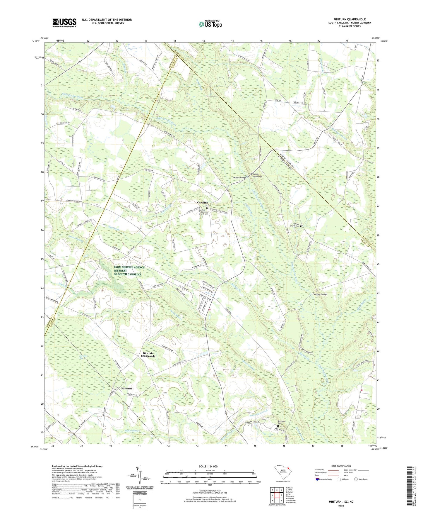
2024 topographic map quadrangle Minturn in the states of South Carolina, North Carolina. Scale: 1:24000. Based on the newly updated USGS 7.5' US Topo map series, this map is in the following counties: Dillon, Robeson, Marlboro. The map contains contour data, water features, and other items you are used to seeing on USGS maps, but also has updated roads and other features. This is the next generation of topographic maps. Printed on high-quality waterproof paper with UV fade-resistant inks.
Quads adjacent to this one:
West: Clio
Northwest: McColl
North: Johns
Northeast: Maxton
East: Rowland
Southeast: Dillon East
South: Dillon West
Southwest: Bingham
This map covers the same area as the classic USGS quad with code o34079e4.
Contains the following named places: Beaverdam Creek, Berea Church, Berea School, Bull Branch, Carolina, Carolina Branch, Carolina Church, Carolina Presbyterian Church Cemetery, Carolina School, Dillon County Fire Department Station 5, Donohoe Bay, Fairview Church, Fairview Church Cemetery, Glasdrum Farms, Hamer Pond Dam D-3595, Judson, Judson Church, Leith Creek, Leland Grove Cemetery, Leland Grove Church, Leland Grove School, Little Rock Division, Martins Branch, McGregor Branch, McInnis Bridge, McKays Bridge, McRae Mill, Mill Prong School, Millers Chapel, Minturn, Minturn Church, Minturn School, Mount Olive Church, Mount Zion Church, New Holy Church, New Holy School, New Zion Church, Number 7 Church, Oakland Volunteer Fire Department, Parishs Mill, Pee Dee Chapel, Reedy Branch, Reedy Branch Church, Reedy Branch School, Sherwood Cemetery, Shoe Heel Creek, Sinclair Crossroads, Upper South Carolina Pee Dee State Designated Tribal Statistical Area, Verges Chapel, Wash Branch, ZIP Code: 29567