MyTopo
Siloam North Carolina US Topo Map
Couldn't load pickup availability
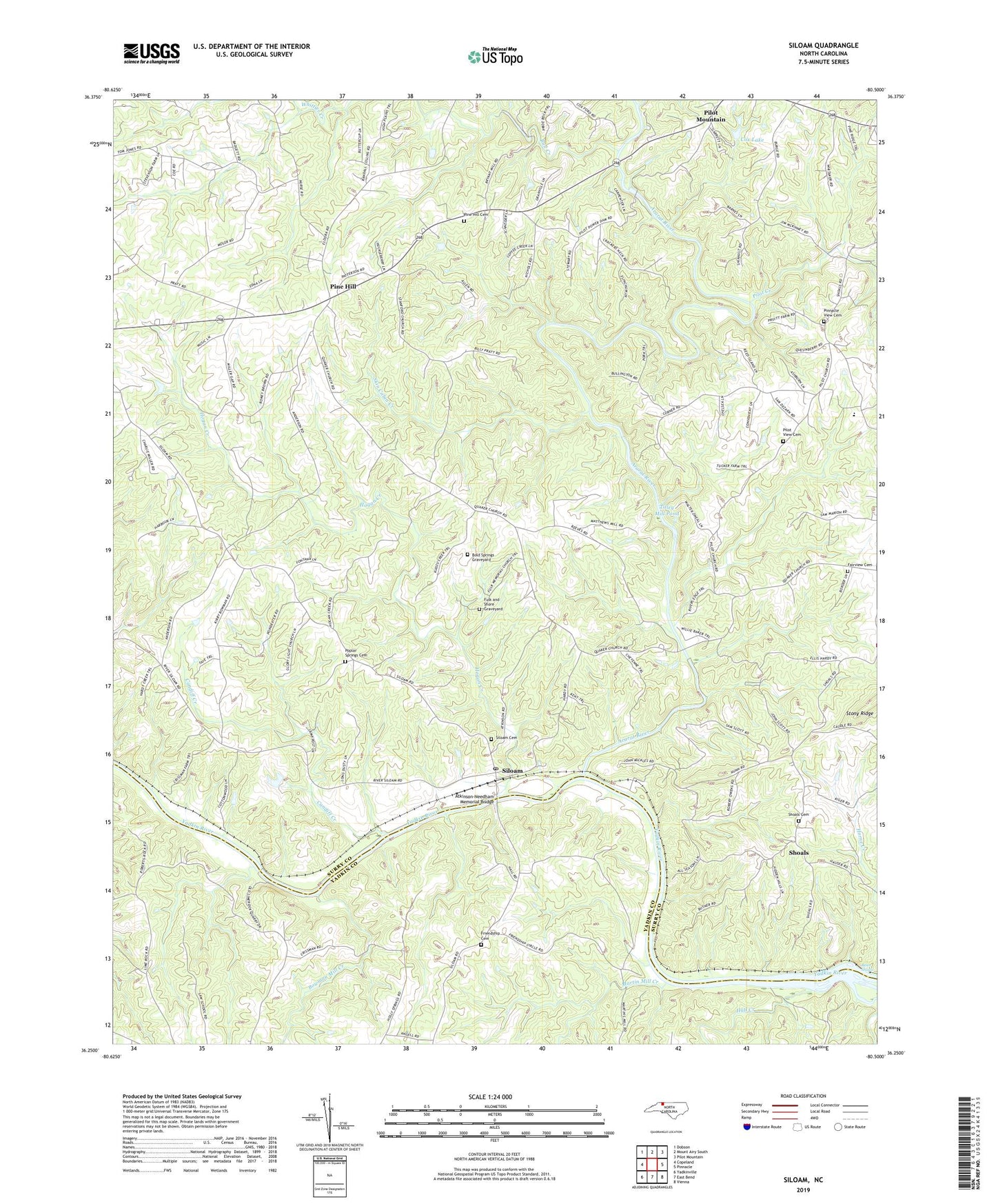
2019 topographic map quadrangle Siloam in the state of North Carolina. Scale: 1:24000. Based on the newly updated USGS 7.5' US Topo map series, this map is in the following counties: Surry, Yadkin. The map contains contour data, water features, and other items you are used to seeing on USGS maps, but also has updated roads and other features. This is the next generation of topographic maps. Printed on high-quality waterproof paper with UV fade-resistant inks.
Quads adjacent to this one:
West: Copeland
Northwest: Dobson
North: Mount Airy South
Northeast: Pilot Mountain
East: Pinnacle
Southeast: Vienna
South: East Bend
Southwest: Yadkinville
Contains the following named places: Ararat River, Atkinson-Needham Memorial Bridge, Bean Shoals, Bean Shoals Academy, Bold Springs Graveyard, Bold Springs Meeting House, Bowman Mill Creek, Bowmans Mill, Bull Creek, Candiff Creek, Cedar Hill, Cedar Hill Primitive Baptist Church, Cox Lake, Fairview Baptist Church Cemetery, Fairview United Methodist Church, Friendship, Friendship Baptist Church, Friendship Cemetery, Fulk Memorial Church Cemetery, Fulk Memorial Primitive Baptist Church, Hall Creek, Halls Ferry, Hausers Ferry, Hills Grove Baptist Church, Hogan Creek, Hogan Creek Primitive Baptist Church, Holly Spring, Hyatts Forge Number 1, Lime Rock, Marsh Farms, Martin Mill Creek, Old Siloam Methodist Church, Pilot Creek, Pilot Mountain State Park, Pilot View Cemetery, Pilot View Methodist Church, Pilot View School, Pine Hill, Pine Hill Cemetery, Pine Hill Church, Pine Hill Community Church, Pinnacle View Baptist Church, Pinnacle View Cemetery, Poplar Springs Cemetery, Poplar Springs Methodist Church, Shoals, Shoals Baptist Church, Shoals Cemetery, Shoals Elementary School, Shoals High School, Shoals Mill, Shoals United Methodist Church, Siloam, Siloam Baptist Church, Siloam Cemetery, Siloam Post Office, Siloam School, Siloam United Methodist Church, Skin Cabin Creek, Stanford Methodist Church, Stony Ridge, Stony Ridge Church, Surry County Historical Farm Museum, Tilley Mill Pond, Toms Creek, Township of North Fall Creek, Township of Siloam, White Oak Limb School, ZIP Code: 27047