MyTopo
Bottineau North Dakota US Topo Map
Couldn't load pickup availability
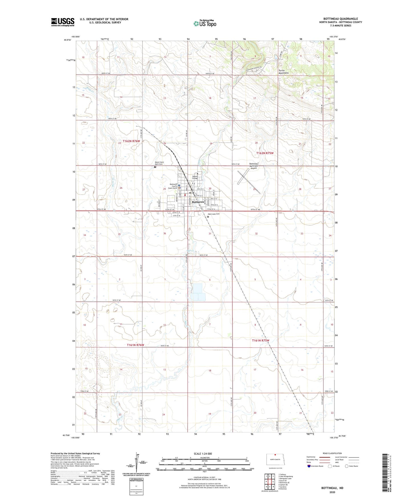
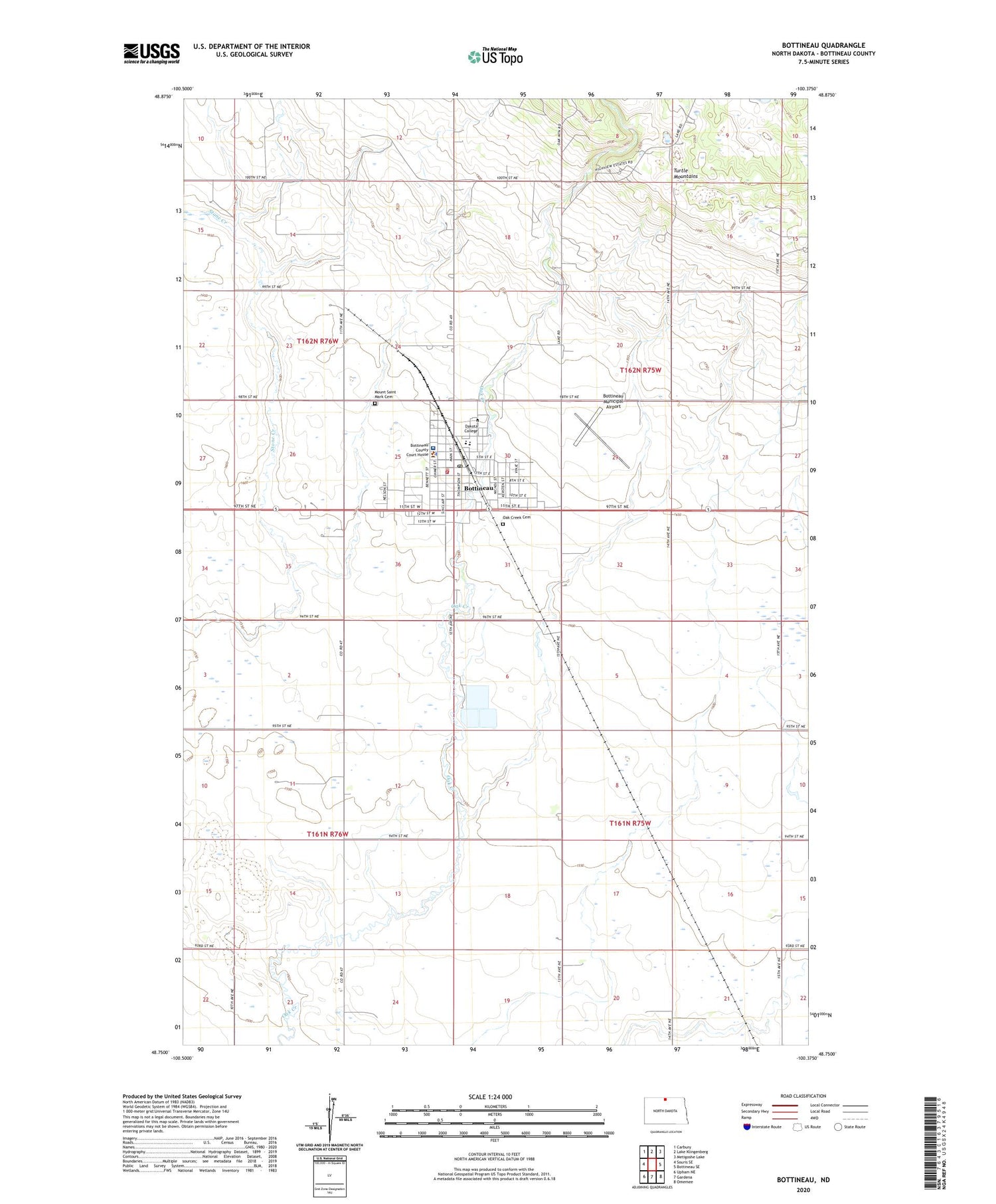
2020 topographic map quadrangle Bottineau in the state of North Dakota. Scale: 1:24000. Based on the newly updated USGS 7.5' US Topo map series, this map is in the following counties: Bottineau. The map contains contour data, water features, and other items you are used to seeing on USGS maps, but also has updated roads and other features. This is the next generation of topographic maps. Printed on high-quality waterproof paper with UV fade-resistant inks.
Quads adjacent to this one:
West: Souris SE
Northwest: Carbury
North: Lake Klingenberg
Northeast: Metigoshe Lake
East: Bottineau SE
Southeast: Omemee
South: Gardena
Southwest: Upham NE
Contains the following named places: Bottineau, Bottineau Ambulance Service, Bottineau Central School, Bottineau City Hall, Bottineau City Landfill, Bottineau Country Club, Bottineau County Courthouse, Bottineau County Historical Museum, Bottineau County Jail, Bottineau County Library, Bottineau County Sheriff's Office, Bottineau Junior-Senior High School, Bottineau Municipal Airport, Bottineau Post Office, Bottineau Rural Volunteer Fire Department, C N Nelson Science Center, City of Bottineau, Dakota College at Bottineau, Dakota College at Bottineau Library, Good Samaritan Society-Bottineau, Gross Hall, Knudson Student Center, Lath House, Mead Hall, Milligan Hall, Molberg Center, Mount Saint Mark Cemetery, Oak Creek Cemetery, Old Main Building, Saint Andrew's Health Center - Hospital, School Number 1, Thatcher Hall, Tommy Turtle Park, Tommy Turtle Statue, Township of Amity, Township of Whitteron, Vinje School, ZIP Code: 58318