MyTopo
Metigoshe Lake North Dakota US Topo Map
Couldn't load pickup availability
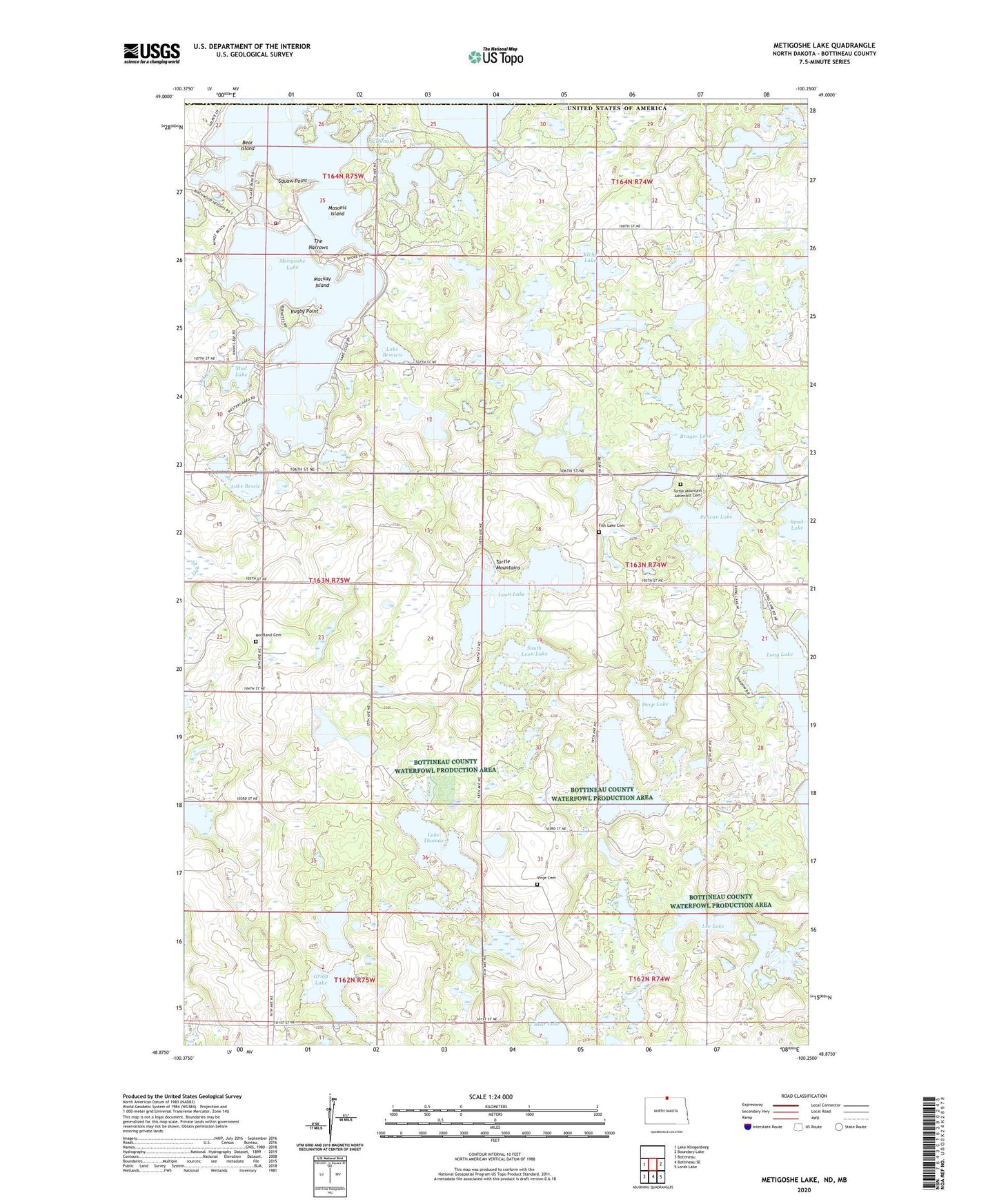
2024 topographic map quadrangle Metigoshe Lake in the state of North Dakota. Scale: 1:24000. Based on the newly updated USGS 7.5' US Topo map series, this map is in the following counties: Bottineau. The map contains contour data, water features, and other items you are used to seeing on USGS maps, but also has updated roads and other features. This is the next generation of topographic maps. Printed on high-quality waterproof paper with UV fade-resistant inks.
Quads adjacent to this one:
West: Lake Klingenberg
East: Boundary Lake
Southeast: Lords Lake
South: Bottineau SE
Southwest: Bottineau
This map covers the same area as the classic USGS quad with code o48100h3.
Contains the following named places: Bear Island, Bear Lake, Bittener Lake, Bottineau County Dive Rescue Squad, Bottineau Fire Department Station 2, Brager Lake, Deep Lake, Fish Lake Cemetery, Grigg Lake, Hahn's Bay Recreation Area, Hemming Lake, Hilton School Number 3, Hilton School Number 5, Homen State Forest, Klebe Lake, Lake Bennett, Lake Bessie, Lake McDonald, Lake Metigoshe Dam, Lake Metigoshe State Park, Lake Thomas, Lee Lake, Long Lake, Long Lake Boat Ramp, Loon Lake, Loon Lake School Number 1, Loon Lake School Number 3, Loon Lake School Number 5, Mackay Island, Masonic Island, Metigoshe Lake, Mud Lake, Norberg Lake, Nordland Cemetery, Norland Church, Pelican Lake, Pelican Sandy Recreation Area, Rugby Point, Sand Lake, School Section Lake, Sinclair Lake, Sivertson Lake, Smithsrund Lake, South Loon Lake, Squaw Point, The Narrows, Turtle Mountain Adventist Cemetery, Vinje Cemetery, Vinje Church