
MyTopo
Cooperstown East North Dakota US Topo Map
Couldn't load pickup availability
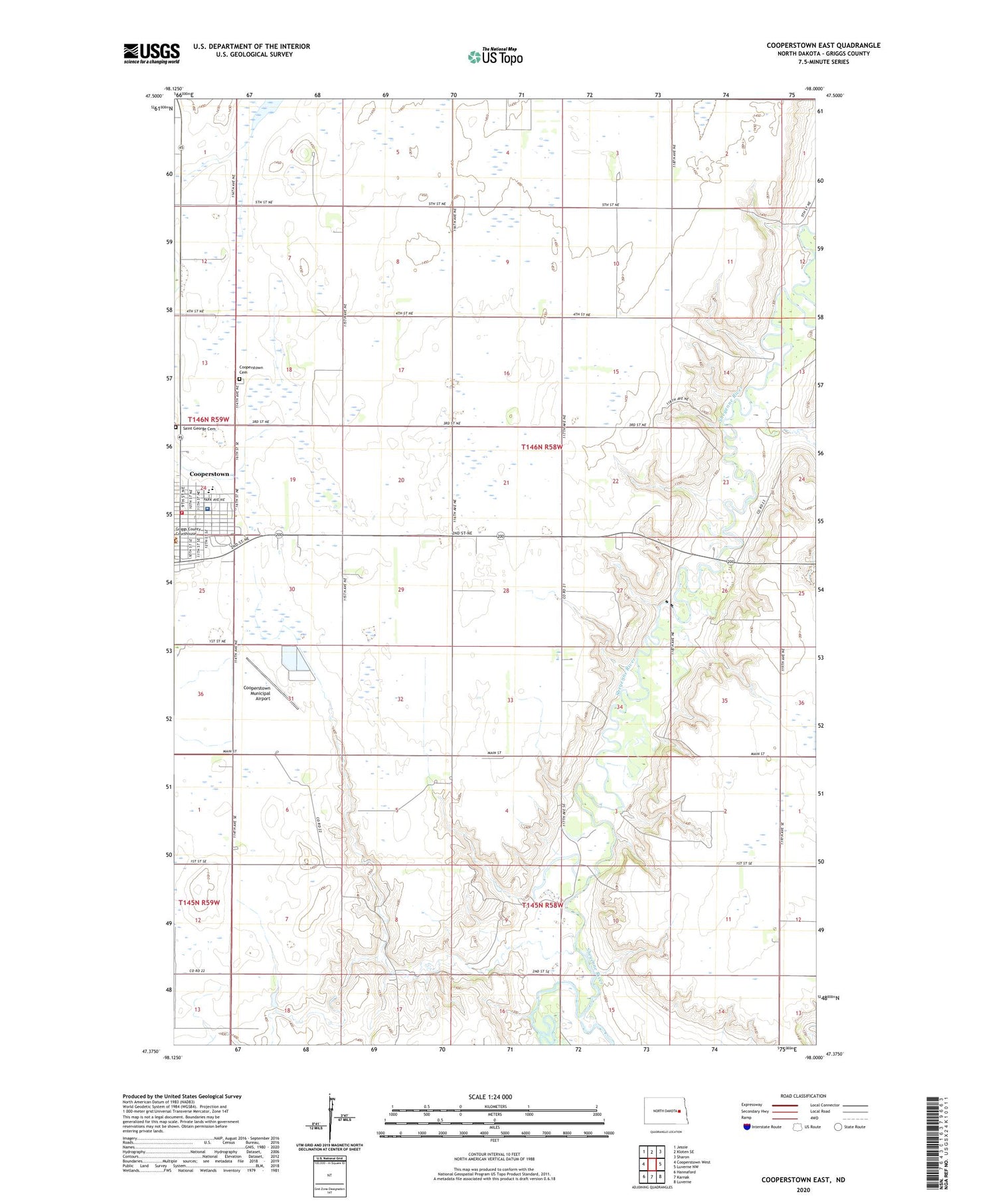
2020 topographic map quadrangle Cooperstown East in the state of North Dakota. Scale: 1:24000. Based on the newly updated USGS 7.5' US Topo map series, this map is in the following counties: Griggs. The map contains contour data, water features, and other items you are used to seeing on USGS maps, but also has updated roads and other features. This is the next generation of topographic maps. Printed on high-quality waterproof paper with UV fade-resistant inks.
Quads adjacent to this one:
West: Cooperstown West
Northwest: Jessie
North: Kloten SE
Northeast: Sharon
East: Luverne NW
Southeast: Luverne
South: Karnak
Southwest: Hannaford
Contains the following named places: Binford Quick Response - Cooperstown Ambulance Service, Cooperstown, Cooperstown Cemetery, Cooperstown City Ambulance Service and Fire Station, Cooperstown City Hall, Cooperstown City Police Department, Cooperstown Medical Center, Cooperstown Municipal Airport, Griggs County Care Center, Griggs County Central Public School, Griggs County Courthouse, Griggs County Historical Museum, Griggs County Library, Griggs County Sheriff's Office, Mardell, Saint George Cemetery, Township of Nelson, Township of Washburn, Ueland Dam, ZIP Code: 58425


