MyTopo
Sharon North Dakota US Topo Map
Couldn't load pickup availability
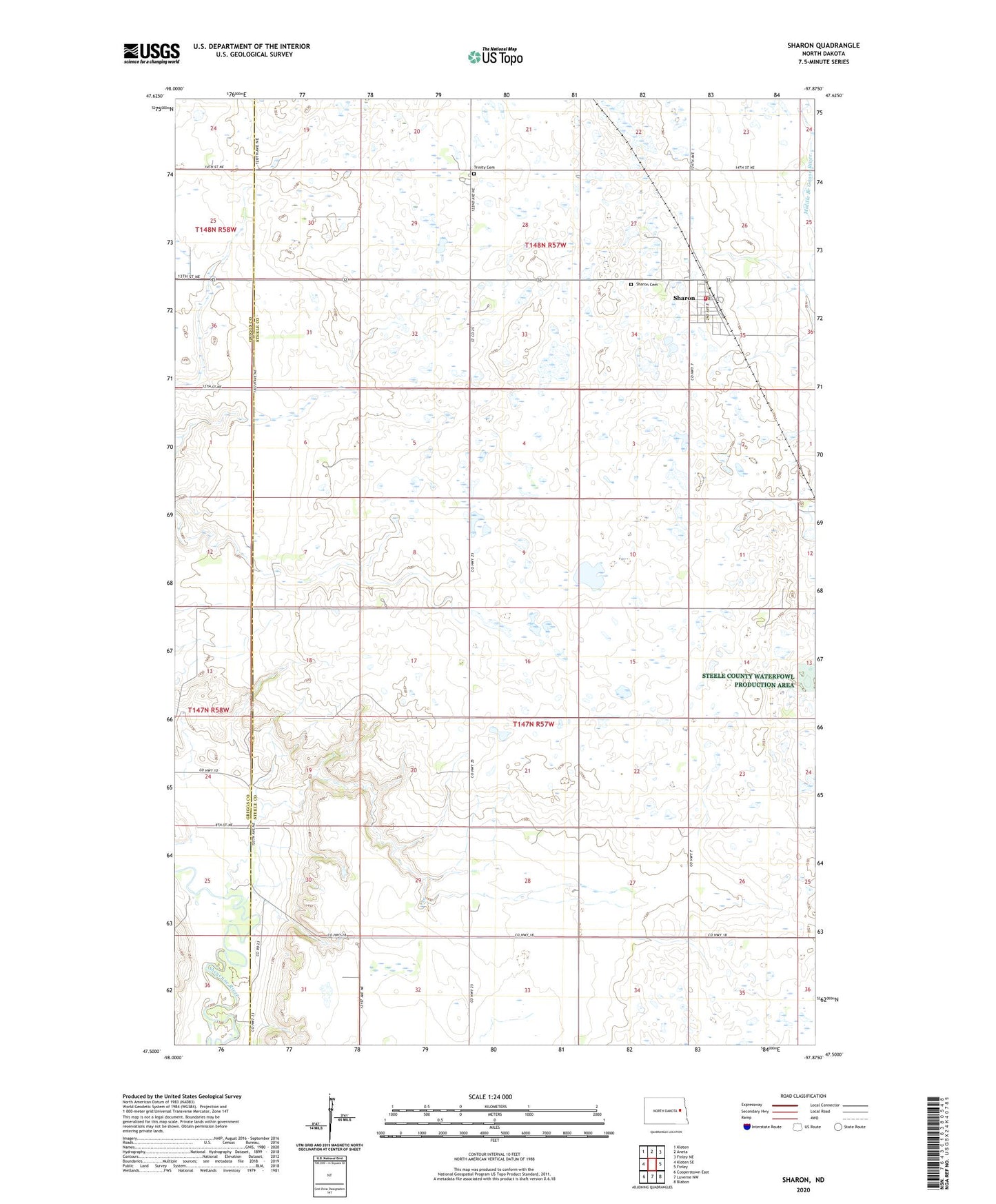
2024 topographic map quadrangle Sharon in the state of North Dakota. Scale: 1:24000. Based on the newly updated USGS 7.5' US Topo map series, this map is in the following counties: Steele, Griggs. The map contains contour data, water features, and other items you are used to seeing on USGS maps, but also has updated roads and other features. This is the next generation of topographic maps. Printed on high-quality waterproof paper with UV fade-resistant inks.
Quads adjacent to this one:
West: Kloten SE
Northwest: Kloten
North: Aneta
Northeast: Finley NE
East: Finley
Southeast: Blabon
South: Luverne NW
Southwest: Cooperstown East
This map covers the same area as the classic USGS quad with code o47097e8.
Contains the following named places: City of Sharon, Hill and Dale Golf Club, Sharon, Sharon Cemetery, Sharon City Hall, Sharon Fire Department, Sharon Post Office, Township of Franklin, Trinity Cemetery