MyTopo
Devils Lake North Dakota US Topo Map
Couldn't load pickup availability
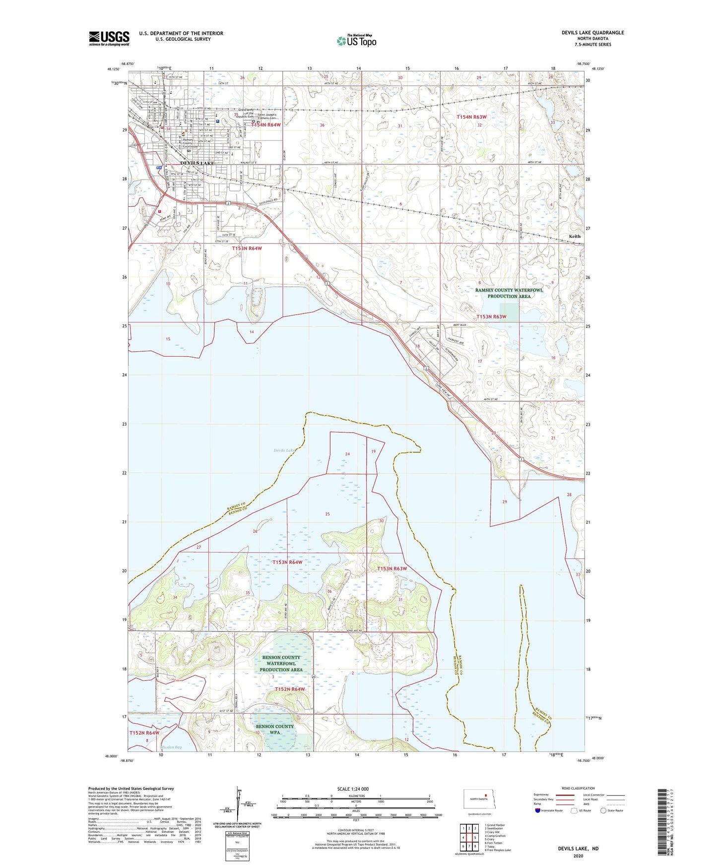
2020 topographic map quadrangle Devils Lake in the state of North Dakota. Scale: 1:24000. Based on the newly updated USGS 7.5' US Topo map series, this map is in the following counties: Ramsey, Benson. The map contains contour data, water features, and other items you are used to seeing on USGS maps, but also has updated roads and other features. This is the next generation of topographic maps. Printed on high-quality waterproof paper with UV fade-resistant inks.
Quads adjacent to this one:
West: Camp Grafton
Northwest: Grand Harbor
North: Sweetwater
Northeast: Crary NW
East: Crary
Southeast: Free Peoples Lake
South: Tokio
Southwest: Fort Totten
Contains the following named places: Central Middle School, City of Devils Lake, Devils Lake City Fire Station, Devils Lake City Hall, Devils Lake Police Department, Devils Lake Post Office, Devils Lake Rural Fire Department, Good Samaritan Society-Devils Lake, Grand Army of the Republic Cemetery, Heartland Care Center, KDLR-AM (Devils Lake), KDVL-FM (Devils Lake), Keith, Lake Region Ambulance Service, Lake Region Heritage Center, Lake Region Public Library, Lincoln School, Minnie H Elementary School, North Dakota Highway Patrol Eastern Division Devils Lake Office, North Dakota Maritime Museum, North Dakota School for the Deaf, Prairie View Elementary School, Ramsey County Courthouse, Ramsey County Jail, Ramsey County Sheriff's Office, Roosevelt Park, Saint Alexius Health Devils Lake Hospital, Saint Joseph Elementary School, Saint Joseph's Catholic Cemetery, Saint Marys Academy, School Number 1, School Number 3, Sheriff's Musuem, Sweetwater Elementary School, Washington School