MyTopo
Fort Totten North Dakota US Topo Map
Couldn't load pickup availability
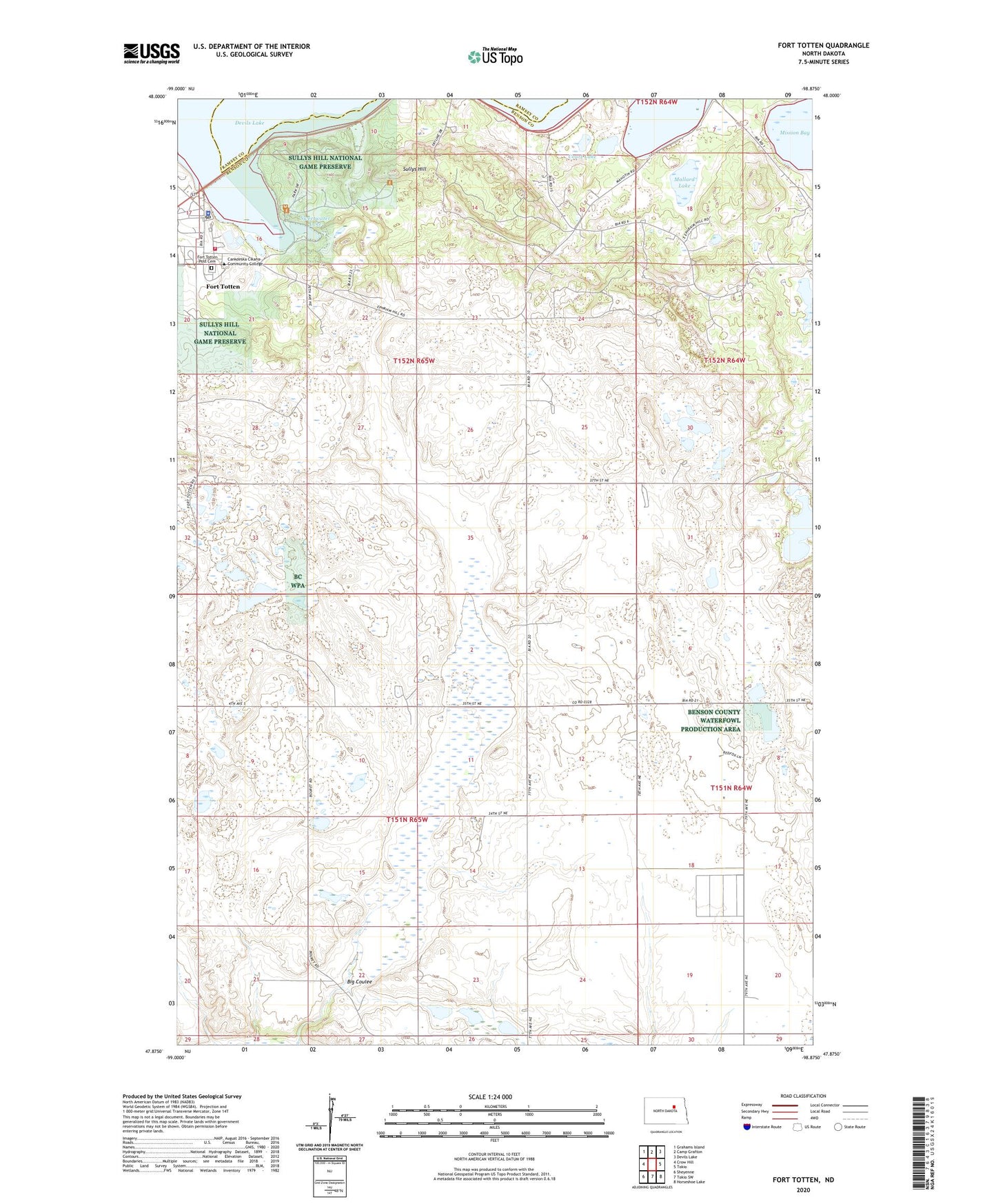
2024 topographic map quadrangle Fort Totten in the state of North Dakota. Scale: 1:24000. Based on the newly updated USGS 7.5' US Topo map series, this map is in the following counties: Benson, Ramsey. The map contains contour data, water features, and other items you are used to seeing on USGS maps, but also has updated roads and other features. This is the next generation of topographic maps. Printed on high-quality waterproof paper with UV fade-resistant inks.
Quads adjacent to this one:
West: Crow Hill
Northwest: Grahams Island
North: Camp Grafton
Northeast: Devils Lake
East: Tokio
Southeast: Horseshoe Lake
South: Tokio SW
Southwest: Sheyenne
This map covers the same area as the classic USGS quad with code o47098h8.
Contains the following named places: Big Coulee, Cankdeska Cikana Community College, Cankdeska Cikana Community College Student Union, Court Lake, East Side Day School, Fort Totten, Fort Totten Census Designated Place, Fort Totten District, Fort Totten Indian Agency, Fort Totten Post Cemetery, Fort Totten Post Office, Lake Region Pioneer Daughters Museum, Lone Tree School Number 1, Mallard Lake, Natural Resource Building, Spirit Lake Fire Department, Spirit Lake Reservation, Sprit Lake Tribal Police Department, Sullys Hill, Sullys Hill National Game Preserve, Sweetwater Lake, Township of Twin Tree, Unorganized Territory of Fort Totten, Valerie Merrick Memorial Library, Vocational Carpentry Trades Building