MyTopo
Fairfield North Dakota US Topo Map
Couldn't load pickup availability
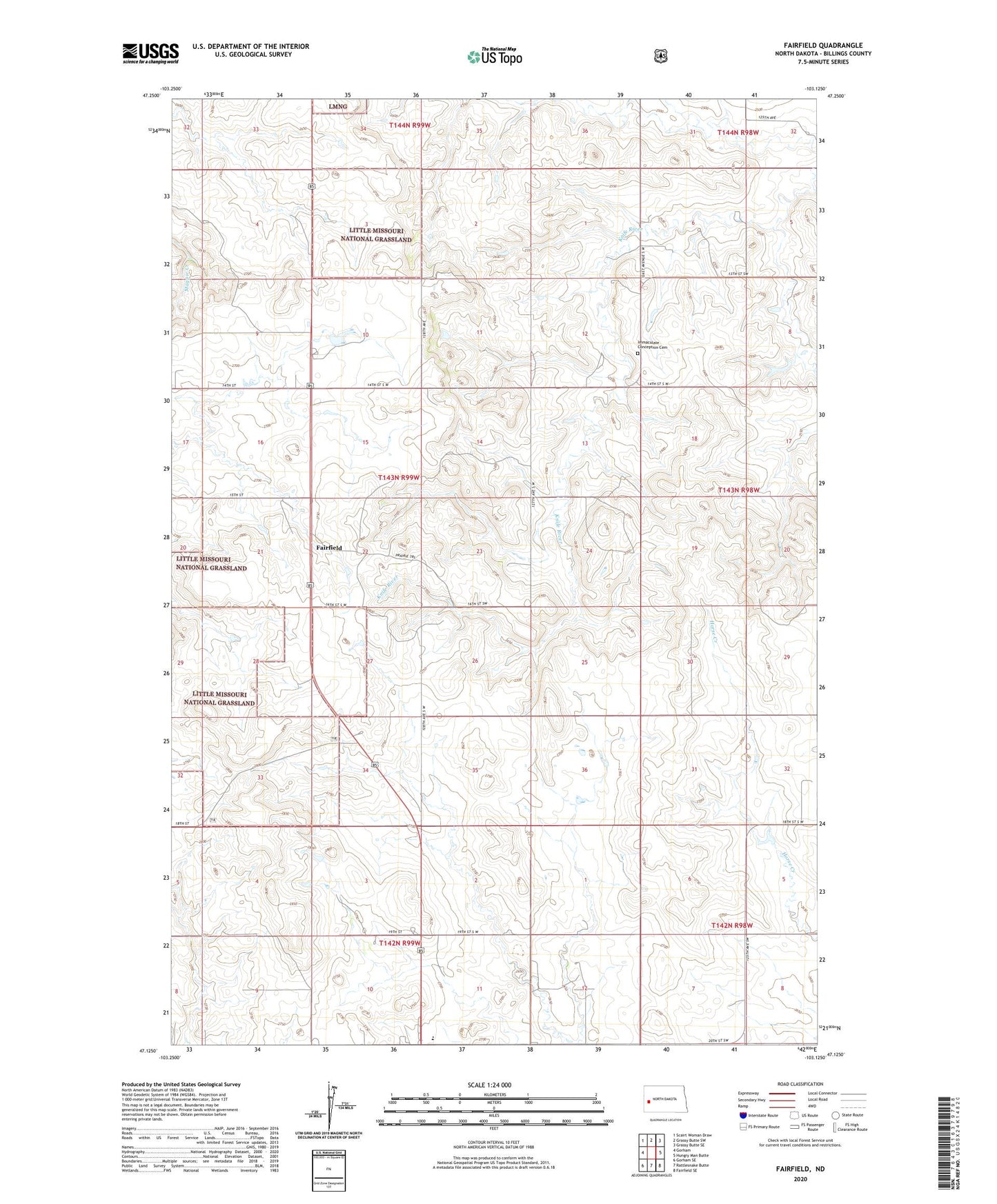
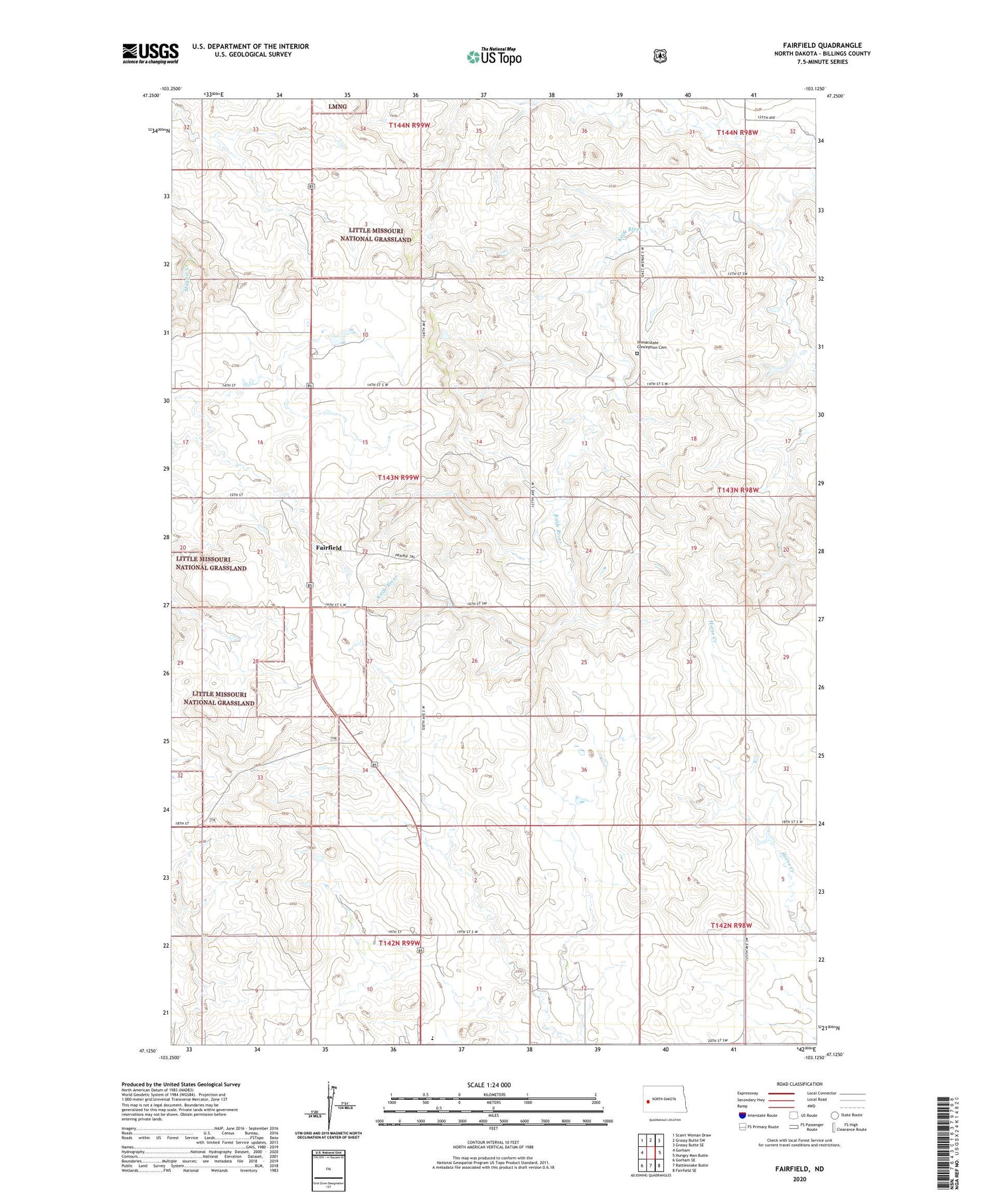
2020 topographic map quadrangle Fairfield in the state of North Dakota. Scale: 1:24000. Based on the newly updated USGS 7.5' US Topo map series, this map is in the following counties: Billings. The map contains contour data, water features, and other items you are used to seeing on USGS maps, but also has updated roads and other features. This is the next generation of topographic maps. Printed on high-quality waterproof paper with UV fade-resistant inks.
Quads adjacent to this one:
West: Gorham
Northwest: Scairt Woman Draw
North: Grassy Butte SW
Northeast: Grassy Butte SE
East: Hungry Man Butte
Southeast: Fairfield SE
South: Rattlesnake Butte
Southwest: Gorham SE
Contains the following named places: Fairfield, Fairfield Post Office, Fairfield School, Fairfield Store, Glade School, Hecker School, Immaculate Conception Cemetery, Joint School, Prairie Elementary School