MyTopo
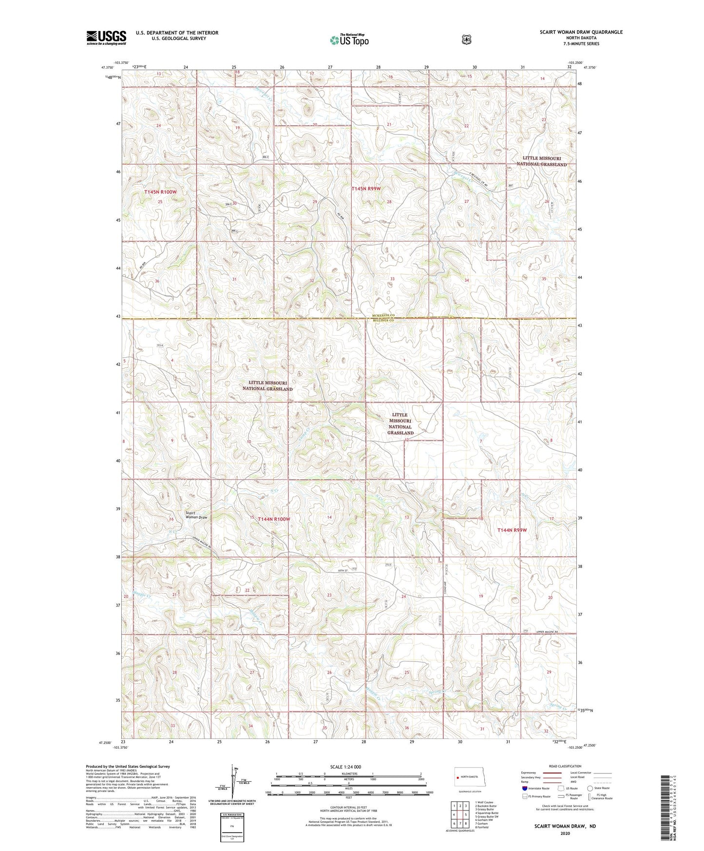
Scairt Woman Draw North Dakota US Topo Map
Couldn't load pickup availability
Also explore the Scairt Woman Draw Forest Service Topo of this same quad for updated USFS data
2024 topographic map quadrangle Scairt Woman Draw in the state of North Dakota. Scale: 1:24000. Based on the newly updated USGS 7.5' US Topo map series, this map is in the following counties: Billings, McKenzie. The map contains contour data, water features, and other items you are used to seeing on USGS maps, but also has updated roads and other features. This is the next generation of topographic maps. Printed on high-quality waterproof paper with UV fade-resistant inks.
Quads adjacent to this one:
West: Squaretop Butte
Northwest: Wolf Coulee
North: Buckskin Butte
Northeast: Grassy Butte
East: Grassy Butte SW
Southeast: Fairfield
South: Gorham
Southwest: Gorham NW
This map covers the same area as the classic USGS quad with code o47103c3.
Contains the following named places: Camp Creek, L Tachenko Ranch, Lillibridge Ranch, Palunak Dam, Scairt Woman Draw, Scairt Woman Oil Field, Spring Creek, Tester School