MyTopo
Haley North Dakota US Topo Map
Couldn't load pickup availability
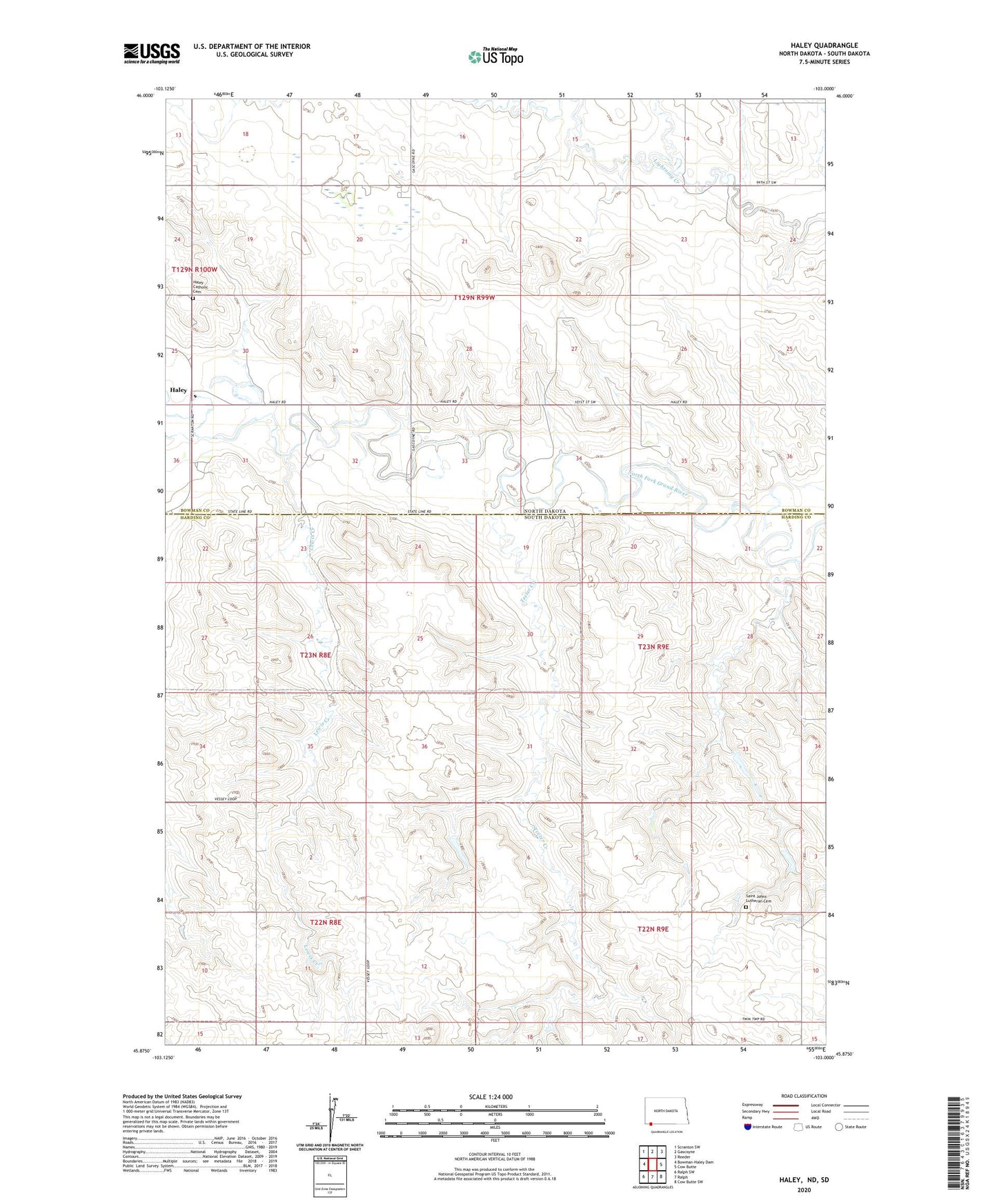
2020 topographic map quadrangle Haley in the states of South Dakota, North Dakota. Scale: 1:24000. Based on the newly updated USGS 7.5' US Topo map series, this map is in the following counties: Bowman, Harding. The map contains contour data, water features, and other items you are used to seeing on USGS maps, but also has updated roads and other features. This is the next generation of topographic maps. Printed on high-quality waterproof paper with UV fade-resistant inks.
Quads adjacent to this one:
Northwest: Scranton SW
North: Gascoyne
Northeast: Reeder
Southeast: Cow Butte SW
South: Ralph
Southwest: Ralph SW
Contains the following named places: Haley, Haley Catholic Cemetery, Haley School, Lewis Creek, Nelson Airport, Saint Johns Lutheran Cemetery, Teeter Creek, Township of Haley, Township of Vessey, Washout Dam, Wilson Creek