MyTopo
Hillsboro North Dakota US Topo Map
Couldn't load pickup availability
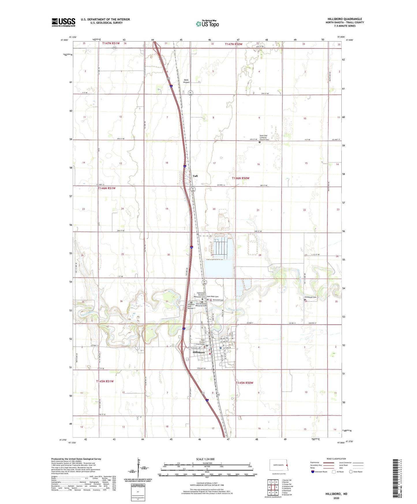
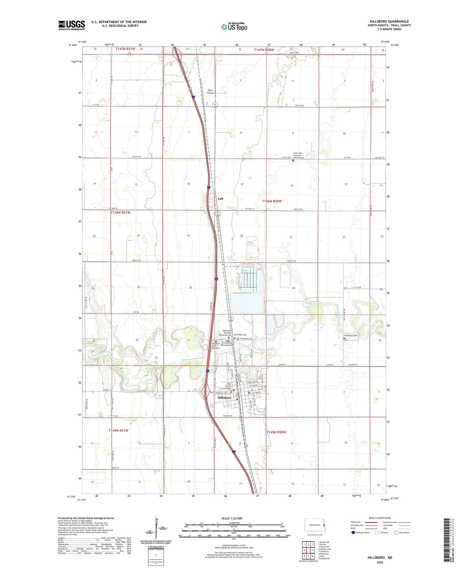
2020 topographic map quadrangle Hillsboro in the state of North Dakota. Scale: 1:24000. Based on the newly updated USGS 7.5' US Topo map series, this map is in the following counties: Traill. The map contains contour data, water features, and other items you are used to seeing on USGS maps, but also has updated roads and other features. This is the next generation of topographic maps. Printed on high-quality waterproof paper with UV fade-resistant inks.
Quads adjacent to this one:
West: Hillsboro NW
Northwest: Buxton SW
North: Buxton
Northeast: Climax SW
East: Caledonia
Southeast: Halstad SW
South: Kelso
Southwest: Blanchard
Contains the following named places: City of Hillsboro, Deck Airport, Eldorado Town Hall, Elmwood Cemetery, Hillsboro, Hillsboro Cemetery Number 1, Hillsboro Dam, Hillsboro Elementary School, Hillsboro Fire Station, Hillsboro High School, Hillsboro Medical Center, Hillsboro Police Department, Hillsboro Post Office, Hillsboro Town Hall, Hjelmstad Brothers Memorial Cemetery, Immanuel Cemetery, Lynn W Elton Memorial Cemetery, Saint Olaf Church, Saint Olaf Lutheran Church Cemetery, Saint Rose Cemetery, Sanford Hillsboro Nursing Home, Taft, Township of Eldorado, Traill County Courthouse, Traill County Jail, Traill County Museum Complex, Traill County Sheriff's Office, ZIP Code: 58045