MyTopo
Buxton North Dakota US Topo Map
Couldn't load pickup availability
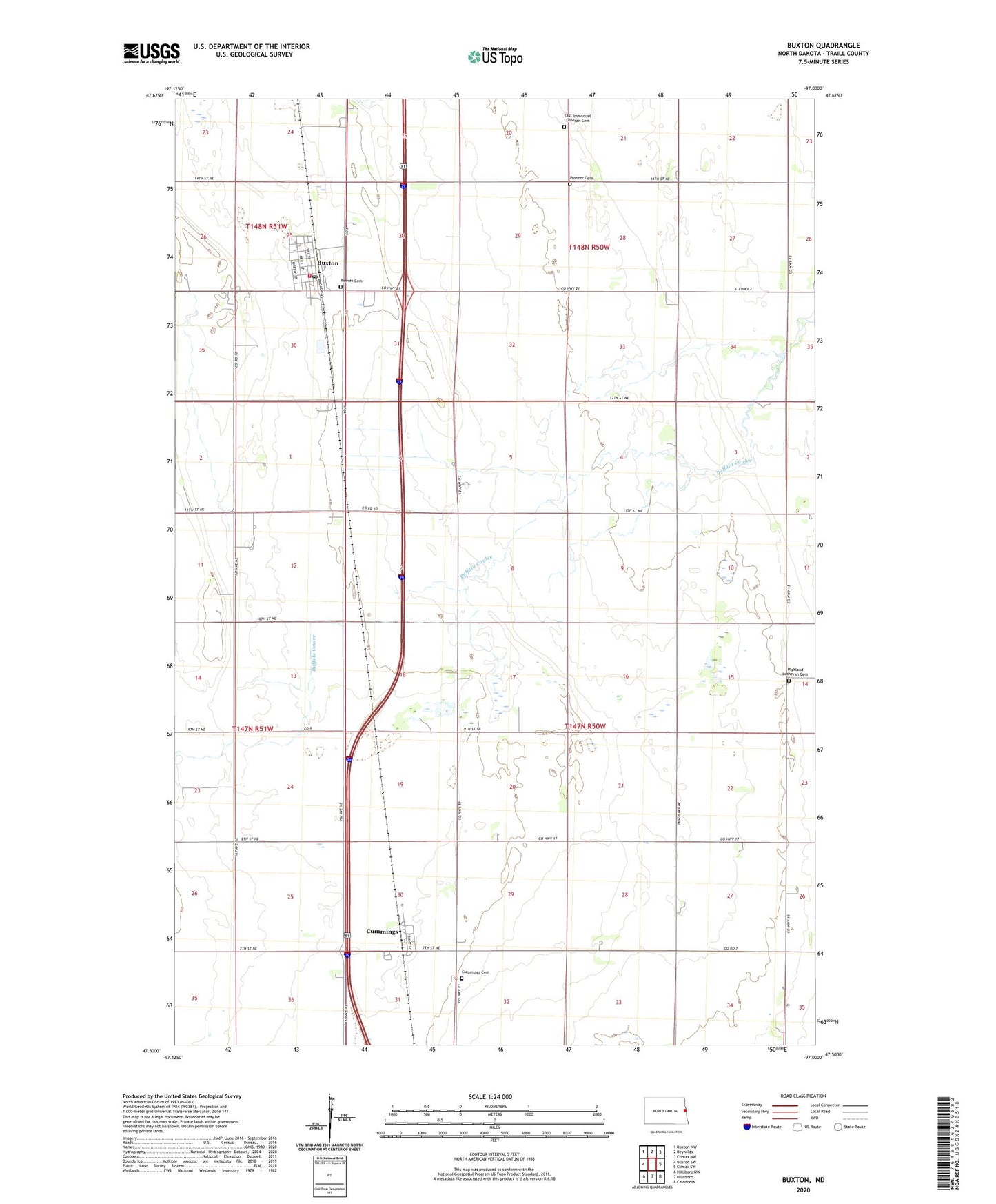
2024 topographic map quadrangle Buxton in the state of North Dakota. Scale: 1:24000. Based on the newly updated USGS 7.5' US Topo map series, this map is in the following counties: Traill. The map contains contour data, water features, and other items you are used to seeing on USGS maps, but also has updated roads and other features. This is the next generation of topographic maps. Printed on high-quality waterproof paper with UV fade-resistant inks.
Quads adjacent to this one:
West: Buxton SW
Northwest: Buxton NW
North: Reynolds
Northeast: Climax NW
East: Climax SW
Southeast: Caledonia
South: Hillsboro
Southwest: Hillsboro NW
This map covers the same area as the classic USGS quad with code o47097e1.
Contains the following named places: Buxton, Buxton Post Office, Buxton Rural Fire District Station, City of Buxton, Cummings, Cummings Cemetery, East Immanuel Lutheran Cemetery, Ervin Town Hall, Highland Church, Highland Lutheran Cemetery, Pioneer Cemetery, Reeves Cemetery, Township of Buxton, Township of Ervin, ZIP Codes: 58218, 58223