MyTopo
Lake Tschida West North Dakota US Topo Map
Couldn't load pickup availability
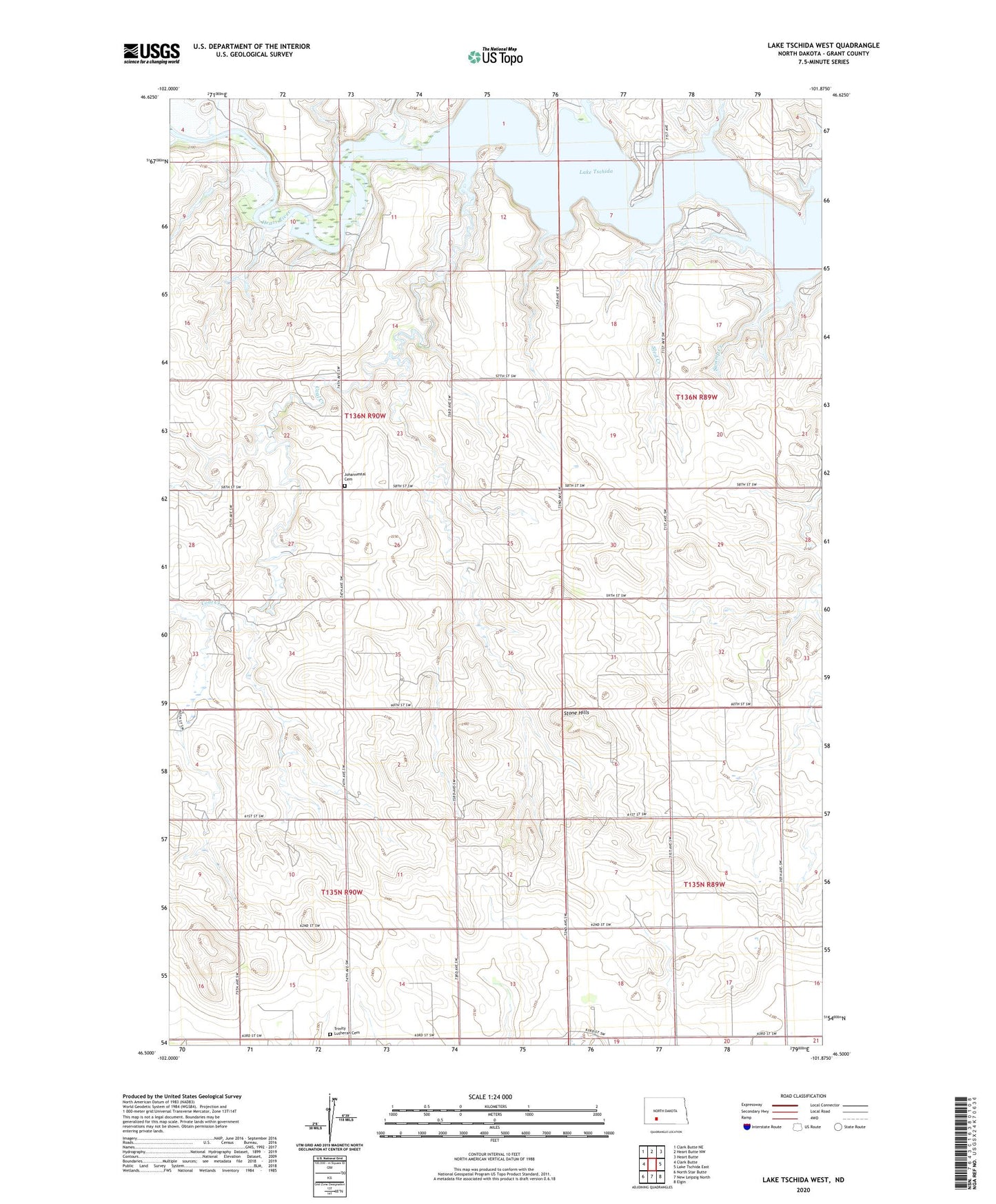
2020 topographic map quadrangle Lake Tschida West in the state of North Dakota. Scale: 1:24000. Based on the newly updated USGS 7.5' US Topo map series, this map is in the following counties: Grant. The map contains contour data, water features, and other items you are used to seeing on USGS maps, but also has updated roads and other features. This is the next generation of topographic maps. Printed on high-quality waterproof paper with UV fade-resistant inks.
Quads adjacent to this one:
West: Clark Butte
Northwest: Clark Butte NE
North: Heart Butte NW
Northeast: Heart Butte
East: Lake Tschida East
Southeast: Elgin
South: New Leipzig North
Southwest: North Star Butte
Contains the following named places: Coal Creek, Johannestal Cemetery, Johannestown Church, Lake Tschida, Lignite Mine, Rattlesnake Point, Red Creek, School Number 1, School Number 2, School Number 3, School Number 4, Sled Creek, Spring Creek, Stone Hills, Swamp Creek, Trinity Church, Trinity Lutheran Cemetery