MyTopo
Elgin North Dakota US Topo Map
Couldn't load pickup availability
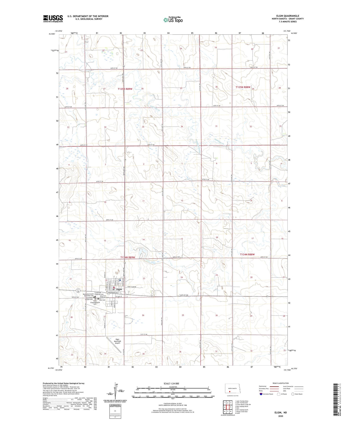
2024 topographic map quadrangle Elgin in the state of North Dakota. Scale: 1:24000. Based on the newly updated USGS 7.5' US Topo map series, this map is in the following counties: Grant. The map contains contour data, water features, and other items you are used to seeing on USGS maps, but also has updated roads and other features. This is the next generation of topographic maps. Printed on high-quality waterproof paper with UV fade-resistant inks.
Quads adjacent to this one:
West: New Leipzig North
Northwest: Lake Tschida West
North: Lake Tschida East
Northeast: Crown Butte Creek SW
East: Heil
Southeast: Leith
South: Sheep Creek Dam
Southwest: New Leipzig South
This map covers the same area as the classic USGS quad with code o46101d7.
Contains the following named places: American Lutheran Cemetery, Assembly of God Cemetery, Bethesda United Methodist Cemetery, City of Elgin, Elgin, Elgin City Hall, Elgin City Police Department, Elgin Community Center, Elgin Elementary School, Elgin Fire District, Elgin Municipal Airport, Elgin Museum, Elgin Post Office, Elgin Public Library, Grant County High School, Hope Congregational Cemetery, Immanuel Lutheran Cemetery, Jacobson Memorial Hospital Care Center, Township of Buckskin, Township of Minnie, Zion Cemetery, ZIP Code: 58533