
MyTopo
Mandan North Dakota US Topo Map
Couldn't load pickup availability
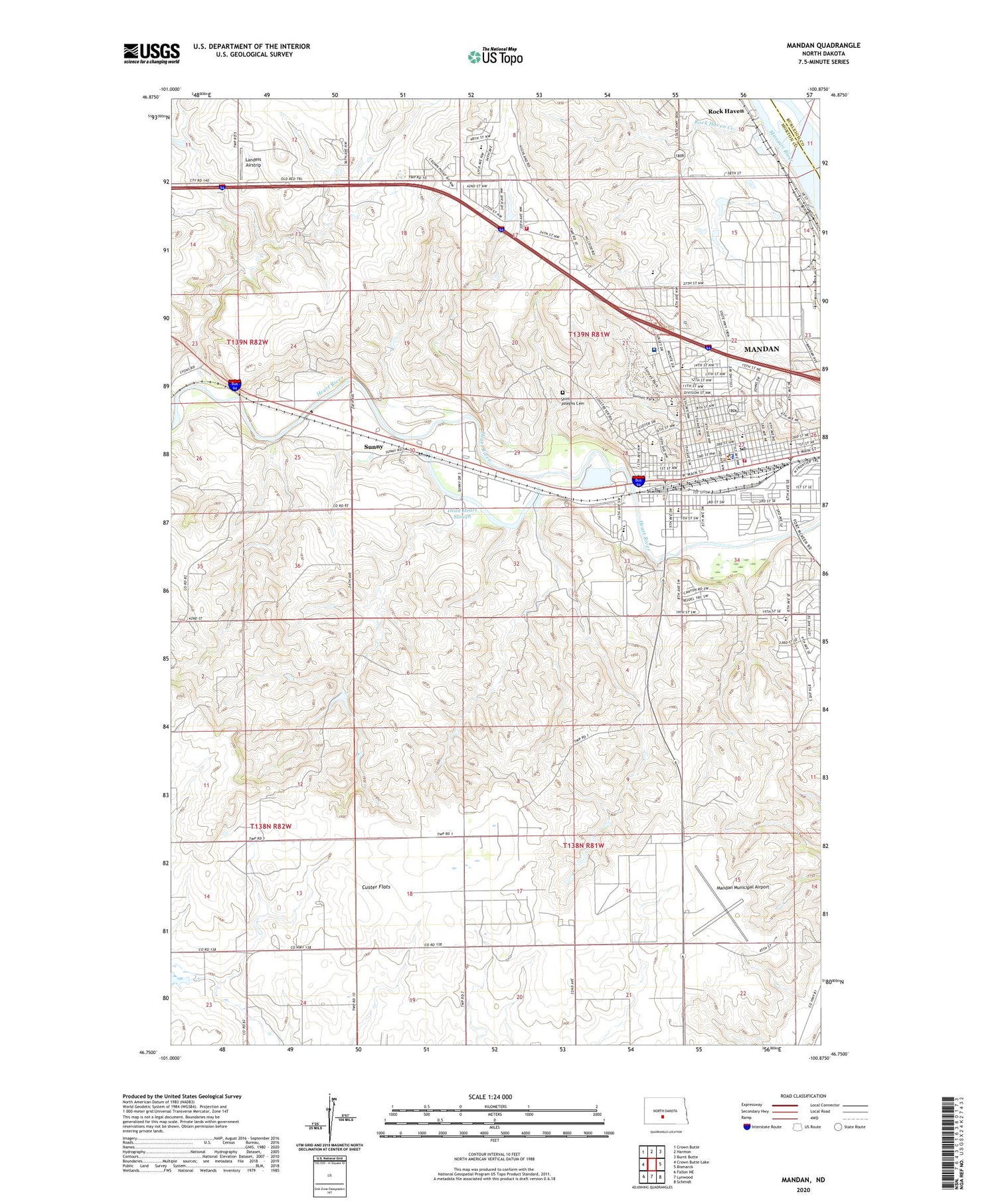
2020 topographic map quadrangle Mandan in the state of North Dakota. Scale: 1:24000. Based on the newly updated USGS 7.5' US Topo map series, this map is in the following counties: Morton, Burleigh. The map contains contour data, water features, and other items you are used to seeing on USGS maps, but also has updated roads and other features. This is the next generation of topographic maps. Printed on high-quality waterproof paper with UV fade-resistant inks.
Quads adjacent to this one:
West: Crown Butte Lake
Northwest: Crown Butte
North: Harmon
Northeast: Burnt Butte
East: Bismarck
Southeast: Schmidt
South: Lynwood
Southwest: Fallon NE
Contains the following named places: Brave Center Academy, Christ the King Elementary School, City of Mandan, Custer Elementary School, Custer Flats, Dakota Alpha Nursing Home, Dead Heart Slough, El Rancho Mobile Home Park, Fort Lincoln Elementary School, Kens Mobile Home Park, Landeis Airstrip, Lewis and Clark Elementary School, Mandan, Mandan City Fire Station 1, Mandan City Hall, Mandan High School, Mandan Middle School, Mandan Municipal Airport, Mandan Police Department, Mandan Post Office, Mandan Rural Fire Department, Marmot Schools, Mary Stark Elementary School, Meadow Park, Metro Area Ambulance Service Mandan, Morton County Correctional Center, Morton County Courthouse, Morton County Sheriff's Office, Morton Mandan Public Library, North Dakota State Railroad Museum, Rock Haven, Rock Haven Creek, Roosevelt Elementary School, Saint Joseph Elementary School, Saint Josephs Cemetery, Sanford Health Continuing Care Center, Sanford Health Sunset Drive Continuing Care Center, Sunny, Syndicate School, Unorganized Territory of Mandan, Vibra Hospital of the Central Dakotas, Wildwood Mobile Home Park


