MyTopo
Michigan West North Dakota US Topo Map
Couldn't load pickup availability
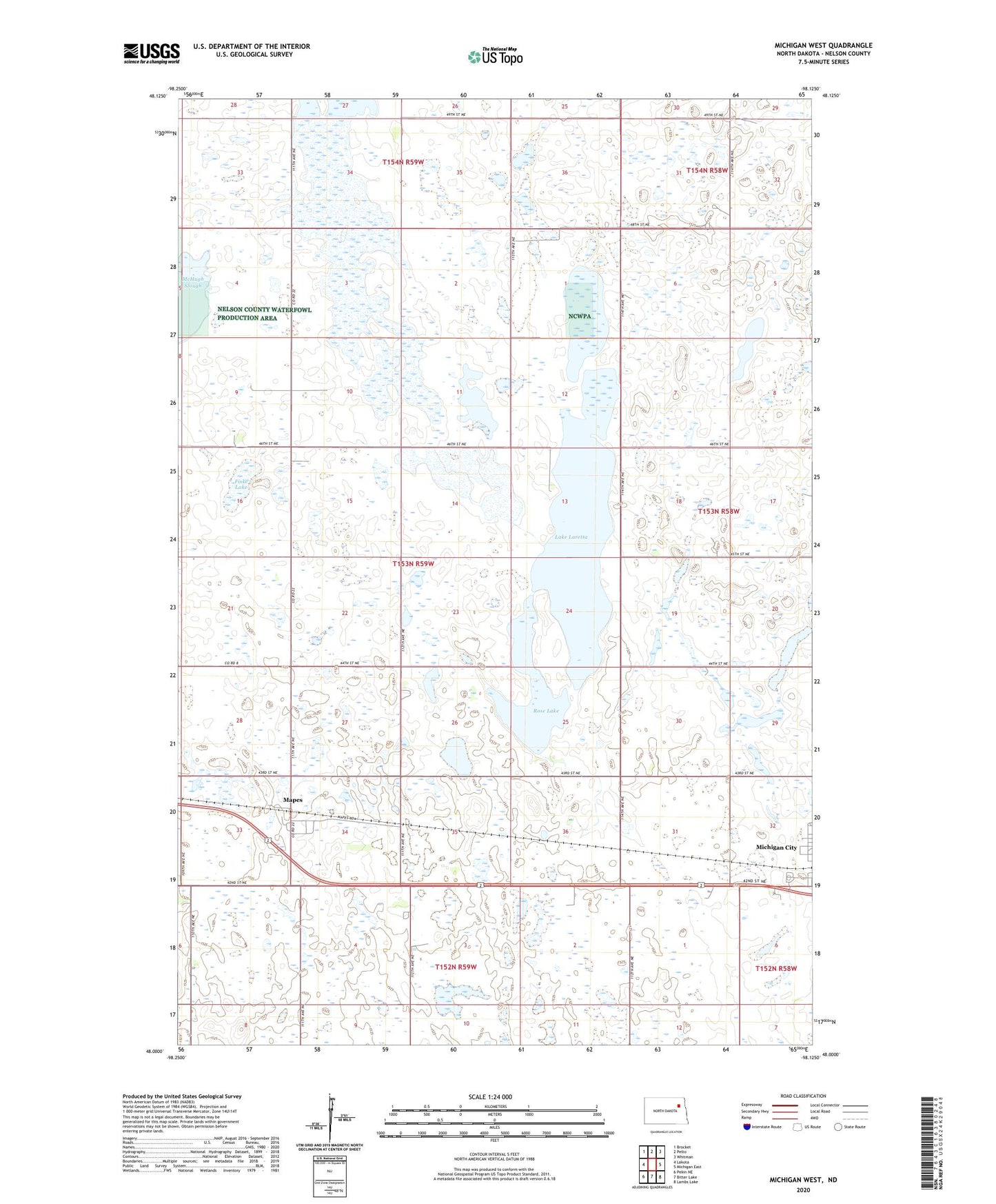
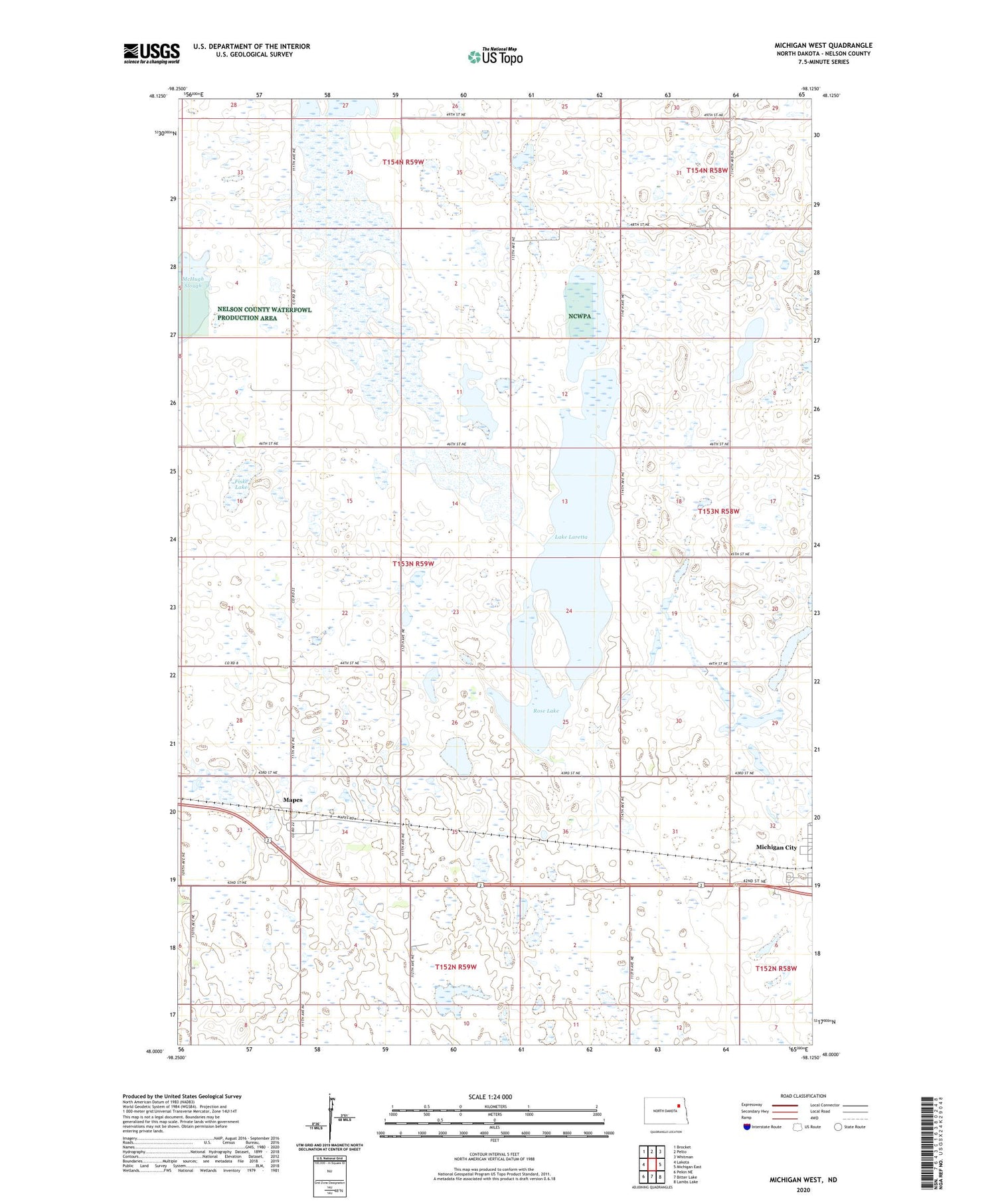
2020 topographic map quadrangle Michigan West in the state of North Dakota. Scale: 1:24000. Based on the newly updated USGS 7.5' US Topo map series, this map is in the following counties: Nelson. The map contains contour data, water features, and other items you are used to seeing on USGS maps, but also has updated roads and other features. This is the next generation of topographic maps. Printed on high-quality waterproof paper with UV fade-resistant inks.
Quads adjacent to this one:
West: Lakota
Northwest: Brocket
North: Pelto
Northeast: Whitman
East: Michigan East
Southeast: Lambs Lake
South: Bitter Lake
Southwest: Pekin NE
Contains the following named places: Fiske Lake, Lake Laretta, Lake Mary, Mapes, Rose Lake, Township of Mapes, Township of Rubin, ZIP Code: 58259