MyTopo
Lakota North Dakota US Topo Map
Couldn't load pickup availability
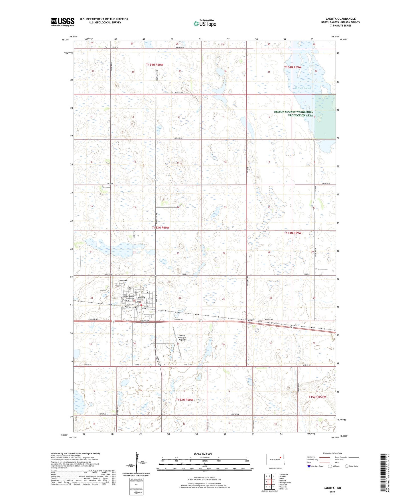
2024 topographic map quadrangle Lakota in the state of North Dakota. Scale: 1:24000. Based on the newly updated USGS 7.5' US Topo map series, this map is in the following counties: Nelson. The map contains contour data, water features, and other items you are used to seeing on USGS maps, but also has updated roads and other features. This is the next generation of topographic maps. Printed on high-quality waterproof paper with UV fade-resistant inks.
Quads adjacent to this one:
West: Bartlett
Northwest: Lakota NW
North: Brocket
Northeast: Pelto
East: Michigan West
Southeast: Bitter Lake
South: Pekin NE
Southwest: Pekin NW
This map covers the same area as the classic USGS quad with code o48098a3.
Contains the following named places: City of Lakota, Dodds Town Hall, Good Samaritan Society-Lakota, Lakota, Lakota Ambulance Service, Lakota Cemetery, Lakota City Hall, Lakota City Library, Lakota Elementary School, Lakota Fire District Station, Lakota High School, Lakota Municipal Airport, Lakota Police Department, Lakota Post Office, McHugh Slough, Nelson County Courthouse, Nelson County Sheriff's Office, Nelson County Waterfowl Production Area, Township of Kane, Township of Lakota, ZIP Code: 58344