
MyTopo
Northwood North Dakota US Topo Map
Couldn't load pickup availability
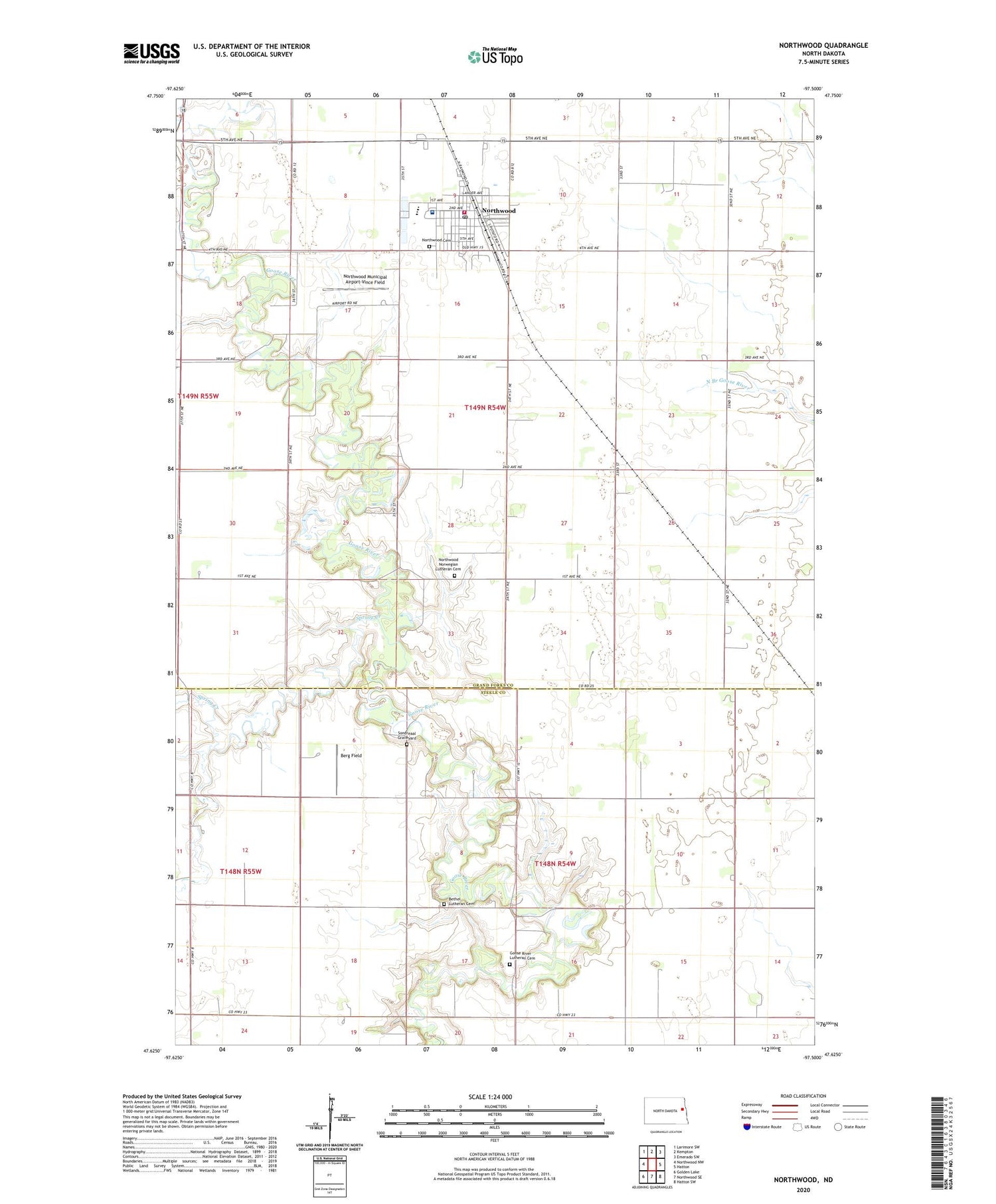
2020 topographic map quadrangle Northwood in the state of North Dakota. Scale: 1:24000. Based on the newly updated USGS 7.5' US Topo map series, this map is in the following counties: Grand Forks, Steele. The map contains contour data, water features, and other items you are used to seeing on USGS maps, but also has updated roads and other features. This is the next generation of topographic maps. Printed on high-quality waterproof paper with UV fade-resistant inks.
Quads adjacent to this one:
West: Northwood NW
Northwest: Larimore SW
North: Kempton
Northeast: Emerado SW
East: Hatton
Southeast: Hatton SW
South: Northwood SE
Southwest: Golden Lake
Contains the following named places: Berg Field, Bethel Lutheran Cemetery, City of Northwood, Goose River Church, Goose River Lutheran Cemetery, Little Goose River, Newburgh Town Hall, Northwood, Northwood Cemetery, Northwood City Hall, Northwood Community Center, Northwood Deaconess Health Center, Northwood Deaconess Health Nursing Home, Northwood Municipal Airport-Vince Field, Northwood Norwegian Lutheran Cemetery, Northwood Pioneer Museum, Northwood Police Department, Northwood Post Office, Northwood Public School, Northwood School and City Library, Northwood Volunteer Fire Department, Sondreaal Graveyard, Spring Creek, Township of Newburgh, Township of Northwood


