MyTopo
Hatton North Dakota US Topo Map
Couldn't load pickup availability
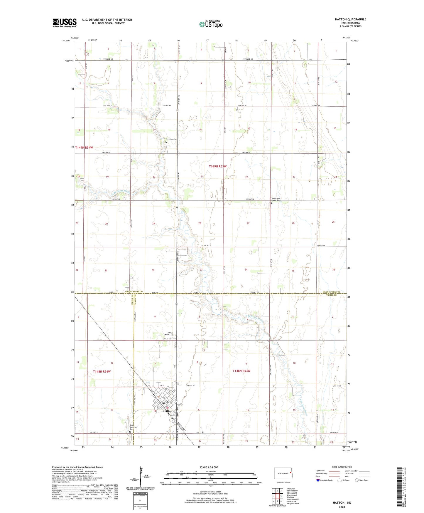
2024 topographic map quadrangle Hatton in the state of North Dakota. Scale: 1:24000. Based on the newly updated USGS 7.5' US Topo map series, this map is in the following counties: Grand Forks, Traill, Steele. The map contains contour data, water features, and other items you are used to seeing on USGS maps, but also has updated roads and other features. This is the next generation of topographic maps. Printed on high-quality waterproof paper with UV fade-resistant inks.
Quads adjacent to this one:
West: Northwood
Northwest: Kempton
North: Emerado SW
Northeast: Emerado SE
East: Holmes
Southeast: Mayville North
South: Hatton SW
Southwest: Northwood SE
This map covers the same area as the classic USGS quad with code o47097f4.
Contains the following named places: Carl Ben Eielson Cemetery, City of Hatton, Hatton, Hatton Centennial Community Center, Hatton City Hall, Hatton Eielson Public Schoool, Hatton Post Office, Hatton School and Public Library, Hatton Volunteer Fire Department, Hatton-Eielson Museum, Swenson Cemetery, Township of Garfield, Township of Washington, Tri-County Health Care, Washington Prairie Cemetery, Washington Prairie Church, Zoar Lutheran Cemetery, ZIP Code: 58240