MyTopo
Reeder North Dakota US Topo Map
Couldn't load pickup availability
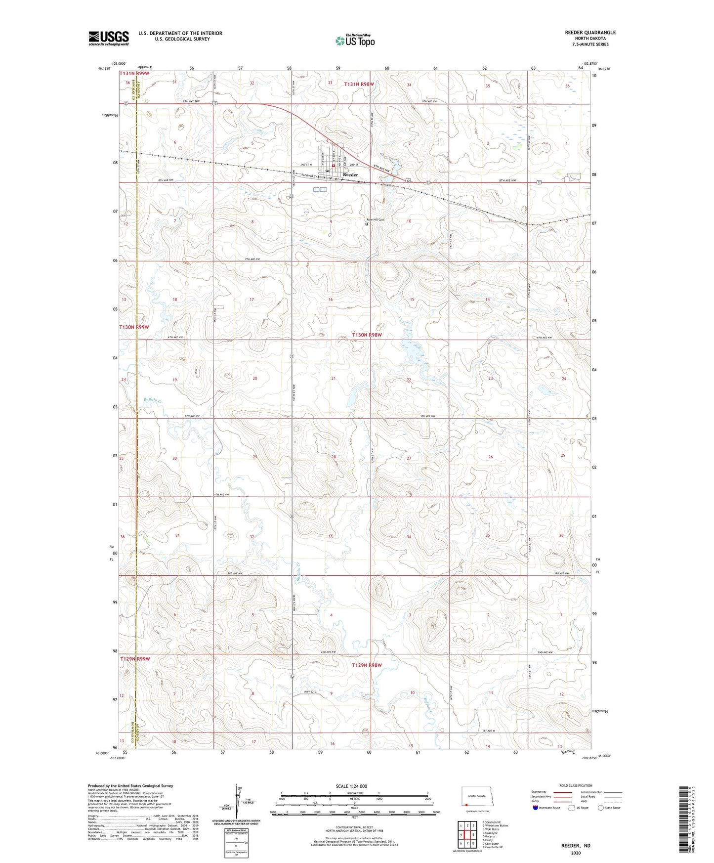
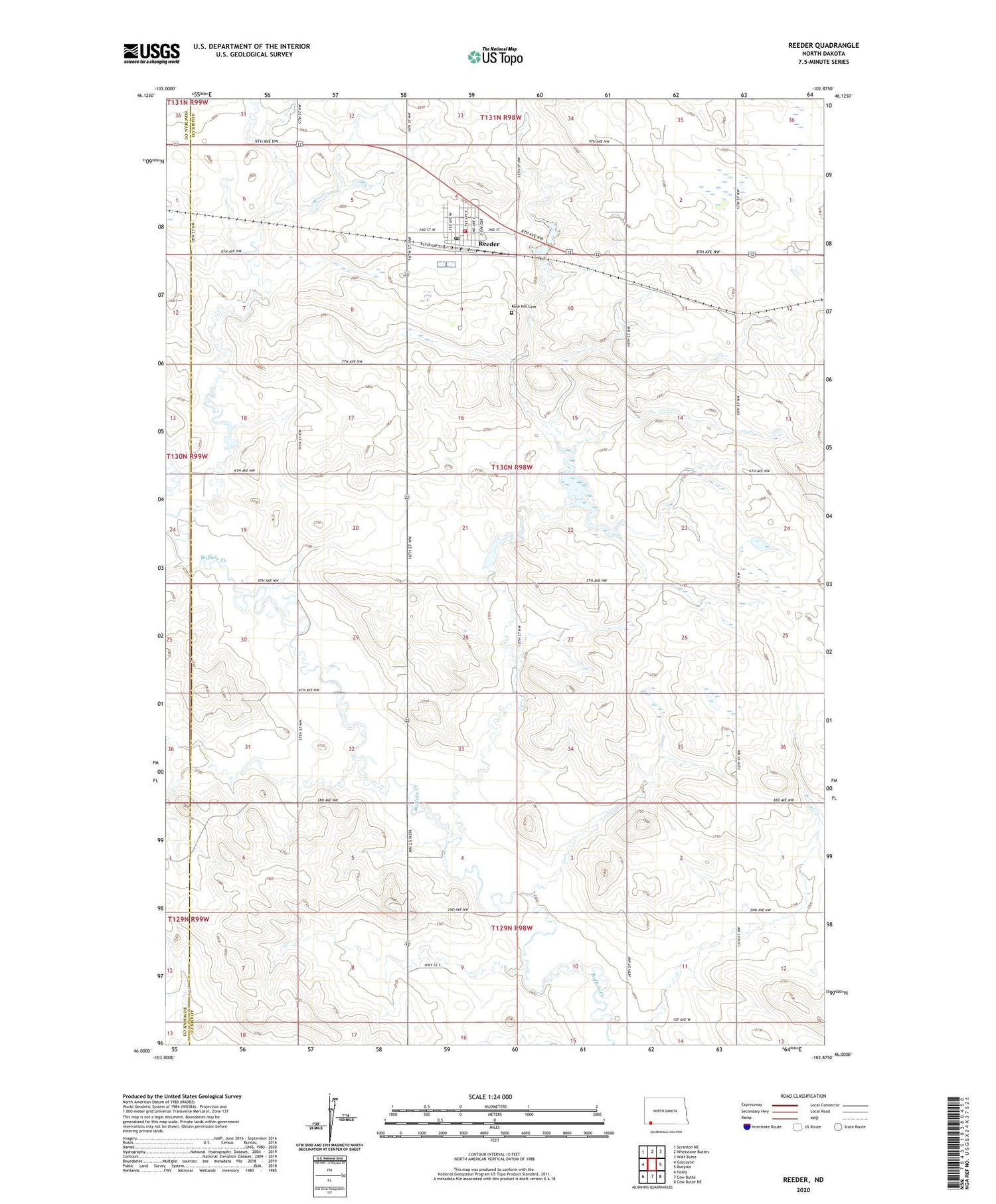
2020 topographic map quadrangle Reeder in the state of North Dakota. Scale: 1:24000. Based on the newly updated USGS 7.5' US Topo map series, this map is in the following counties: Adams, Bowman. The map contains contour data, water features, and other items you are used to seeing on USGS maps, but also has updated roads and other features. This is the next generation of topographic maps. Printed on high-quality waterproof paper with UV fade-resistant inks.
Quads adjacent to this one:
West: Gascoyne
Northwest: Scranton NE
North: Whetstone Buttes
Northeast: Wolf Butte
East: Bucyrus
Southeast: Cow Butte NE
Contains the following named places: City of Reeder, Reeder, Reeder Community Center, Reeder Fire District, Reeder Landing Field, Reeder Post Office, Rose Hill Cemetery, Township of Lemmon, Township of Reeder