MyTopo
Rutland North Dakota US Topo Map
Couldn't load pickup availability
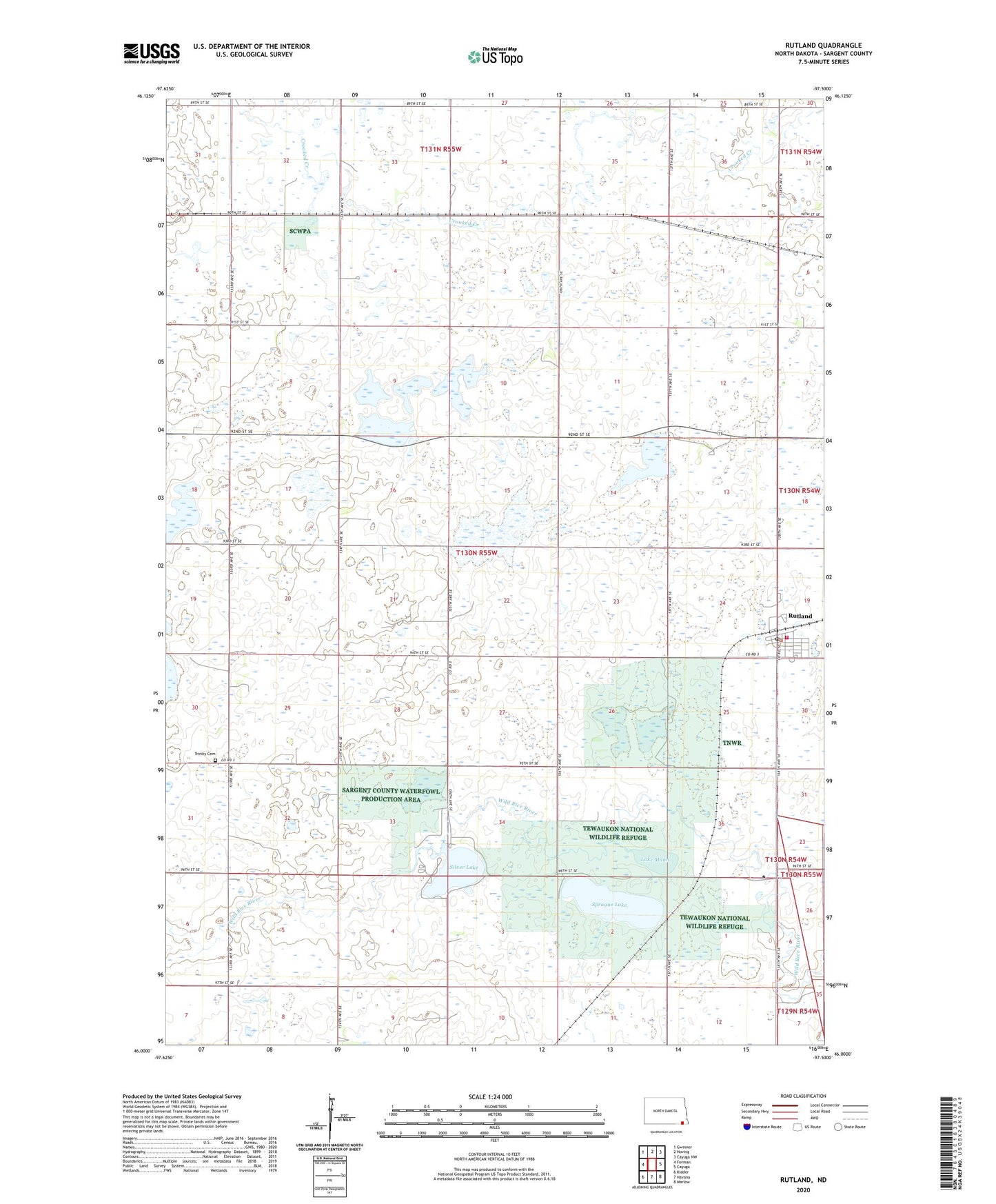
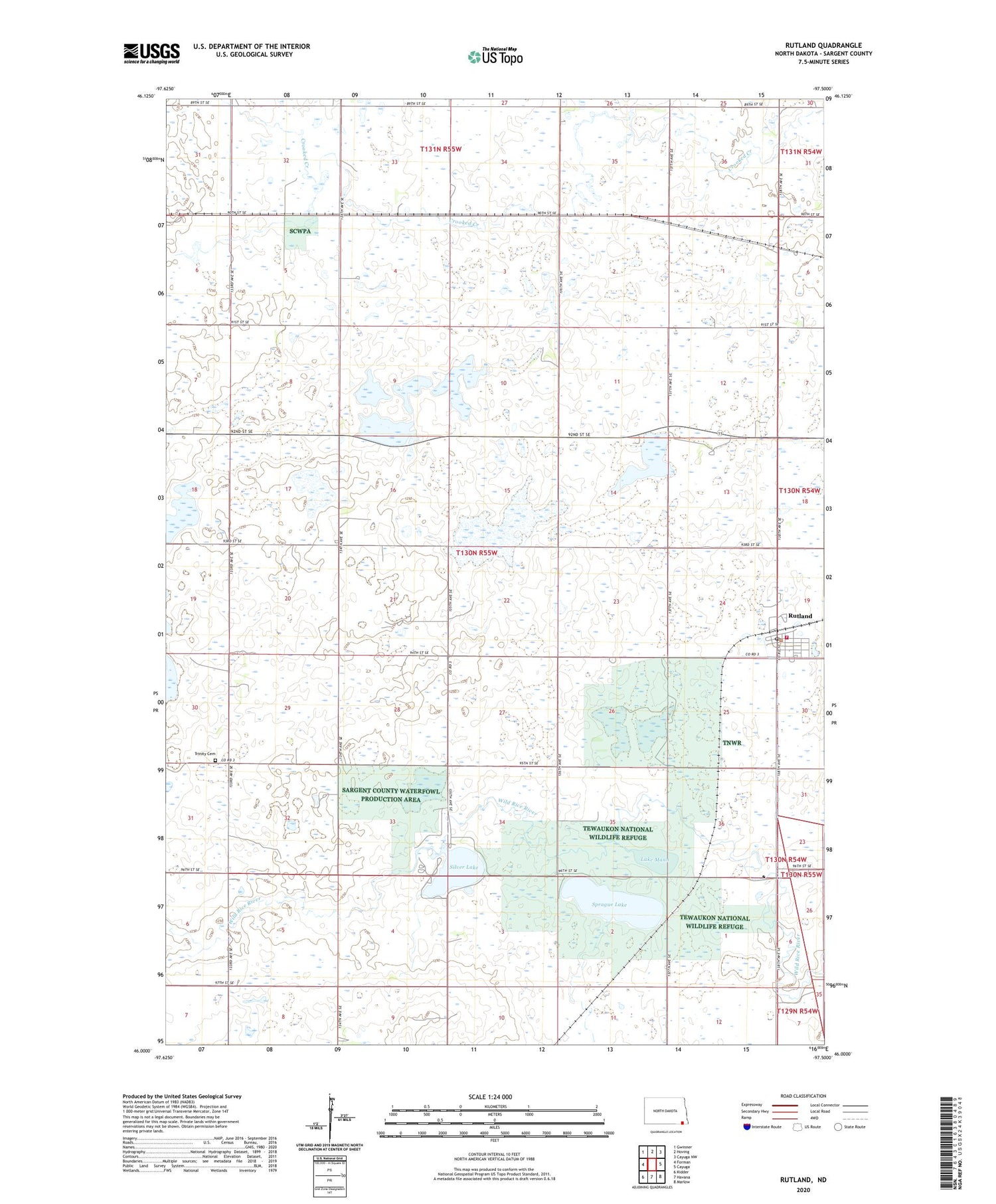
2020 topographic map quadrangle Rutland in the state of North Dakota. Scale: 1:24000. Based on the newly updated USGS 7.5' US Topo map series, this map is in the following counties: Sargent. The map contains contour data, water features, and other items you are used to seeing on USGS maps, but also has updated roads and other features. This is the next generation of topographic maps. Printed on high-quality waterproof paper with UV fade-resistant inks.
Quads adjacent to this one:
West: Forman
Northwest: Gwinner
North: Hoving
Northeast: Cayuga NW
East: Cayuga
South: Havana
Contains the following named places: City of Rutland, Lake Mann, Rutland, Rutland - Cayuga Fire Station, Rutland City Hall, Rutland Post Office, Rutland School, School Number 4, Silver Lake, Silver Lake Dam, Sprague Lake, Township of Rutland, Trinity Cemetery