MyTopo
Gwinner North Dakota US Topo Map
Couldn't load pickup availability
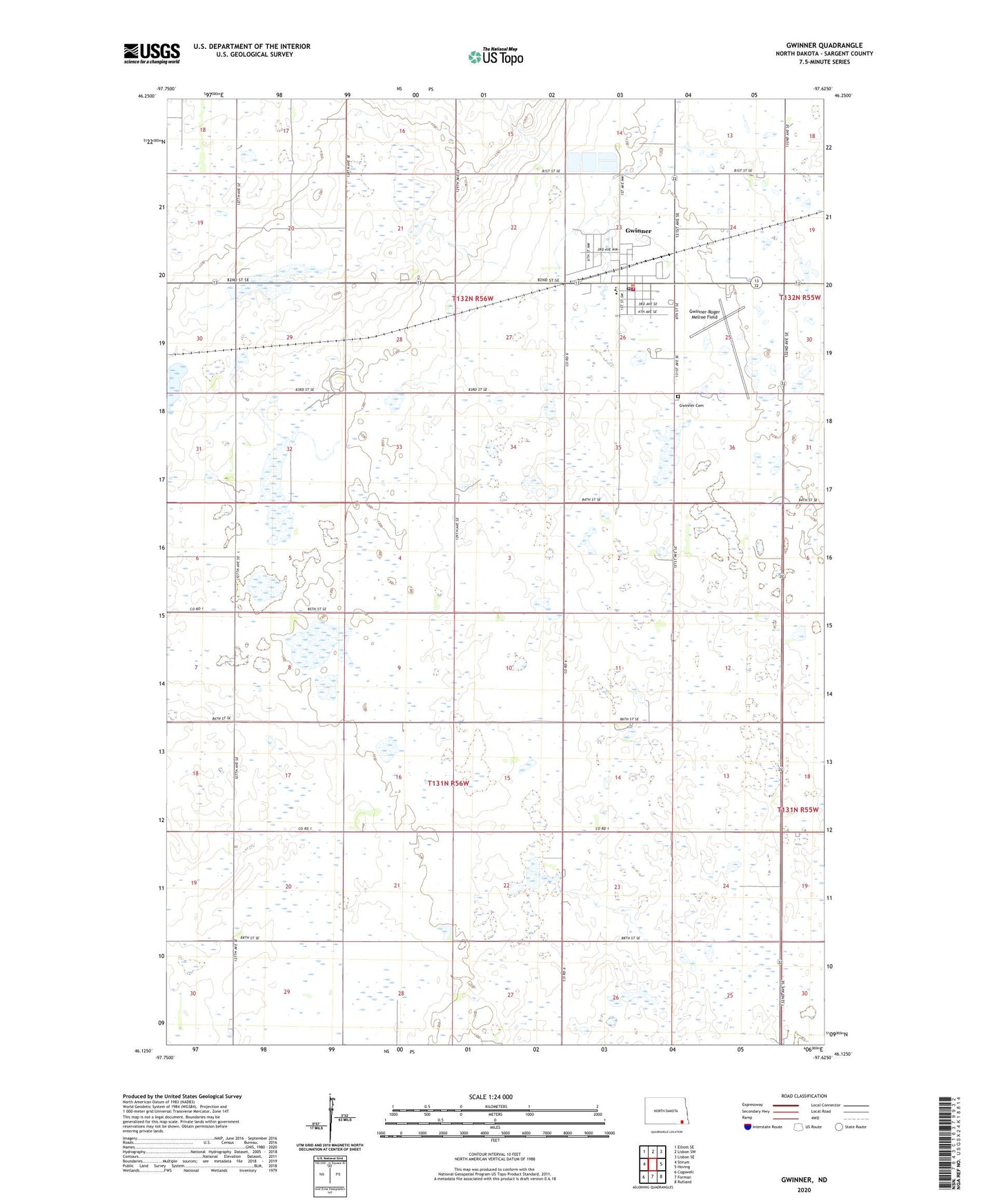
2024 topographic map quadrangle Gwinner in the state of North Dakota. Scale: 1:24000. Based on the newly updated USGS 7.5' US Topo map series, this map is in the following counties: Sargent. The map contains contour data, water features, and other items you are used to seeing on USGS maps, but also has updated roads and other features. This is the next generation of topographic maps. Printed on high-quality waterproof paper with UV fade-resistant inks.
Quads adjacent to this one:
West: Stirum
Northwest: Elliott SE
North: Lisbon SW
Northeast: Lisbon SE
East: Hoving
Southeast: Rutland
South: Forman
Southwest: Cogswell
This map covers the same area as the classic USGS quad with code o46097b6.
Contains the following named places: City of Gwinner, Gwinner, Gwinner Cemetery, Gwinner City Hall, Gwinner City Police Department, Gwinner Emergency Response Center, Gwinner Fire Station, Gwinner Post Office, Gwinner-Roger Melroe Field, North Sargent Public School, Township of Bowen, Township of Millsburgh, Township of Whitestone Hill, ZIP Code: 58040