MyTopo
Sentinel Butte SE North Dakota US Topo Map
Couldn't load pickup availability
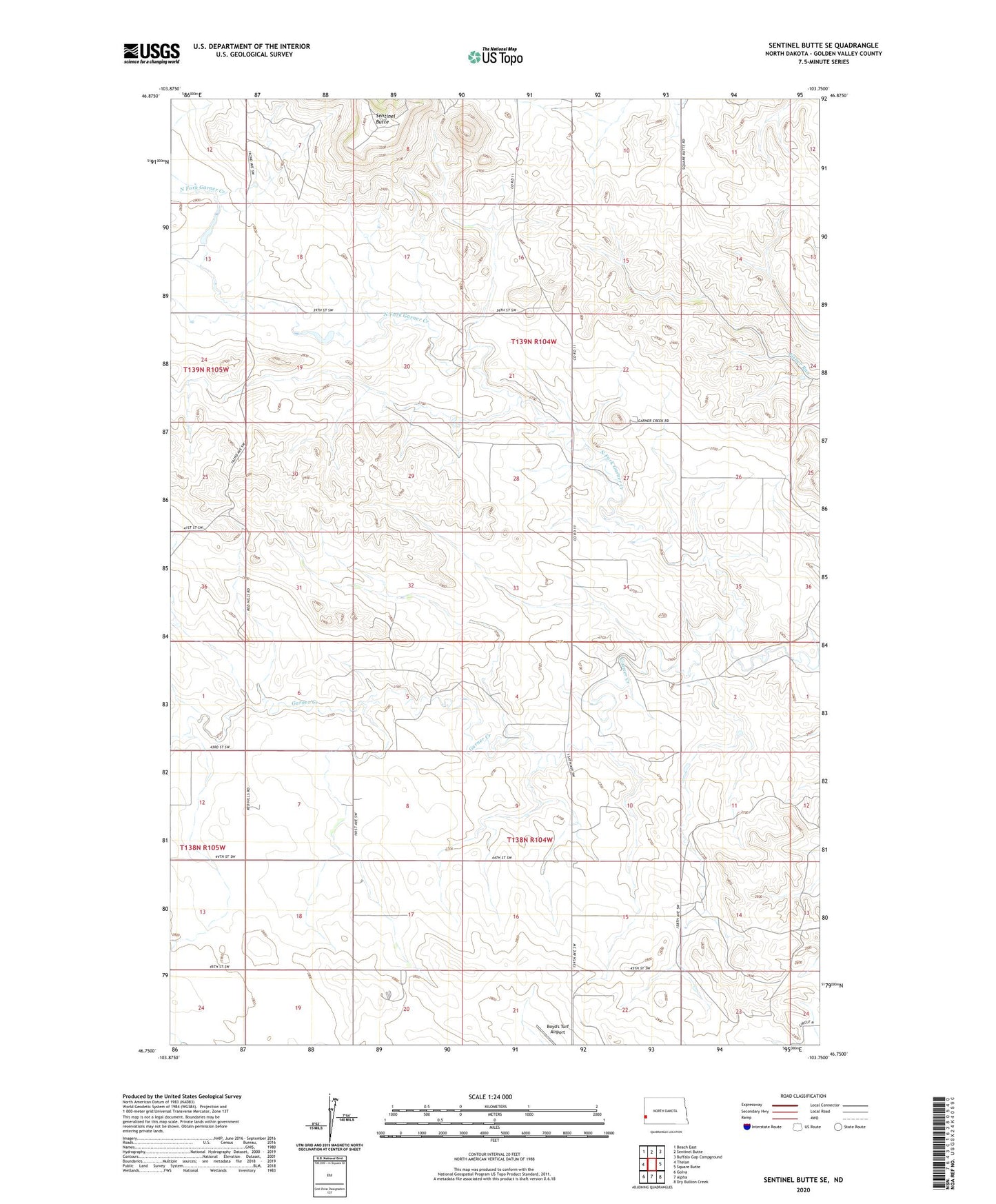
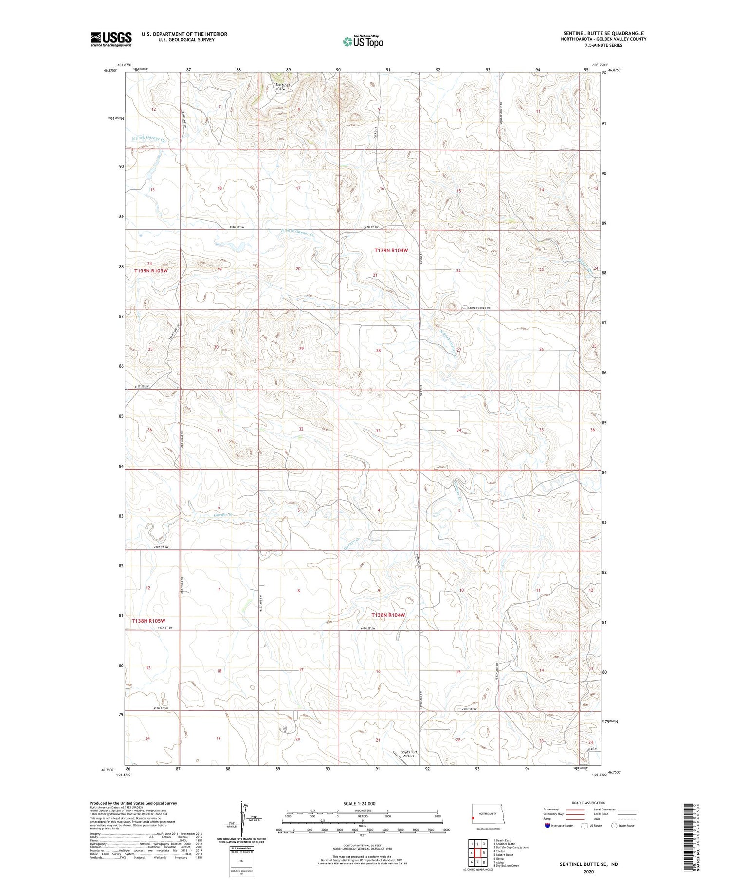
2020 topographic map quadrangle Sentinel Butte SE in the state of North Dakota. Scale: 1:24000. Based on the newly updated USGS 7.5' US Topo map series, this map is in the following counties: Golden Valley. The map contains contour data, water features, and other items you are used to seeing on USGS maps, but also has updated roads and other features. This is the next generation of topographic maps. Printed on high-quality waterproof paper with UV fade-resistant inks.
Quads adjacent to this one:
West: Thelan
Northwest: Beach East
North: Sentinel Butte
Northeast: Buffalo Gap Campground
East: Square Butte
Southeast: Dry Bullion Creek
South: Alpha
Southwest: Golva
Contains the following named places: North Fork Garner Creek, Pietz Ranch, Sentinel Butte, Township of Garner, Uekert Dam, Underwood Ranch