MyTopo
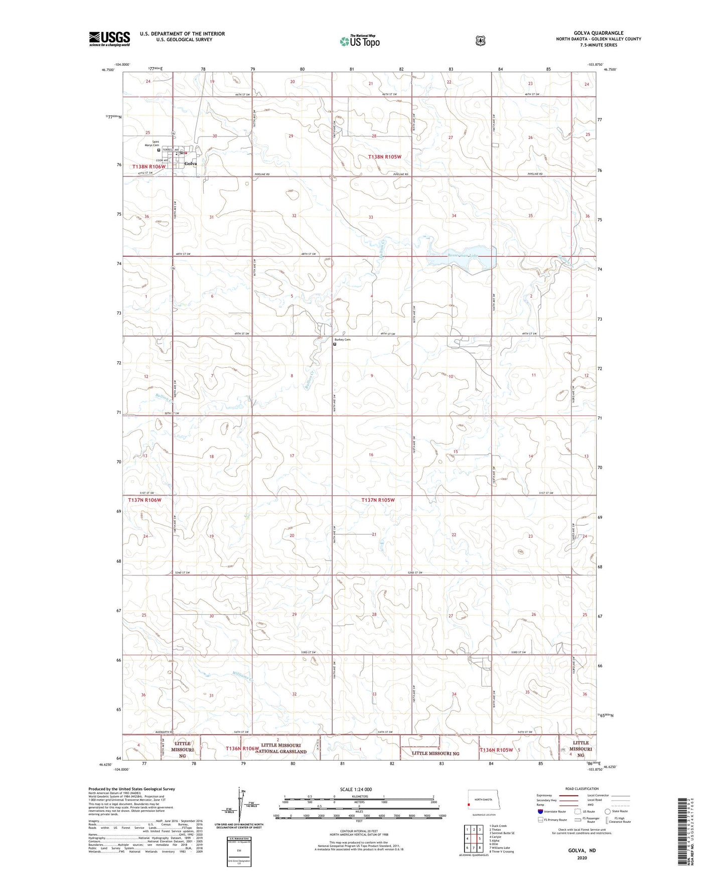
Golva North Dakota US Topo Map
Couldn't load pickup availability
Also explore the Golva Forest Service Topo of this same quad for updated USFS data
2024 topographic map quadrangle Golva in the state of North Dakota. Scale: 1:24000. Based on the newly updated USGS 7.5' US Topo map series, this map is in the following counties: Golden Valley. The map contains contour data, water features, and other items you are used to seeing on USGS maps, but also has updated roads and other features. This is the next generation of topographic maps. Printed on high-quality waterproof paper with UV fade-resistant inks.
Quads adjacent to this one:
West: Carlyle
Northwest: Duck Creek
North: Thelan
Northeast: Sentinel Butte SE
East: Alpha
Southeast: Three V Crossing
South: Williams Lake
Southwest: Ollie
This map covers the same area as the classic USGS quad with code o46103f8.
Contains the following named places: Bosserman Lake, Burkey Cemetery, City of Golva, Finneman Private Field, Golva, Golva Elementary School, Golva Post Office, Golva Rural Fire Station, Saint Marys Cemetery, Township of Lone Tree, ZIP Code: 58632