MyTopo
Stocke Butte North Dakota US Topo Map
Couldn't load pickup availability
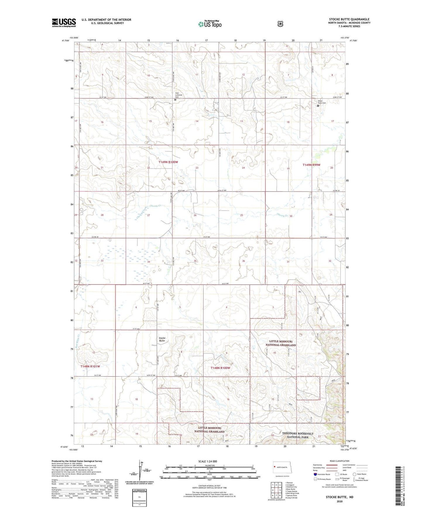
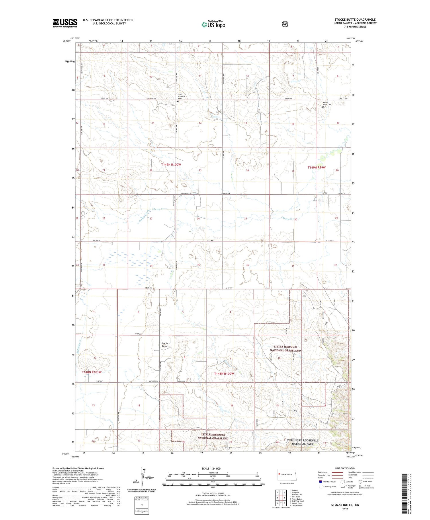
2020 topographic map quadrangle Stocke Butte in the state of North Dakota. Scale: 1:24000. Based on the newly updated USGS 7.5' US Topo map series, this map is in the following counties: McKenzie. The map contains contour data, water features, and other items you are used to seeing on USGS maps, but also has updated roads and other features. This is the next generation of topographic maps. Printed on high-quality waterproof paper with UV fade-resistant inks.
Quads adjacent to this one:
West: Bear Butte
Northwest: Rawson
North: Arnegard
Northeast: Watford City
East: Tepee Buttes
Southeast: Long X Divide
South: Sperati Point
Southwest: Red Wing Creek
Contains the following named places: A Gravos Ranch, L Anderson Ranch, L Anderson Water Well, McKenzie County, Olson Farm Cemetery, Red Wing School, Stocke Butte, Zoar Church, Zoar Lutheran Cemetery