MyTopo
Watford City North Dakota US Topo Map
Couldn't load pickup availability
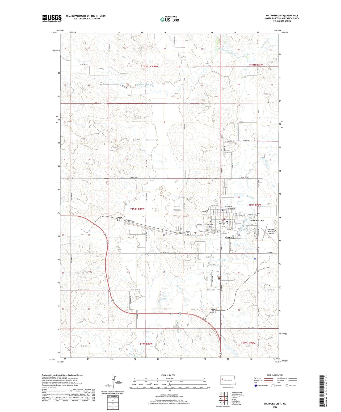
2024 topographic map quadrangle Watford City in the state of North Dakota. Scale: 1:24000. Based on the newly updated USGS 7.5' US Topo map series, this map is in the following counties: McKenzie. The map contains contour data, water features, and other items you are used to seeing on USGS maps, but also has updated roads and other features. This is the next generation of topographic maps. Printed on high-quality waterproof paper with UV fade-resistant inks.
Quads adjacent to this one:
West: Arnegard
Northwest: Watford City NW
North: Watford City NE
Northeast: Timber Prong Creek
East: Schafer
Southeast: Lone Butte NW
South: Tepee Buttes
Southwest: Stocke Butte
This map covers the same area as the classic USGS quad with code o47103g3.
Contains the following named places: City of Watford City, Crosspoint Church Cemetery, Long X Trading Post Visitor Center, McKenzie County Ambulance Service, McKenzie County Courthouse, McKenzie County Healthcare Systems Long Term Care, McKenzie County Heritage Park, Mckenzie County Hospital, McKenzie County Public Library, McKenzie County Sheriff's Office, McKenzie County Veterans Memorial Building, McKenzie Ranger Station, Pioneer Museum of McKenzie County, Spring Creek, Township of Ideal, Watford City, Watford City Elementary School, Watford City Fire Station, Watford City Hall, Watford City High School, Watford City Municipal Airport, Watford City Police Department, Watford City Post Office