
MyTopo
Surrey North Dakota US Topo Map
Couldn't load pickup availability
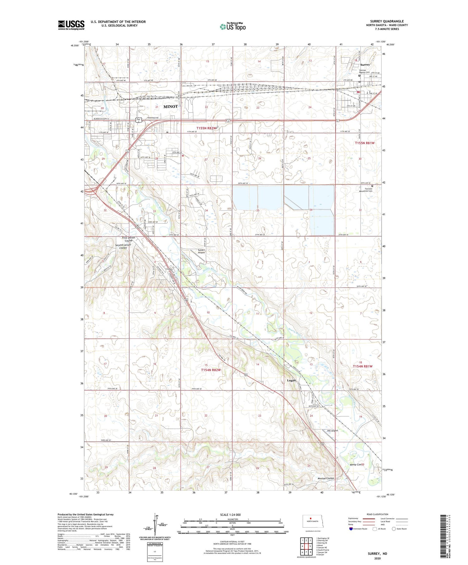
2020 topographic map quadrangle Surrey in the state of North Dakota. Scale: 1:24000. Based on the newly updated USGS 7.5' US Topo map series, this map is in the following counties: Ward. The map contains contour data, water features, and other items you are used to seeing on USGS maps, but also has updated roads and other features. This is the next generation of topographic maps. Printed on high-quality waterproof paper with UV fade-resistant inks.
Quads adjacent to this one:
West: Minot
Northwest: Burlington SE
North: Deering SW
Northeast: Deering SE
East: Sawyer NE
Southeast: Sawyer
South: Sawyer SW
Southwest: South Prairie
Contains the following named places: Bell Elementary School, Bell School Number 2, Bell School Number 3, City of Surrey, Fairview Mennonite Cemetery, First Larson Coulee, German Baptist Cemetery, Hill Airport, Kemp Coulee, KHRT-AM (Minot), KKOA-AM (Minot), Logan, Logan Census Designated Place, Mostad Coulee, Nedrose Elementary School, School Number 2, Second Larson Coulee, Sundre Airport, Surrey, Surrey City Hall, Surrey Fire Station, Surrey Police Department, Surrey Post Office, Surrey Public School, Township of Nedrose, Township of Sundre


