MyTopo
Burlington SE North Dakota US Topo Map
Couldn't load pickup availability
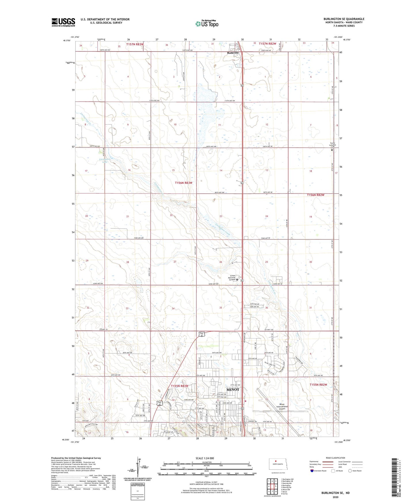
2024 topographic map quadrangle Burlington SE in the state of North Dakota. Scale: 1:24000. Based on the newly updated USGS 7.5' US Topo map series, this map is in the following counties: Ward. The map contains contour data, water features, and other items you are used to seeing on USGS maps, but also has updated roads and other features. This is the next generation of topographic maps. Printed on high-quality waterproof paper with UV fade-resistant inks.
Quads adjacent to this one:
West: Burlington
Northwest: Burlington NW
North: Burlington NE
Northeast: Deering NW
East: Deering SW
Southeast: Surrey
South: Minot
Southwest: Minot NW
This map covers the same area as the classic USGS quad with code o48101c3.
Contains the following named places: Bethel Free Lutheran Church, Calvary Alliance Church, Cameron Indoor Tennis Center, Campus Heights Apartments, Church of Christ, Dakota Territory Air Museum, Erik Ramstad Middle School, Keith White Sertoma Sports Complex, Lewis and Clark Elementary School, Livingston Lake, Minot Fire Station 3, Minot International Airport, Minot Optimist Soccer Complex, Minot State University Amphitheater, Minot State University Observatory, North Prairie Church, Ruthville, Ruthville Census Designated Place, School Number 4, Sunset Memorial Gardens, Township of Eureka, Trinity Lutheran Cemetery, University Heights, ZIP Code: 58703