MyTopo
Tepee Buttes North Dakota US Topo Map
Couldn't load pickup availability
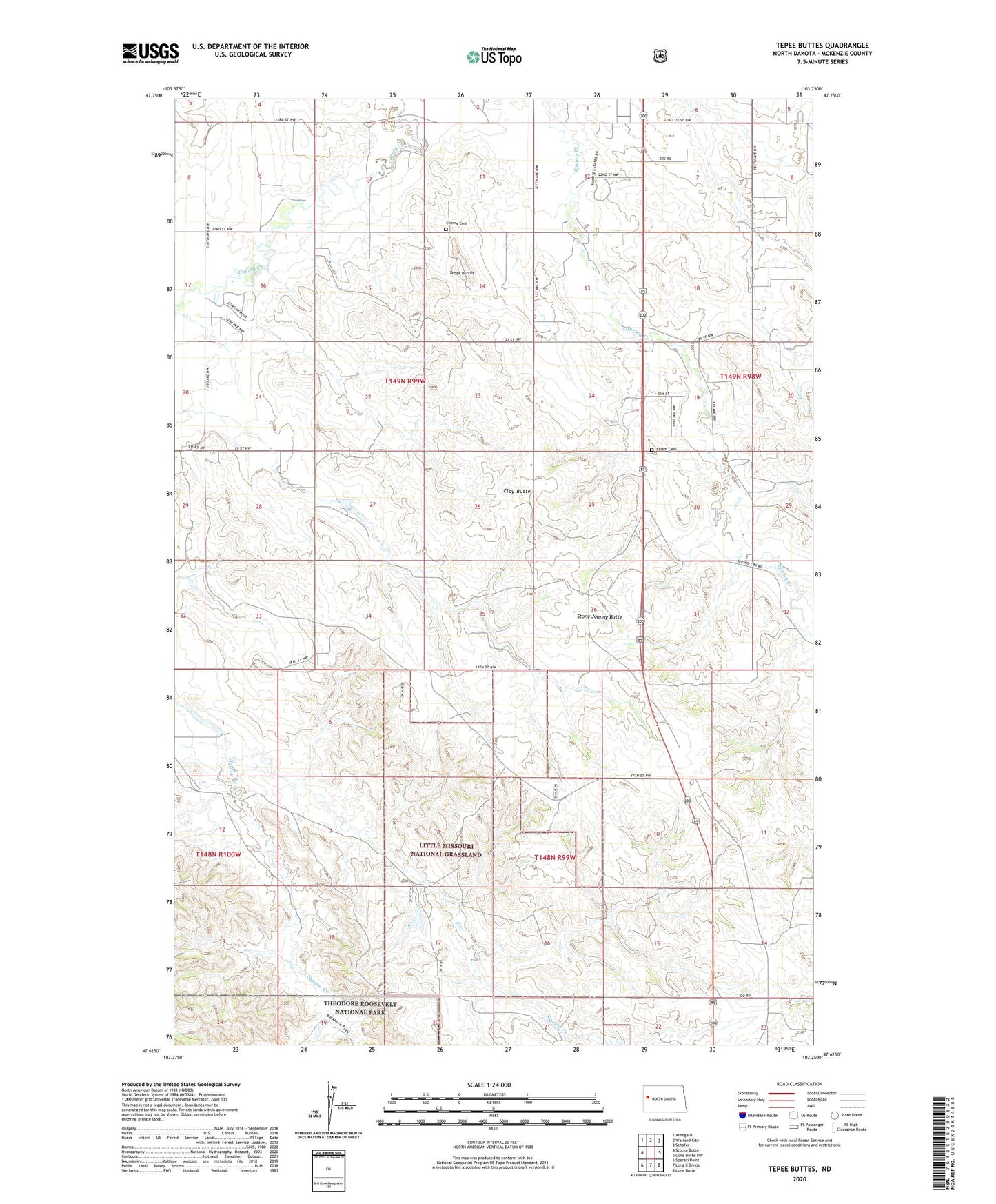
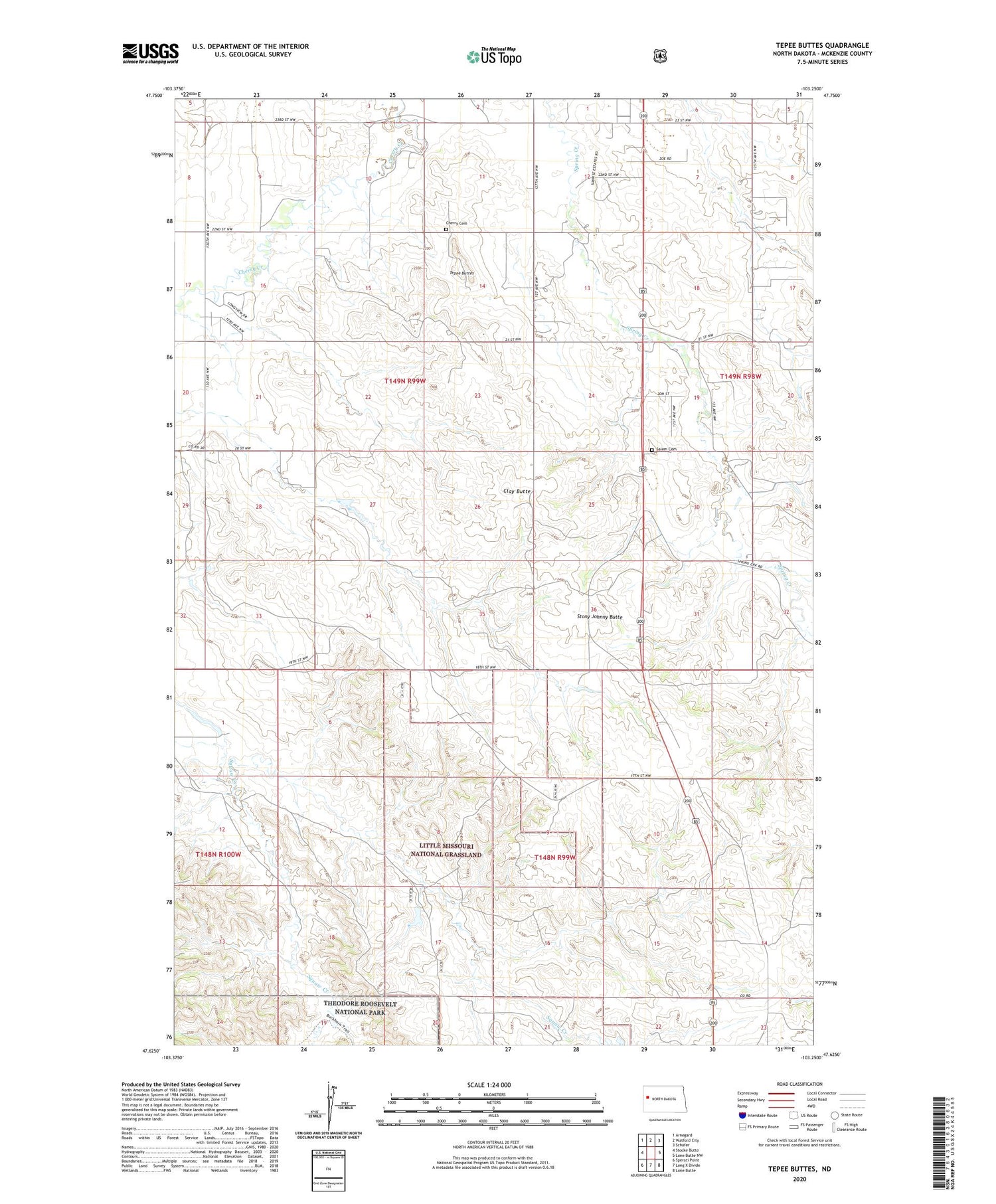
2020 topographic map quadrangle Tepee Buttes in the state of North Dakota. Scale: 1:24000. Based on the newly updated USGS 7.5' US Topo map series, this map is in the following counties: McKenzie. The map contains contour data, water features, and other items you are used to seeing on USGS maps, but also has updated roads and other features. This is the next generation of topographic maps. Printed on high-quality waterproof paper with UV fade-resistant inks.
Quads adjacent to this one:
West: Stocke Butte
Northwest: Arnegard
North: Watford City
Northeast: Schafer
East: Lone Butte NW
Southeast: Lone Butte
South: Long X Divide
Southwest: Sperati Point
Contains the following named places: Cherry Cemetery, Cherry School, Clay Butte, E Nordsven Junior Ranch, G Wright Ranch, Pleasant Hill School, Roughrider Dam, Salem Cemetery, Stock Dam P10 A1 Reservoir, Stony Johnny Butte, Tepee Buttes