MyTopo
Thompson North Dakota US Topo Map
Couldn't load pickup availability
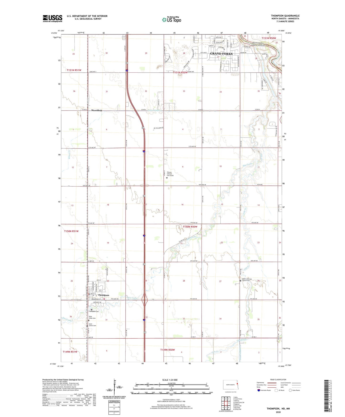
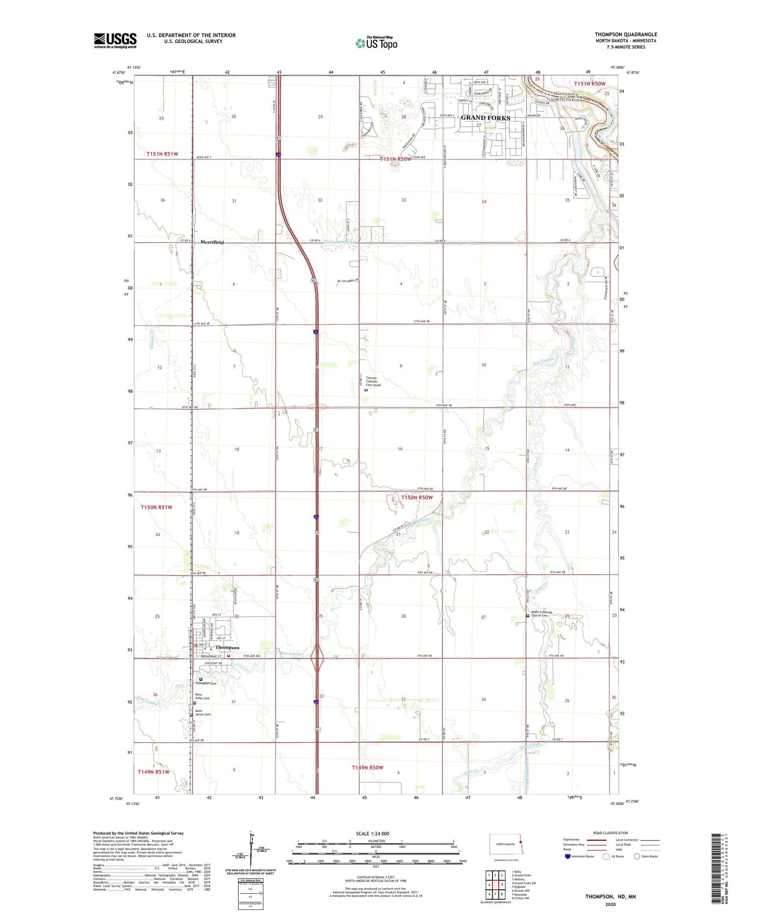
2020 topographic map quadrangle Thompson in the state of North Dakota. Scale: 1:24000. Based on the newly updated USGS 7.5' US Topo map series, this map is in the following counties: Grand Forks, Polk. The map contains contour data, water features, and other items you are used to seeing on USGS maps, but also has updated roads and other features. This is the next generation of topographic maps. Printed on high-quality waterproof paper with UV fade-resistant inks.
Quads adjacent to this one:
West: Grand Forks SW
Northwest: Kelly
North: Grand Forks
Northeast: Mallory
East: Bygland
Southeast: Climax NW
South: Reynolds
Southwest: Buxton NW
Contains the following named places: Calvary Catholic Cemetery South, City of Thompson, Drain Number 4, Elm Coulee, KNOX-AM (Grand Forks), Merrifield, Saint James Cemetery, Saint Judes Cemetery, South Middle School, Thompson, Thompson Cemetery, Thompson City Hall, Thompson Community Center, Thompson Fire Station, Thompson Police Department, Thompson Post Office, Thompson Public School, Township of Grand Forks, Township of Walle, Walle Church, Walle Lutheran Church Cemetery, Walle Town Hall, Wilson Creek, ZIP Code: 58278