MyTopo
Kelly North Dakota US Topo Map
Couldn't load pickup availability
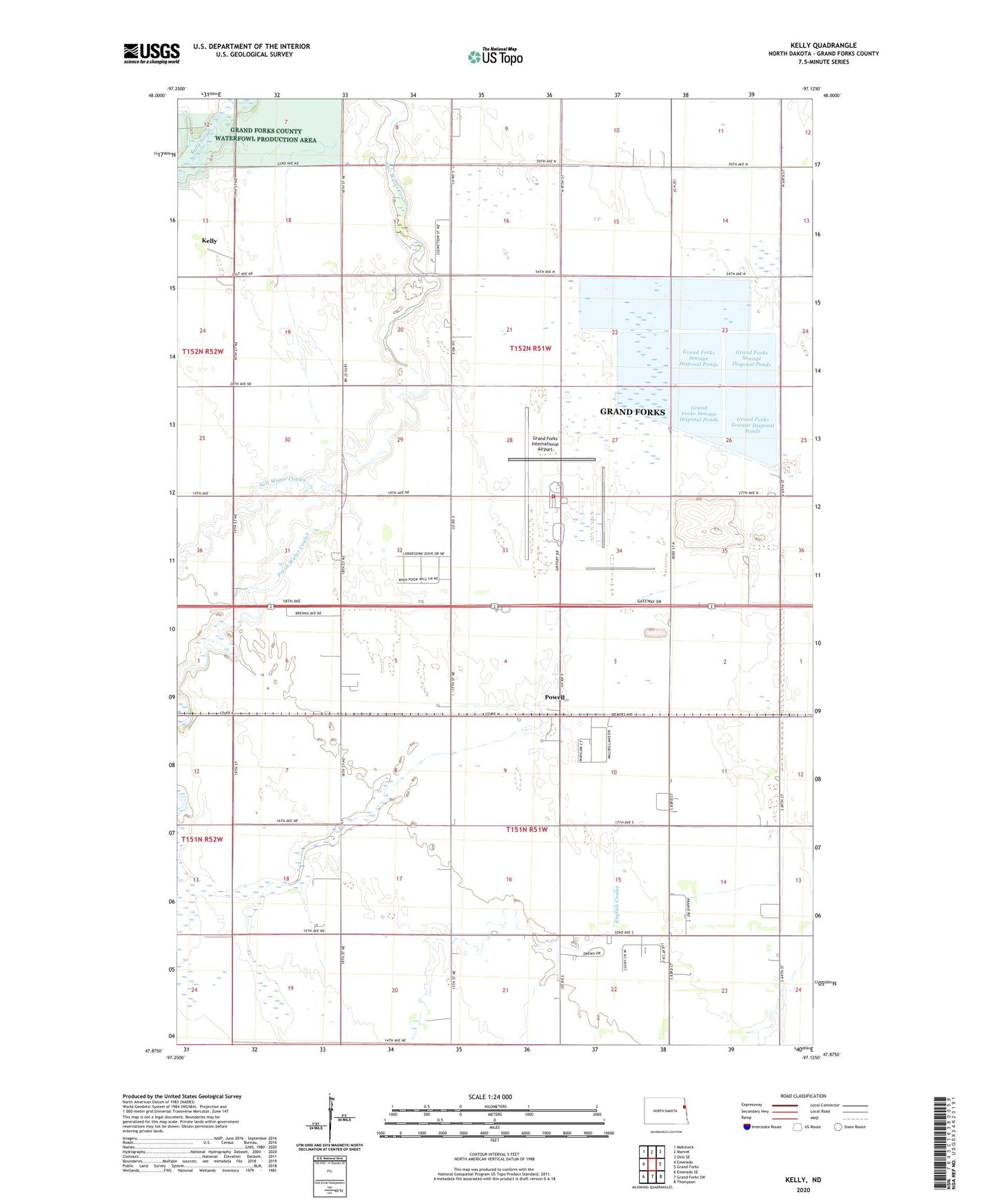
2024 topographic map quadrangle Kelly in the state of North Dakota. Scale: 1:24000. Based on the newly updated USGS 7.5' US Topo map series, this map is in the following counties: Grand Forks. The map contains contour data, water features, and other items you are used to seeing on USGS maps, but also has updated roads and other features. This is the next generation of topographic maps. Printed on high-quality waterproof paper with UV fade-resistant inks.
Quads adjacent to this one:
West: Emerado
Northwest: Mekinock
North: Manvel
Northeast: Oslo SE
East: Grand Forks
Southeast: Thompson
South: Grand Forks SW
Southwest: Emerado SE
This map covers the same area as the classic USGS quad with code o47097h2.
Contains the following named places: Brenna Town Hall, Fresh Water Coulee, Grand Forks International Airport, Grand Forks International Airport Fire Station, Grand Forks Sewage Disposal Ponds, Kelly, Powell, Rye Town Hall, School Number 25, School Number 30, Township of Brenna, Township of Rye, ZIP Code: 58203