
MyTopo
Tokio North Dakota US Topo Map
Couldn't load pickup availability
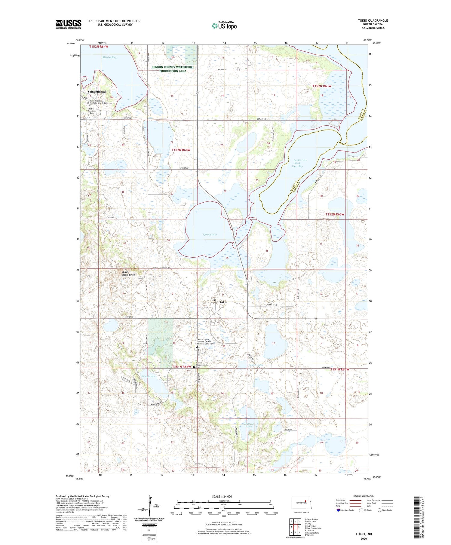
2020 topographic map quadrangle Tokio in the state of North Dakota. Scale: 1:24000. Based on the newly updated USGS 7.5' US Topo map series, this map is in the following counties: Benson, Ramsey. The map contains contour data, water features, and other items you are used to seeing on USGS maps, but also has updated roads and other features. This is the next generation of topographic maps. Printed on high-quality waterproof paper with UV fade-resistant inks.
Quads adjacent to this one:
West: Fort Totten
Northwest: Camp Grafton
North: Devils Lake
Northeast: Crary
East: Free Peoples Lake
Southeast: Warwick
South: Horseshoe Lake
Southwest: Tokio SW
Contains the following named places: Bdecan Presbyterian Cemetery, Black Tiger Bay, Dakotah Oyate Lutheran / Native American Cemetery - Tokio, Devils Heart Butte, Mallard Lake, Native American Cemetery, Saint Michael, Saint Michael District, Saint Michael Post Office, Saint Michaels Catholic Church Cemetery, School Number 3, Spring Lake, Square Lake, Tokio, Tokio Post Office, Township of Mission, Township of Wood Lake, Wood Lake, Wood Lake Church, Wood Lake Marsh Dam, Wood Lake Marsh Reservoir, Wood Lake National Wildlife Refuge, ZIP Codes: 58370, 58379


