MyTopo
Tower City North Dakota US Topo Map
Couldn't load pickup availability
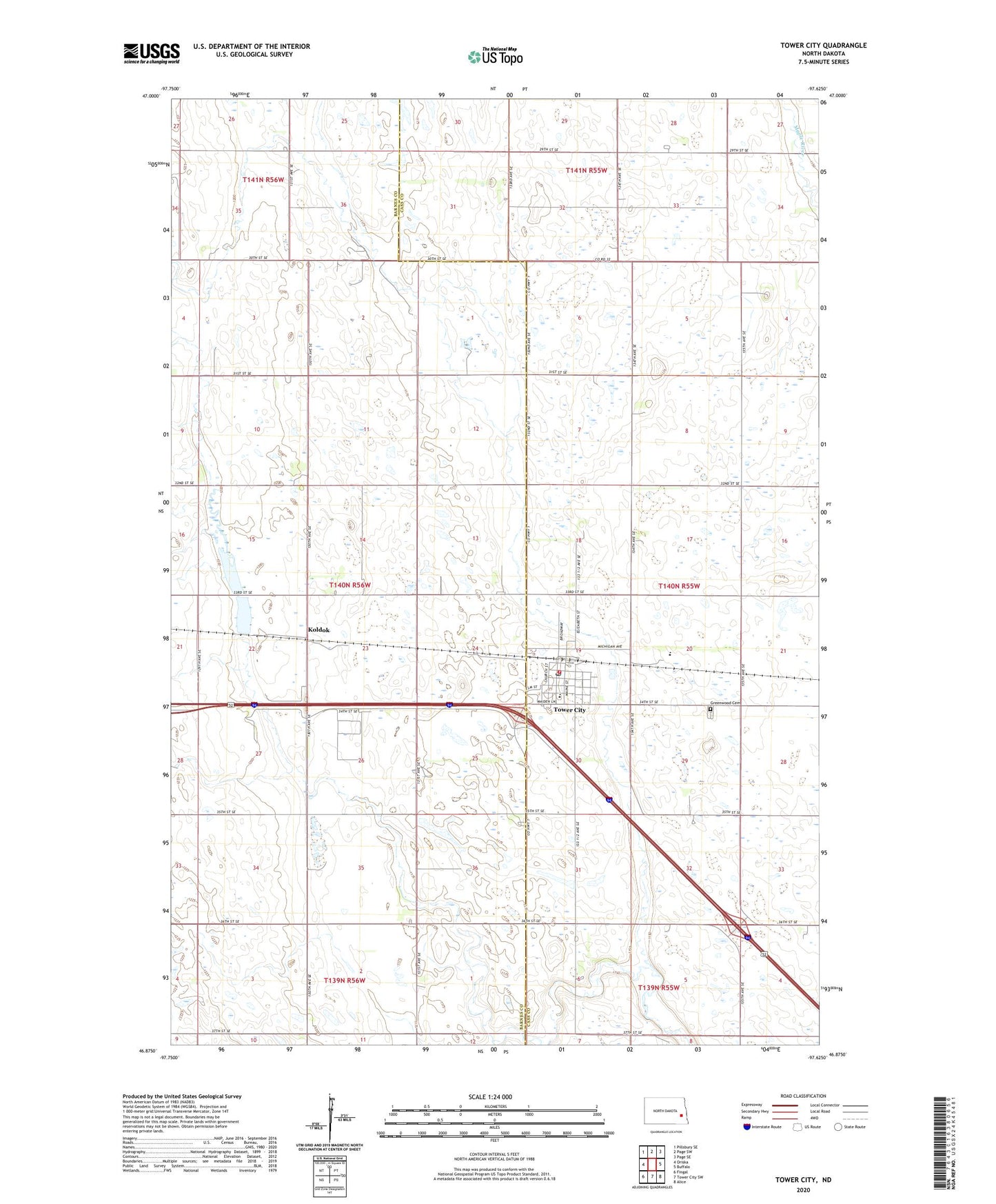
2020 topographic map quadrangle Tower City in the state of North Dakota. Scale: 1:24000. Based on the newly updated USGS 7.5' US Topo map series, this map is in the following counties: Cass, Barnes. The map contains contour data, water features, and other items you are used to seeing on USGS maps, but also has updated roads and other features. This is the next generation of topographic maps. Printed on high-quality waterproof paper with UV fade-resistant inks.
Quads adjacent to this one:
West: Oriska
Northwest: Pillsbury SE
North: Page SW
Northeast: Page SE
East: Buffalo
Southeast: Alice
South: Tower City SW
Southwest: Fingal
Contains the following named places: City of Tower City, Greenwood Cemetery, Koldok, Koldok State Game Management Area, Maple Valley High School, Tower City, Tower City Fire Protection District, Tower City Hall, Tower City Post Office, Township of Oriska, Wheatland Colony, Wheatland Colony School, ZIP Code: 58071