MyTopo
Wyndmere SE North Dakota US Topo Map
Couldn't load pickup availability
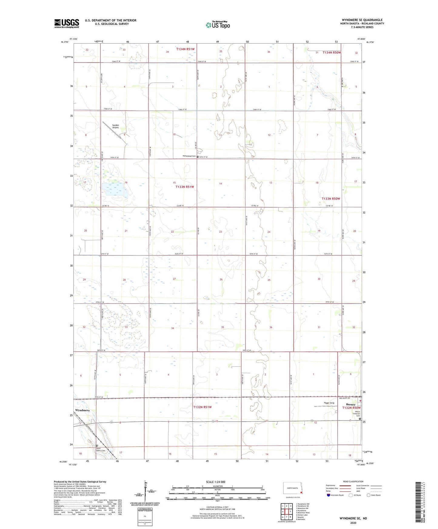
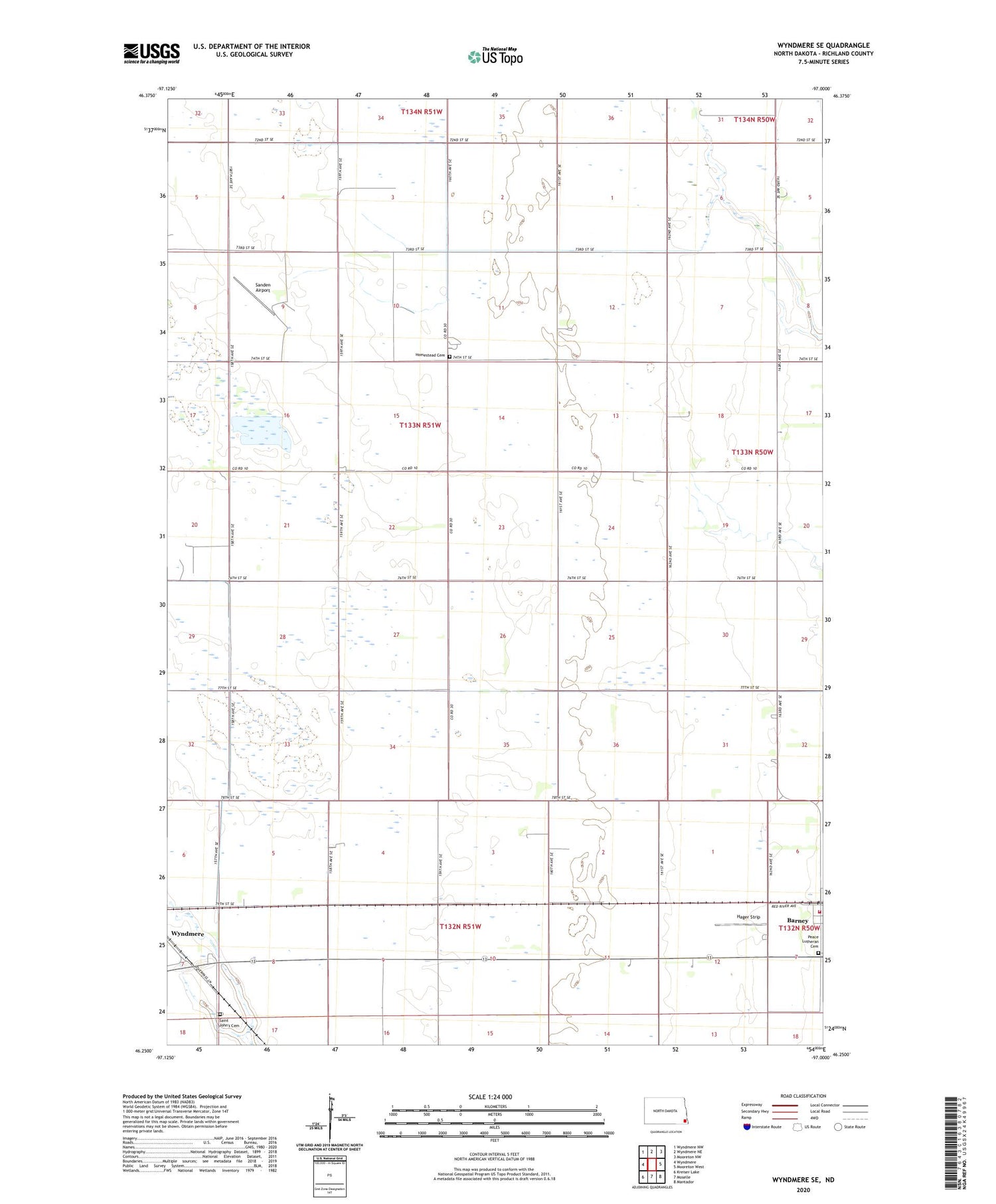
2020 topographic map quadrangle Wyndmere SE in the state of North Dakota. Scale: 1:24000. Based on the newly updated USGS 7.5' US Topo map series, this map is in the following counties: Richland. The map contains contour data, water features, and other items you are used to seeing on USGS maps, but also has updated roads and other features. This is the next generation of topographic maps. Printed on high-quality waterproof paper with UV fade-resistant inks.
Quads adjacent to this one:
West: Wyndmere
Northwest: Wyndmere NW
North: Wyndmere NE
Northeast: Mooreton NW
East: Mooreton West
Southeast: Mantador
South: Moselle
Southwest: Kreiser Lake
Contains the following named places: Barney, Barney Fire Station, Barney Post Office, Danton Town Hall, Hager Strip, Homestead Cemetery, Homestead Church, Oberweis Post Office, Peace Lutheran Cemetery, Saint John's Cemetery, Sanden Airport, Township of Homestead, ZIP Code: 58008