MyTopo
Moselle North Dakota US Topo Map
Couldn't load pickup availability
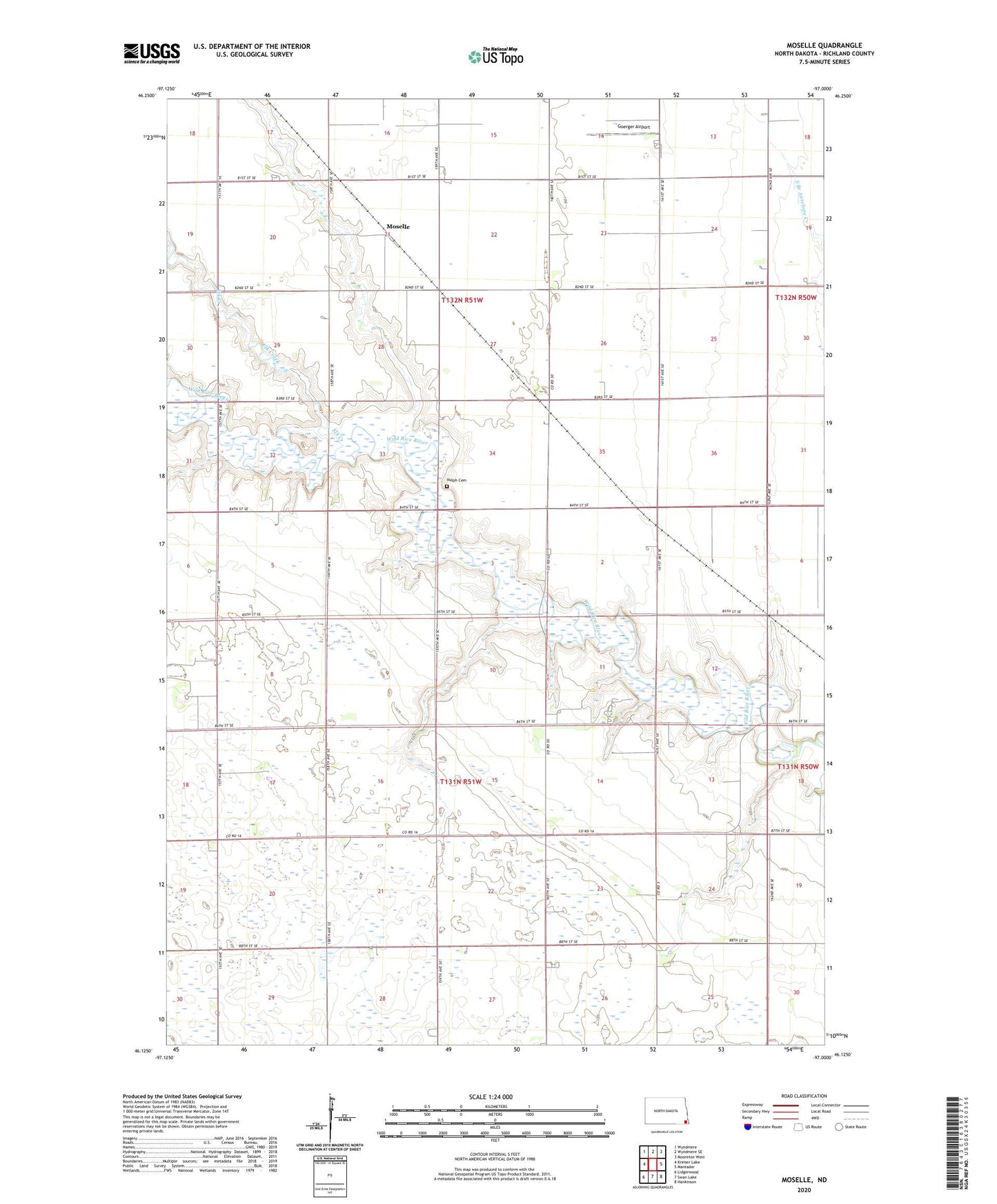
2024 topographic map quadrangle Moselle in the state of North Dakota. Scale: 1:24000. Based on the newly updated USGS 7.5' US Topo map series, this map is in the following counties: Richland. The map contains contour data, water features, and other items you are used to seeing on USGS maps, but also has updated roads and other features. This is the next generation of topographic maps. Printed on high-quality waterproof paper with UV fade-resistant inks.
Quads adjacent to this one:
West: Kreiser Lake
Northwest: Wyndmere
North: Wyndmere SE
Northeast: Mooreton West
East: Mantador
Southeast: Hankinson
South: Swan Lake
Southwest: Lidgerwood
This map covers the same area as the classic USGS quad with code o46097b1.
Contains the following named places: Elk Creek, Goerger Airport, Moselle, Nulph Cemetery, School Number 1, School Number 3, School Number 4, Township of Danton, Township of Liberty Grove