MyTopo
Zap North Dakota US Topo Map
Couldn't load pickup availability
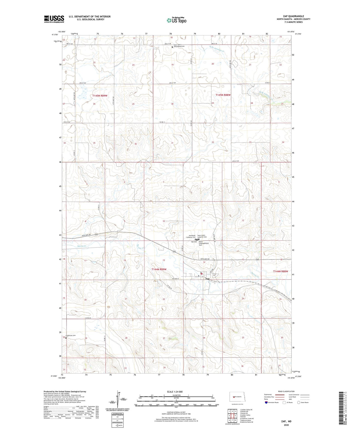
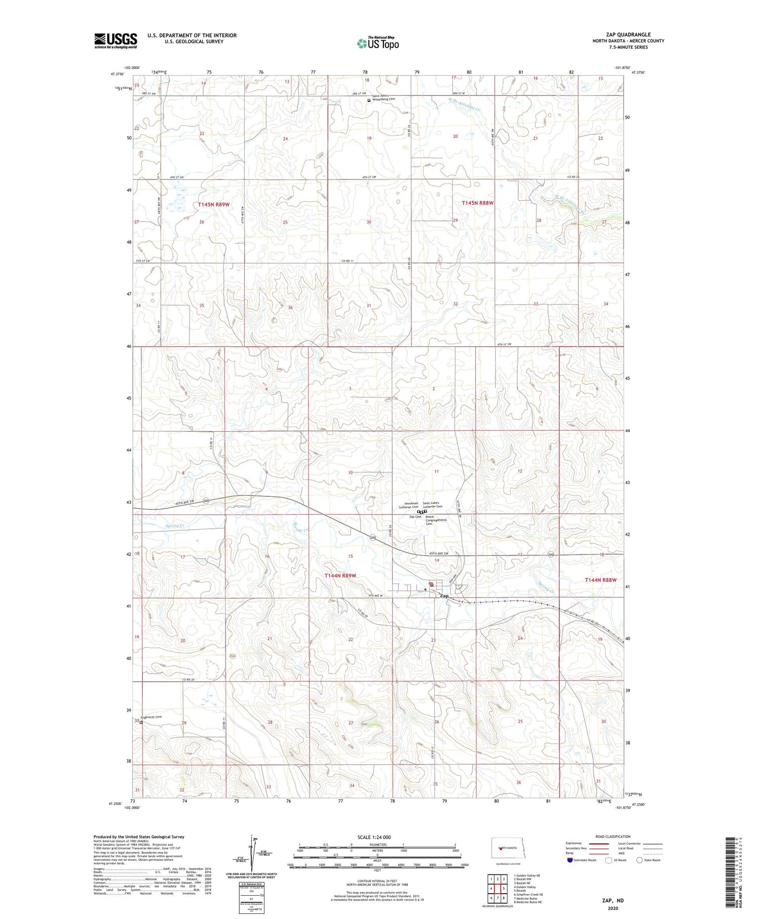
2020 topographic map quadrangle Zap in the state of North Dakota. Scale: 1:24000. Based on the newly updated USGS 7.5' US Topo map series, this map is in the following counties: Mercer. The map contains contour data, water features, and other items you are used to seeing on USGS maps, but also has updated roads and other features. This is the next generation of topographic maps. Printed on high-quality waterproof paper with UV fade-resistant inks.
Quads adjacent to this one:
West: Golden Valley
Northwest: Golden Valley NE
North: Beulah NW
Northeast: Beulah NE
East: Beulah
Southeast: Medicine Butte NE
South: Medicine Butte
Southwest: Schaffner Creek NE
Contains the following named places: City of Zap, Engbrecht Cemetery, Immanuel Lutheran Cemetery, Peace Congregational Cemetery, Saint Johns Church, Saint John's Wittenberg Cemetery, Saint Luke's Lutheran Cemetery, Zap, Zap Cemetery, Zap City Hall, Zap Police Department, Zap Post Office, Zap Rural Fire Protection District, ZIP Code: 58580