MyTopo
Golden Valley North Dakota US Topo Map
Couldn't load pickup availability
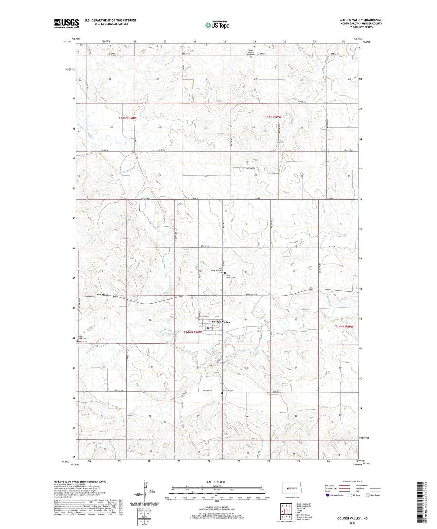
2024 topographic map quadrangle Golden Valley in the state of North Dakota. Scale: 1:24000. Based on the newly updated USGS 7.5' US Topo map series, this map is in the following counties: Mercer. The map contains contour data, water features, and other items you are used to seeing on USGS maps, but also has updated roads and other features. This is the next generation of topographic maps. Printed on high-quality waterproof paper with UV fade-resistant inks.
Quads adjacent to this one:
West: Dodge
Northwest: Golden Valley NW
North: Golden Valley NE
Northeast: Beulah NW
East: Zap
Southeast: Medicine Butte
South: Schaffner Creek NE
Southwest: Schaffner Creek
This map covers the same area as the classic USGS quad with code o47102c1.
Contains the following named places: Brecht Strip, City of Golden Valley, Golden Valley, Golden Valley City Hall, Golden Valley Community Center, Golden Valley Fire Protection District Station, Golden Valley Post Office, Golgotha Cemetery, Goodman Creek, Hope Congregational Cemetery, Saint Jacobus Sofia Cemetery, Saint James Cemetery, Spring Creek Cemetery, ZIP Code: 58541