MyTopo
Allensville Ohio US Topo Map
Couldn't load pickup availability
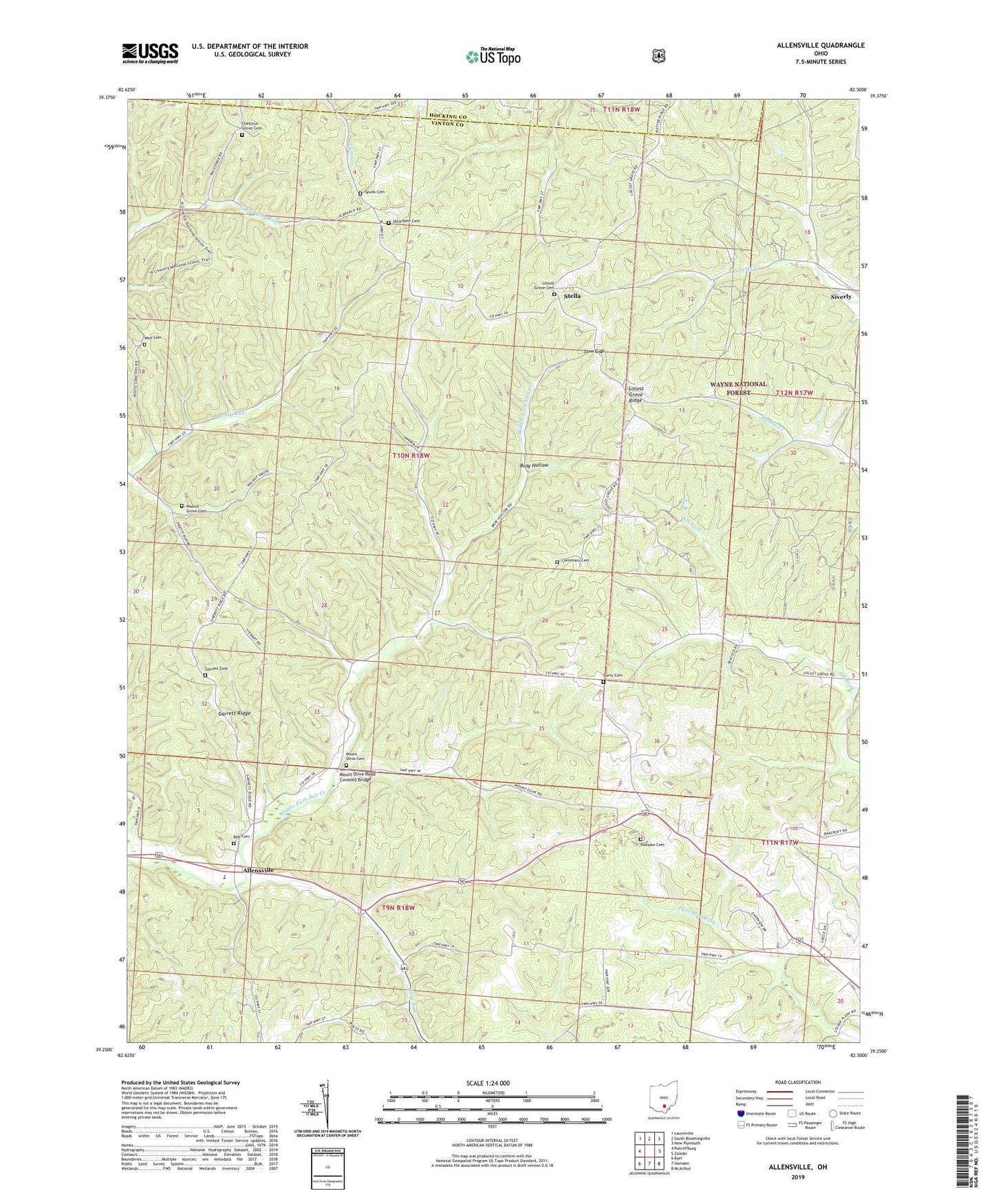
2019 topographic map quadrangle Allensville in the state of Ohio. Scale: 1:24000. Based on the newly updated USGS 7.5' US Topo map series, this map is in the following counties: Vinton, Hocking. The map contains contour data, water features, and other items you are used to seeing on USGS maps, but also has updated roads and other features. This is the next generation of topographic maps. Printed on high-quality waterproof paper with UV fade-resistant inks.
Quads adjacent to this one:
West: Ratcliffburg
Northwest: Laurelville
North: South Bloomingville
Northeast: New Plymouth
East: Zaleski
Southeast: McArthur
South: Hamden
Southwest: Byer
Contains the following named places: Allensville, Allensville Elementary School, Anderson School, Bell Cemetery, Bray Hollow, Browns School, Centenary Cemetery, Centenary Church, Center School, Chestnut Grove Cemetery, Chestnut Grove Church, Curry Cemetery, Curry School, Garrett Cemetery, Garrett Ridge, Goosetown, Greenbrier School, Locust Grove Cemetery, Locust Grove Ridge, Low Gap, Middle Fork Salt Creek, Miller School, Million School, Mount Olive Cemetery, Mount Olive Church, Mount Olive Road Covered Bridge, Otterbein Cemetery, Otterbein Chapel, Papaw School, Pawpaw Cemetery, Pleasant Chapel, Riley Run, Riley School, Robb School, Royal, Shively School, Spunk Cemetery, Stella, Township of Jackson, Vandiford School, Walnut Grove Cemetery, Walnut Grove Church, Wolf Cemetery