MyTopo
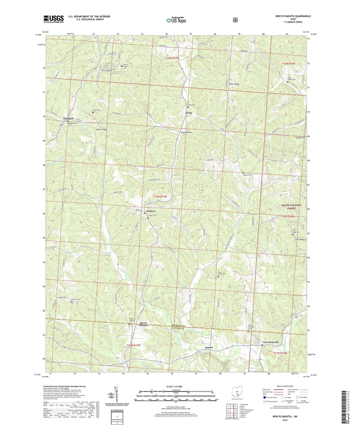
New Plymouth Ohio US Topo Map
Couldn't load pickup availability
Also explore the New Plymouth Forest Service Topo of this same quad for updated USFS data
2023 topographic map quadrangle New Plymouth in the state of Ohio. Scale: 1:24000. Based on the newly updated USGS 7.5' US Topo map series, this map is in the following counties: Hocking, Vinton. The map contains contour data, water features, and other items you are used to seeing on USGS maps, but also has updated roads and other features. This is the next generation of topographic maps. Printed on high-quality waterproof paper with UV fade-resistant inks.
Quads adjacent to this one:
West: South Bloomingville
Northwest: Rockbridge
North: Logan
Northeast: Gore
East: Union Furnace
Southeast: Mineral
South: Zaleski
Southwest: Allensville
This map covers the same area as the classic USGS quad with code o39082d4.
Contains the following named places: Blackjack, Blackjack Cemetery, Blackjack Post Office, Calico Ridge, Camp Otterbein Lake, Carrick Hill, Claylick Run, East Branch Raccoon Creek, Ewing, Ewing Cemetery, Ewing Post Office, Fairview Cemetery, Fairview United Brethren Church, Goat Run, Harble Ridge, Hidden Lake, Hidden Lake Dam, Hocking County, Honey Fork, Ilesboro, Ilesboro Cemetery, Isleboro Post Office, Meldrim Cemetery, Metz Hollow, Miller Chapel Cemetery, Millers Chapel, Morris Chapel, Morris Chapel Cemetery, Mount Pleasant, Mount Pleasant Cemetery, New Plymouth, New Plymouth Cemetery, New Plymouth Post Office, Olive Branch Cemetery, Orland, Smock, Smock Post Office, Strawn Cemetery, Tick Ridge, Tick Ridge Cemetery, Township of Washington, Washington Township Volunteer Fire Department, West Branch Raccoon Creek, Zion Church, ZIP Code: 45622