MyTopo
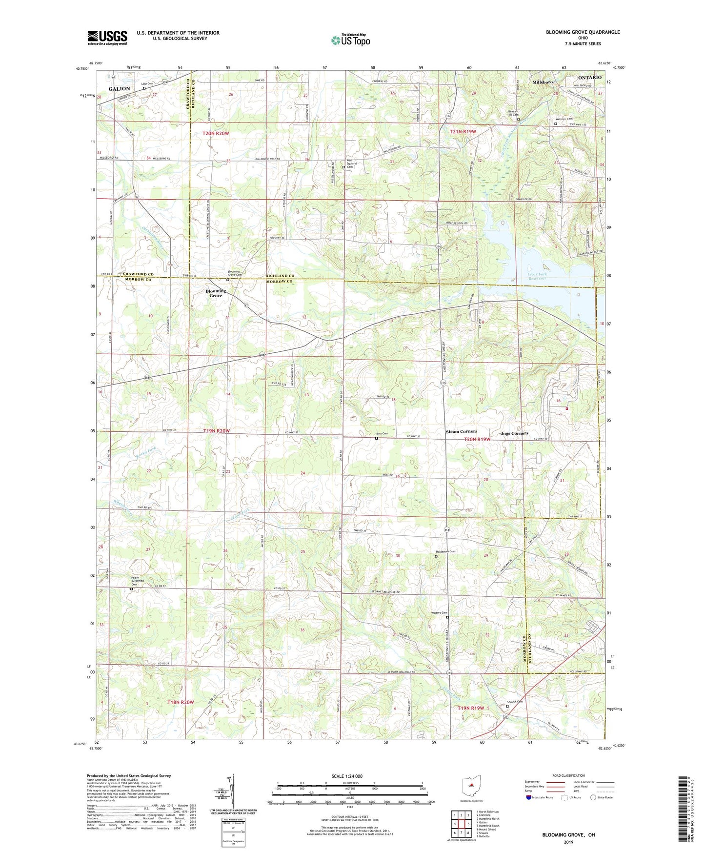
Blooming Grove Ohio US Topo Map
Couldn't load pickup availability
2019 topographic map quadrangle Blooming Grove in the state of Ohio. Scale: 1:24000. Based on the newly updated USGS 7.5' US Topo map series, this map is in the following counties: Morrow, Richland, Crawford. The map contains contour data, water features, and other items you are used to seeing on USGS maps, but also has updated roads and other features. This is the next generation of topographic maps. Printed on high-quality waterproof paper with UV fade-resistant inks.
Quads adjacent to this one:
West: Galion
Northwest: North Robinson
North: Crestline
Northeast: Mansfield North
East: Mansfield South
Southeast: Bellville
South: Shauck
Southwest: Mount Gilead
Contains the following named places: Ahrens Lake, Ahrens Lake Dam, Beech Grove School, Blooming Grove, Blooming Grove Cemetery, Burgener School, Camp Avery, Center School, Chestnut Ridge School, Clear Fork Reservoir, Craley School, Grogg Airport, Haldeman Cemetery, Half Acre School, Harbison School, Jackson, Jugs Corners, Jugs School, Line Cemetery, Mid - Ohio Sports Car Course Fire Station, Mid-Ohio Race Course, Millsboro, Peace Church, Peace Reformed Cemetery, Pleasant Hill Cemetery, Pleasant Hill School, Pleasant Valley School, Red Squirrel Cemetery, Ross Cemetery, School Number 7, Shauck Cemetery, Steam Corners, Steam Corners Post Office, Steam Corners United Methodist Church, Township of North Bloomfield, Township of Troy, Walters Cemetery, Walters School, Webster Cemetery, Wolf School