MyTopo
Dorset Ohio US Topo Map
Couldn't load pickup availability
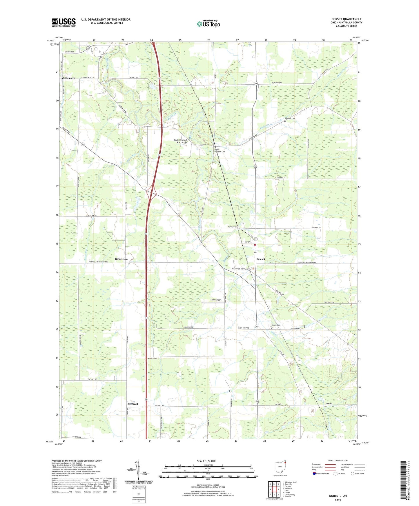
2019 topographic map quadrangle Dorset in the state of Ohio. Scale: 1:24000. Based on the newly updated USGS 7.5' US Topo map series, this map is in the following counties: Ashtabula. The map contains contour data, water features, and other items you are used to seeing on USGS maps, but also has updated roads and other features. This is the next generation of topographic maps. Printed on high-quality waterproof paper with UV fade-resistant inks.
Quads adjacent to this one:
West: Jefferson
Northwest: Ashtabula South
North: Gageville
Northeast: Pierpont
East: Leon
Southeast: Andover
South: Cherry Valley
Southwest: Orwell
Contains the following named places: Allen Airport, Askue Run, Bar D Farm, Bay - Lee - Dell Farms, Butler Farms, Comp Dairy Farm, Dorset, Dorset Cemetery, Dorset Post Office, Dorset Station, Dorset United Methodist Church, Dorset Volunteer Fire Department, Ewings Farms, Kusar Farms, Mill Creek Ranch, Northwind Farm, Peters Creek, Peters Creek Farm, Red Bush Farm, Rowenton, Rowenton Post Office, Sentinel, Sentinel Post Office, South Denmark, South Denmark Cemetery, South Denmark Church, South Denmark Road Bridge, Township of Dorset, Williams Cemetery, Woodard Dairy Farm, ZIP Codes: 44032, 44047