MyTopo
Pierpont Ohio US Topo Map
Couldn't load pickup availability
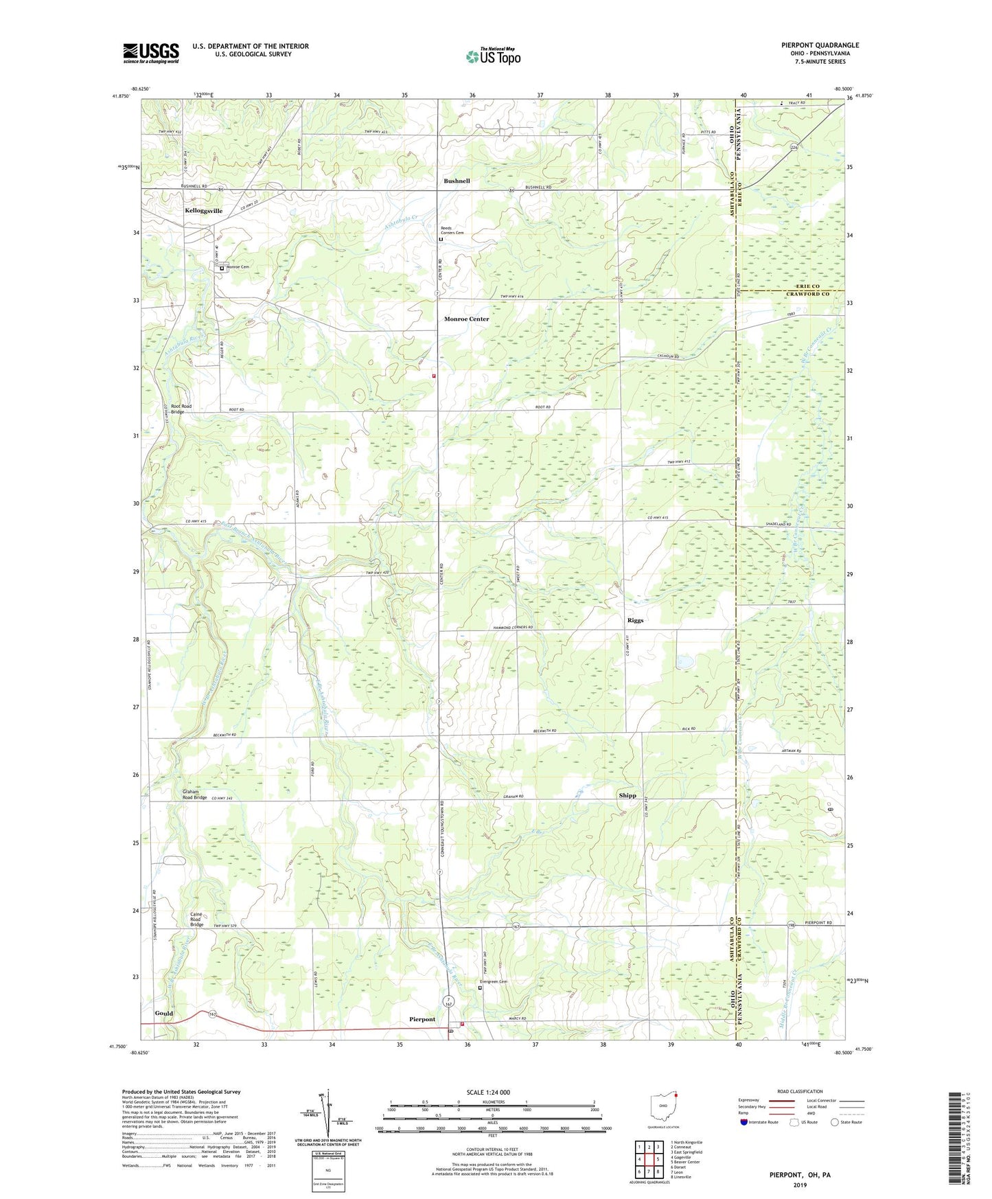
2023 topographic map quadrangle Pierpont in the states of Ohio, Pennsylvania. Scale: 1:24000. Based on the newly updated USGS 7.5' US Topo map series, this map is in the following counties: Ashtabula, Crawford, Erie. The map contains contour data, water features, and other items you are used to seeing on USGS maps, but also has updated roads and other features. This is the next generation of topographic maps. Printed on high-quality waterproof paper with UV fade-resistant inks.
Quads adjacent to this one:
West: Gageville
Northwest: North Kingsville
North: Conneaut
Northeast: East Springfield
East: Beaver Center
Southeast: Linesville
South: Leon
Southwest: Dorset
Contains the following named places: Ashtabula Creek, Bushnell, Caine Road Bridge, East Branch, East Branch Ashtabula River, Evergreen Cemetery, Graham Road Bridge, Kelloggsville, Kellogsville Post Office, Monroe Cemetery, Monroe Center, Monroe Center Post Office, Monroe School, Monroe Township Fire Department, Murtha Airport, Pierpont Elementary School, Pierpont Post Office, Pierpont Volunteer Fire Department, Reeds Corners Cemetery, Riggs, Riggs Post Office, Root Road Bridge, Ship Post Office, Shipp, Speer Farms, State Line United Methodist Church, Township of Monroe, Township of Pierpont, Unionville Post Office, West Branch Ashtabula River, WGOJ-FM (Conneaut), Wing, ZIP Code: 44082