MyTopo
East Ringgold Ohio US Topo Map
Couldn't load pickup availability
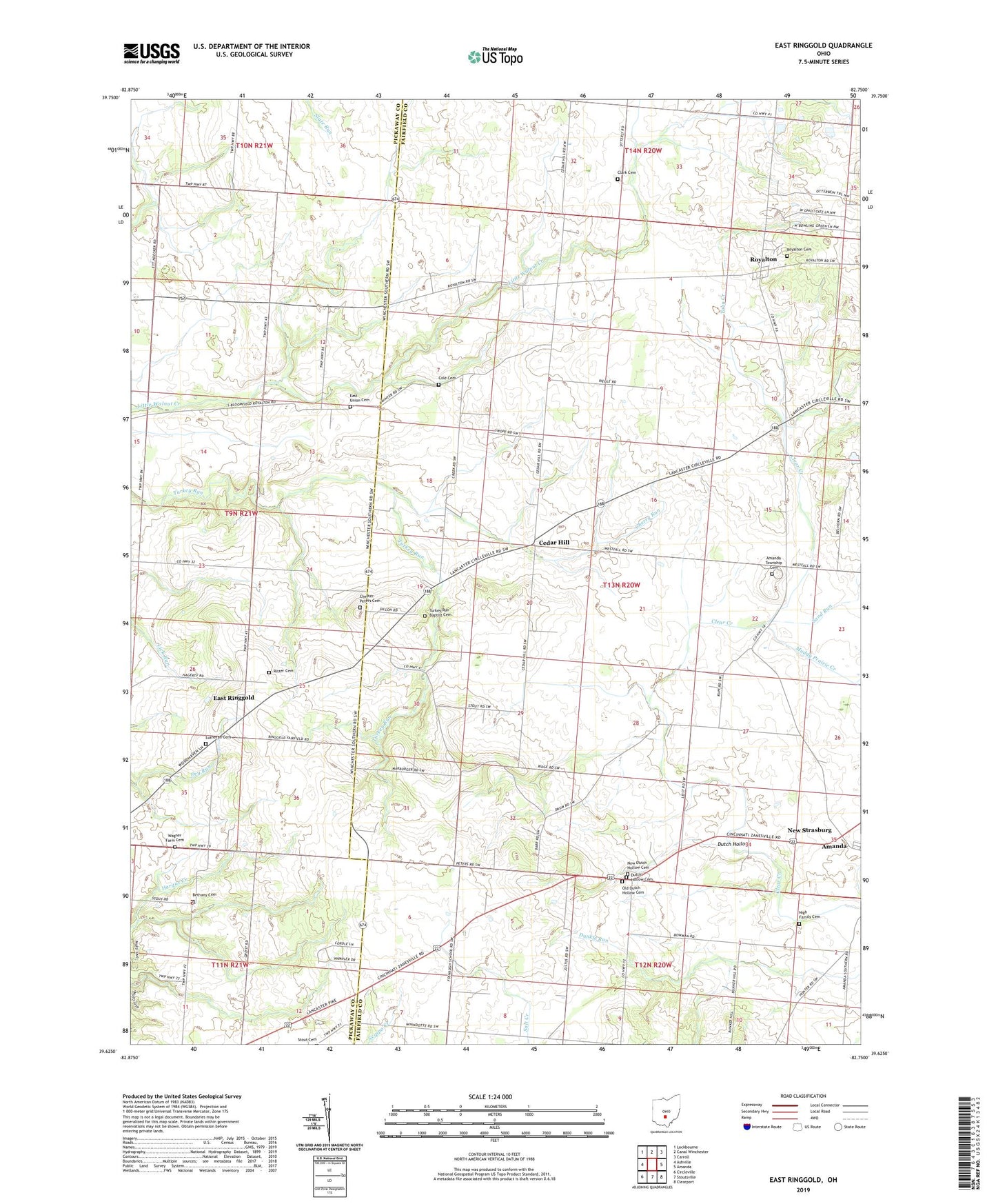
2019 topographic map quadrangle East Ringgold in the state of Ohio. Scale: 1:24000. Based on the newly updated USGS 7.5' US Topo map series, this map is in the following counties: Fairfield, Pickaway. The map contains contour data, water features, and other items you are used to seeing on USGS maps, but also has updated roads and other features. This is the next generation of topographic maps. Printed on high-quality waterproof paper with UV fade-resistant inks.
Quads adjacent to this one:
West: Ashville
Northwest: Lockbourne
North: Canal Winchester
Northeast: Carroll
East: Amanda
Southeast: Clearport
South: Stoutsville
Southwest: Circleville
Contains the following named places: Albert Family Tree Farm, Amanda Township Cemetery, Bethany Cemetery, Cedar Hill, Cedar Hill United Methodist Church, Cedarhill Post Office, Cherry Run, Chester Peters Cemetery, Clark Cemetery, Cole Cemetery, Cole School, Dutch Hollow, Dutch Hollow Cemetery, East Ringgold, East Ringgold Post Office, East Ringgold United Methodist Church, East Union Cemetery, Fasnaugh School, Highlander Trailer Park, Lazy P Farms, Leist Farms, Longbaugh School, Lutheran Cemetery, Muddy Prairie Creek, New Dutch Hollow Cemetery, New Strasburg, Nigh Family Cemetery, Old Dutch Hollow Cemetery, Ridge School, Ritter Cemetery, Royalton, Royalton Cemetery, Royalton Post Office, Ruff Seed Farms, Sand Run, School Number 2, School Number 5, School Number 6, School Number 8, Stebleton Farm, Toby Creek, Township of Amanda, Turkey Run Baptist Cemetery, Turkey Run Church, Turkey Run School, Wagner Farm Cemetery, Walnut, Walnut Post Office, WTLT-FM (Circleville), Wyandotte, ZIP Code: 43102