MyTopo
Amanda Ohio US Topo Map
Couldn't load pickup availability
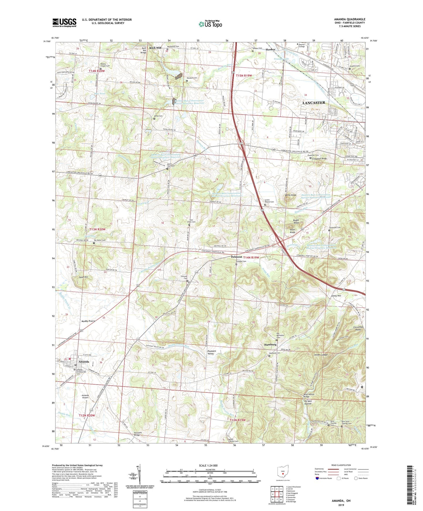
2023 topographic map quadrangle Amanda in the state of Ohio. Scale: 1:24000. Based on the newly updated USGS 7.5' US Topo map series, this map is in the following counties: Fairfield. The map contains contour data, water features, and other items you are used to seeing on USGS maps, but also has updated roads and other features. This is the next generation of topographic maps. Printed on high-quality waterproof paper with UV fade-resistant inks.
Quads adjacent to this one:
West: East Ringgold
Northwest: Canal Winchester
North: Carroll
Northeast: Baltimore
East: Lancaster
Southeast: Rockbridge
South: Clearport
Southwest: Stoutsville
This map covers the same area as the classic USGS quad with code o39082f6.
Contains the following named places: Allen Knob, Amanda, Amanda Airport, Amanda Elementary School, Amanda Post Office, Amanda Presbyterian Cemetery, Amanda Presbyterian Church, Amanda Township Fire Department Station 520, Becks Knob, Black Run, Bloom Township Fire Department Station 2, Camp Buro, Camp Ground Post Office, Camp Ro, Campgrounds, Cedarlen Park, Christ Evangelical Church, Christmas Rocks, Christmas Rocks Nature Preserve, Claypool Knob, Colonial Estates, Crumley Creek, Delmont, Delmont Post Office, Dunkle Run, East Union Cemetery, Eversole Cemetery, Fairfield School for Boys, Graybill Cemetery, Green Mound Cemetery, Greenfield Creek, Guseman Cemetery, Hamburg, Hamburg Cemetery, Hamburg Census Designated Place, Hamburg Post Office, Hooker, Hooker Cemetery, Hooker Post Office, Hunters Run Conservation District Structure Four Dam, Hunters Run Conservation District Structure One Dam, Hunters Run Conservation District Structure Reservoir, Hunters Run Conservation District Structure Three Dam, Hunters Run Conservation District Structure Two Dam, Hutchins Bridge, Jacobs Ladder, Kemp Cemetery, Lancaster Methodist Episcopal Camp Ground Historic District, Markwood Cemetery, Mink Hollow Bridge, Moe Pond, Moe Pond Dam, Mount Zion Cemetery, Muddy Prairie, New Lexington Reservoir Dam, New Saint Thomas Cemetery, Newkirk Cemetery, Ohio State Highway Patrol - Lancaster Patrol Post, Oil Mill Hollow, Old Methodist Cemetery, Pleasant Valley, Reese's Orchard, River Valley Mall Shopping Center, Rock Mill, Rock Mill Bridge, Rock Mill Dam State Wildlife Area, Rock Mill Lake, Rockmill Industrial Park, Ruble Knob, Saint Thomas Cemetery, Sand Hill, Schadel Cemetery, Shallenberger State Nature Reserve, Southeastern Correctional Institution, Stonewall Cemetery, Stonewall Creek, Stony Hill, Township of Hocking, Triangle Lake, Van Meter Cemetery, Village of Amanda, Wesley Chapel, Wesley Chapel Cemetery, WHOK-FM (Lancaster), Wilson Creek, WLOH-AM (Lancaster)


