
MyTopo
Evansport Ohio US Topo Map
Couldn't load pickup availability
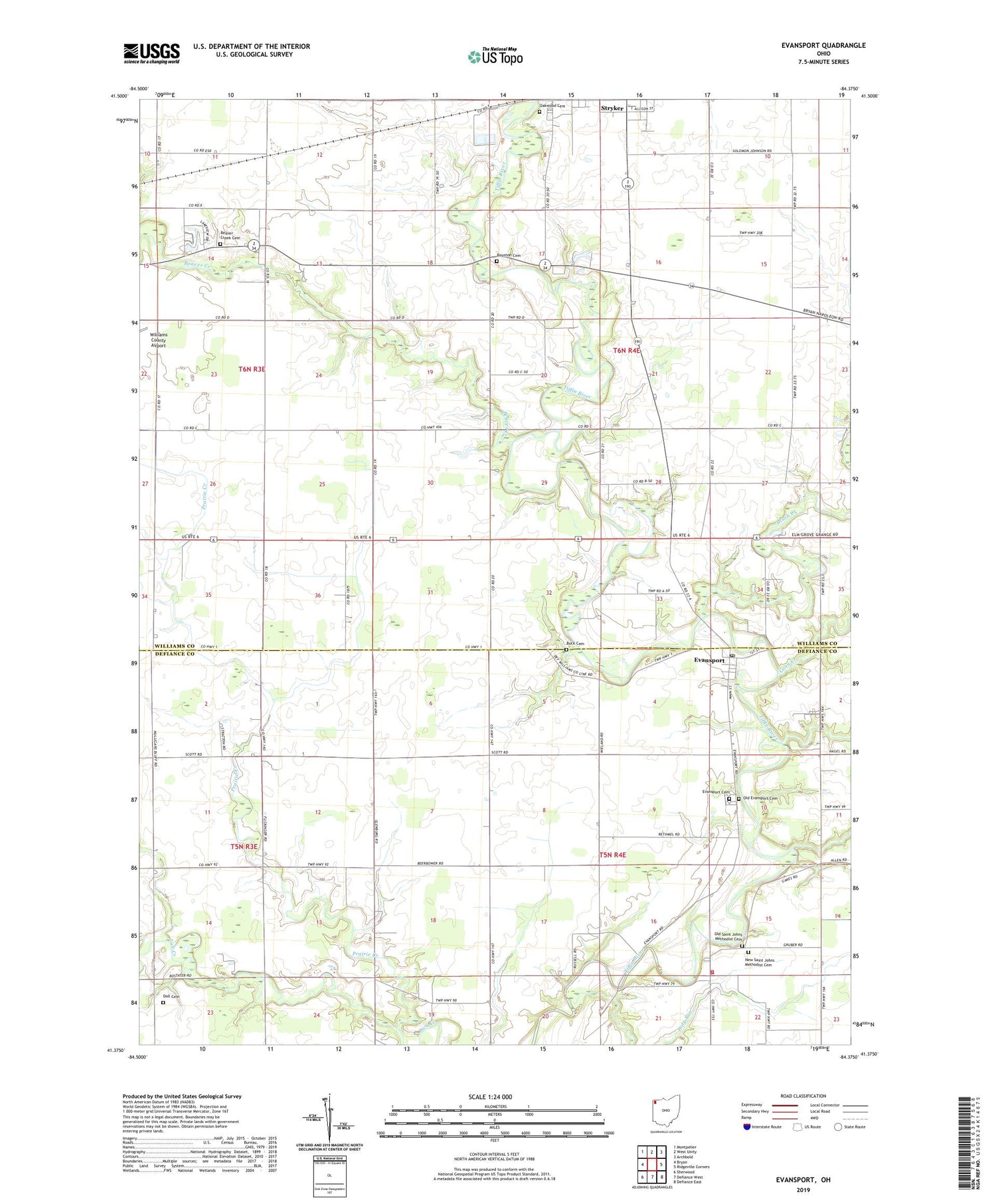
2019 topographic map quadrangle Evansport in the state of Ohio. Scale: 1:24000. Based on the newly updated USGS 7.5' US Topo map series, this map is in the following counties: Williams, Defiance. The map contains contour data, water features, and other items you are used to seeing on USGS maps, but also has updated roads and other features. This is the next generation of topographic maps. Printed on high-quality waterproof paper with UV fade-resistant inks.
Quads adjacent to this one:
West: Bryan
Northwest: Montpelier
North: West Unity
Northeast: Archbold
East: Ridgeville Corners
Southeast: Defiance East
South: Defiance West
Southwest: Sherwood
Contains the following named places: Beaver Creek, Beaver Creek Cemetery, Boynton Cemetery, Brush Creek, Buck Cemetery, Coon Creek, Coy Farms, Doll Cemetery, Doty Run, Evansport, Evansport Cemetery, Evansport Post Office, First Lutheran Church, Glenburg, Glenburg Post Office, Lakeland Woods Estates, New Saint Johns Methodist Cemetery, Oak Grove Church, Oakwood Cemetery, Old Evansport Cemetery, Old Saint Johns Methodist Cemetery, Pine Grove Mennonite Church, Prairie Creek, Riverside Golf Course, Rupp Landing, Saint Johns Church, Shaffers Acres, Sloan Farms, Stryker United Methodist Church, Tiffin Elementary School, Tiffin Township Fire Department, Township High School, Township of Springfield, Township of Tiffin, Union Chapel Church of God, United Methodist Church of Evansport, Wilna, ZIP Codes: 43519, 43557


