MyTopo
Fredonia Ohio US Topo Map
Couldn't load pickup availability
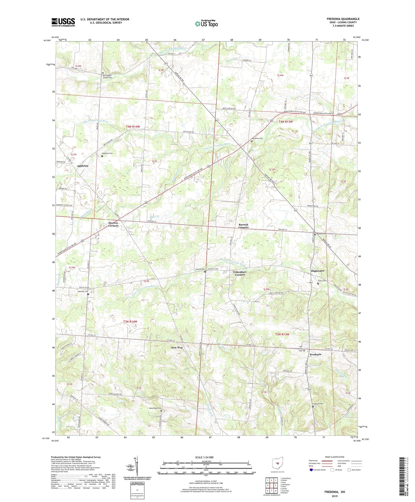
2019 topographic map quadrangle Fredonia in the state of Ohio. Scale: 1:24000. Based on the newly updated USGS 7.5' US Topo map series, this map is in the following counties: Licking. The map contains contour data, water features, and other items you are used to seeing on USGS maps, but also has updated roads and other features. This is the next generation of topographic maps. Printed on high-quality waterproof paper with UV fade-resistant inks.
Quads adjacent to this one:
West: Johnstown
Northwest: Centerburg
North: Homer
Northeast: Hunt
East: Utica
Southeast: Newark
South: Granville
Southwest: Jersey
Contains the following named places: Appleton, Appleton Cemetery, Barrick Corners, Bennington Chapel, Bennington Chapel Cemetery, Bowers Cemetery, Brooks Corners, Brushy Fork School, Center School, Clark Cemetery, Cokesbury Corners, Curtis School, Decrow Corners, Devinney School, Edelblut Corners, Fairview School, Fredonia, Fredonia Cemetery, Fredonia Post Office, Gosnell Corners, Greenbush School, Hancock Cemetery, Hancock School, High Water Post Office, Highwater, Highwater Orchard, Highwater United Church of Christ, Hillcrest Airport, Jones School, Lafayette School, Liberty Cemetery, Liberty Church, McKean School, Moorehead Cemetery, Morgan School, New Way, New-way Post Office, Northridge High School, Old Fredonia Cemetery, Patterson Cemetery, Pattersons Corners, Pattons Corners, Pleasantville School, Reynolds Creek, Runaway School, Six Corners, Sugar Creek, Township of Bennington, Township of Burlington, Township of Liberty, Township of McKean, Union School, Wright School