MyTopo
Hickman Ohio US Topo Map
Couldn't load pickup availability
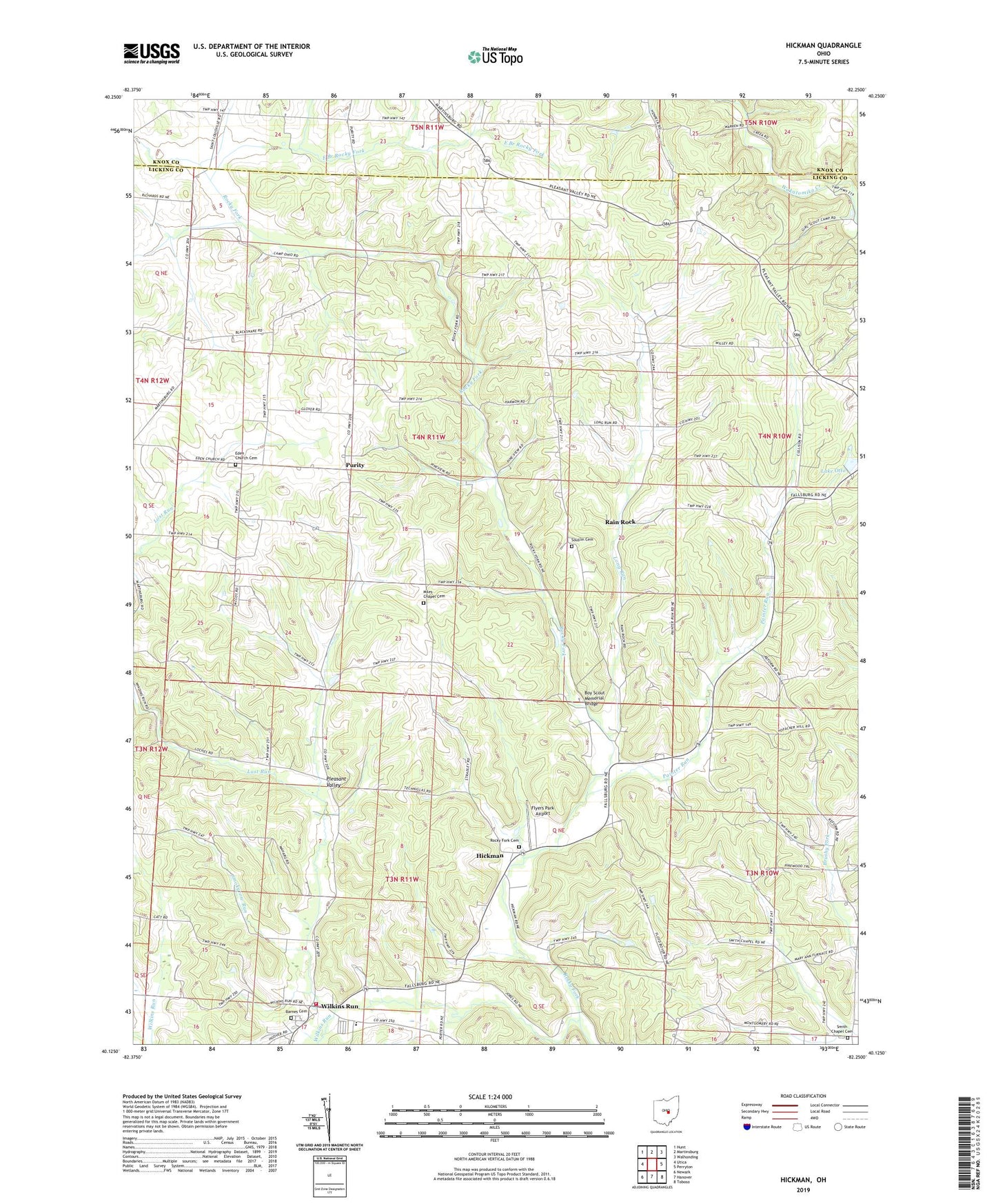
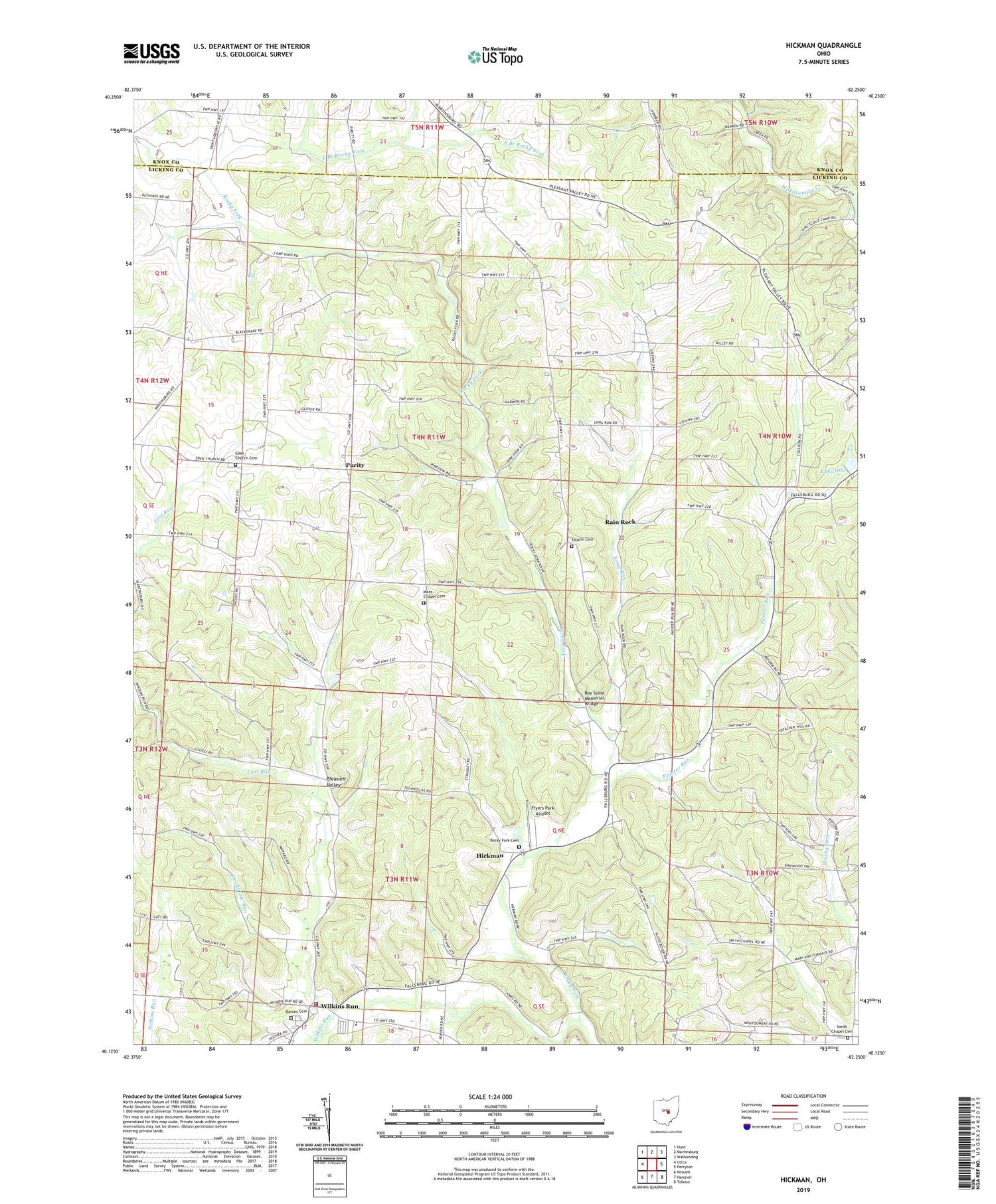
2019 topographic map quadrangle Hickman in the state of Ohio. Scale: 1:24000. Based on the newly updated USGS 7.5' US Topo map series, this map is in the following counties: Licking, Knox. The map contains contour data, water features, and other items you are used to seeing on USGS maps, but also has updated roads and other features. This is the next generation of topographic maps. Printed on high-quality waterproof paper with UV fade-resistant inks.
Quads adjacent to this one:
West: Utica
Northwest: Hunt
North: Martinsburg
Northeast: Walhonding
East: Perryton
Southeast: Toboso
South: Hanover
Southwest: Newark
Contains the following named places: Barnes Cemetery, Boy Scout Memorial Bridge, Burrell Chapel, Camp Ohio, Camp Wakatomika, Concord School, East Branch Rocky Fork, Eden Church, Eden Church Cemetery, Falling Rock Camp, Falls Church School, Flyers Park Airport, Forest Glen Church, Freedom School, Henpeck Corners, Hickman, Hickman Post Office, Lake Otto, Lake Otto Dam, Langley School, Long Run, Long Run Church, Longrun Post Office, Lost Run, Mary Ann Elementary School, Mary Ann Township Volunteer Fire Department, Melita Fellowship Church Cemetery, Miles Chapel, Miles Chapel Cemetery, Painter Run, Pleasant Hill School, Pleasant Valley, Pleasant View Church, Purity, Purity Post Office, Rain Rock, Reform, Reform Post Office, Rocky Fork, Rocky Fork Cemetery, Rocky Fork Post Office, Smith Chapel, Smith Chapel Cemetery, Smokyrow Run, Souslin Cemetery, Township of Eden, Township of Mary Ann, Trapp School, Walsh Christmas Tree Farm, Wild Cherry School, Wilkins Post Office, Wilkins Run, Willey School, ZIP Code: 43071